Curated OER
World Geography: Who am I?
High schoolers are able to provide a basic description of one country that has arsenic in its water supply. They are able to locate these countries on a map. Students explore the majors countries that have been affected by arsenic...
Geography 360°
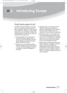
Introducing Europe
Provide your learners with a comprehensive introduction to Europe with this great set of worksheets. Map activities include matching European countries to their capitals and places on a political map, as well as...
National Endowment for the Humanities
Victory and the New Order in Europe
A New Order in Europe calls for a new lesson plan! This third plan in a series of four sequential lessons encourages high schoolers to read primary sources about the development of the New Order and follow up their knowledge with a...
Sharp School
Travel Brochure Project
Designing a travel brochure is a classic project that will help your class members develop a variety of skills, such as researching informational texts, designing creative visual products, and communicating what you have learned.
Curated OER
The Importance of Rivers in the Development of Early Civilizations Importance of Rivers in the Development of Early Civilizations
Sixth graders explore the role of rivers in the construction of early civilizations. In this importance of rivers lesson plan, 6th graders listen to a poem written by Langston Hughes and work cooperatively to develop a graphic organizer...
Curated OER
Where Do Canadians Live?
Students investigate Canadian people by researching the geography of the country. In this world geography lesson plan, students identify locations within Canada with large populations based on their access to waterways....
Curated OER
Major American Water Routes
Sixth graders locate and identify the major bodies of water and waterways in the United States. Through a simulation activity, they describe how early explorers would have described their surroundings. Working in groups, they create...
Curated OER
Where in the world is...
Students identify locations around the world. In this mapping lesson plan, students place tag board pieces with names of locations on a wall map of the world. Initially, students identify states, then cities, then continents,...
Curated OER
Leapin' Landmarks: Locating 10 Man-made Landmarks Around the World
Third graders label continents, oceans, and major mountain ranges on maps and use the maps to write an informational report about landmarks. In this landmarks lesson plan, 3rd graders write about 1 major landmark.
Curated OER
Civil War: Generals at the Battle of Stones River
Students explore U.S. history by creating a computer presentation in class. In this Civil War battle lesson, students read assigned text about the Battle of Stones River and research individual generals from the battles. Students utilize...
Curated OER
Ethnic Culture and Identity in the Columbia River Basin, 1850-1950
Students explore cultural history of immigrant groups that settled in the Columbia River Basin from 1850 to World War II, and examine various primary sources to explore role cultural and social customs played in keeping alive immigrant...
Curated OER
African Americans in the Columbia River Basin
Learners research the Columbia River Basin Ethnic History Archive (CRBEHA) and use a variety of primary sources to explore the history of blacks in the region.
Curated OER
Mancos River Walk Newsletters
Sixth graders create newsletters of the Mancos River Walk. They gather information from the Mancos River Walk and create a newsletter detailing sections of trees, shrubs, river studies, and wildlife studies. They write stories and...
Devine Educational Consultancy Services
Geography Student Workbook, Australia
Your youngsters will be experts on the geography of Australia after working with these activities and worksheets, which review the continent's weather, major landforms, dimensions, history, and climate.
Curated OER
Maps
Maps, globes, and computer software aid young explorers as they locate state capitols, major cities, geographic features, and attractions for states they are researching. They then use desktop publishing software to create a map to share...
Owl Teacher
Teach Ancient Civilizations: Africa
Amazing! Teach learners about the wonders of ancient Africa and Asia with a comprehensive set of teaching tools. You'll click to find a well-constructed presentation, a worksheet that has kids compare and contrast ancient alphabets, a...
Curated OER
We've Gotcha Covered: The Iowa Insurance Story
Analyze the relationship between financial risks and the growth of the insurance industry in Iowa. Learners work in groups to analyze the major catastrophic events that occurred in their community. Several worksheets are included.
Curated OER
Map on the Wall
Students examine the Ogallala aquifer water storage facility, identify rivers that refill the aquifer, and locate major cities near by. Students make maps of the area.
Curated OER
Sea to Sky
Students investigate the Earth's major landforms and how they occur, and how engineers apply this knowledge for the design of transportation systems, mining, and measuring natural hazards. They listen to a teacher-led lecture, match...
Curated OER
Of Maps and Worldviews
Young scholars explore Ptolemy's world map as an expression of the Renaissance view of the world.
Curated OER
Where in the World Is All the Water?
Students investigate the distribution of the earth's water. They conduct a demonstration of water distribution, and create a pie graph to display the results.
Curated OER
Places in My World
Second graders explore where they are located on the globe. In this maps and globes lesson plan, 2nd graders use a map to show where they live and show the cardinal directions. Students identify characteristics of mountains, flat...
Curated OER
Where in the World Is ...
Students locate and place countries and continents on a large map using tag board and yarn. They locate a new geographic location on the map each morning.
Curated OER
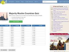
Majority Muslim Countries Quiz
In this online interactive geography quiz worksheet, students respond to 47 identification questions about Muslim cities. Students have 4 minutes to complete the quiz.


