Curated OER
Map Lesson Plan
Fourth graders locate and label major sites related to the Revolutionary War in the Hudson River Valley. They examine topographical features of each site and list a few of these features and list two advantages of each military site.
Ms. Catsos
Ancient Rome Map Worksheet
It wasn't just the great leaders of ancient Rome that shaped their civilization—the geography of the region played a major role as well. After first identifying major land masses, bodies of water, and city states on a map of Europe,...
Curated OER
Maps that Teach
Students study maps to locate the states and capital on the US map. Students locate continents, major world physical features and historical monuments. Students locate the provinces and territories of Canada.
Curated OER
Where in the World Is…
Students identify countries, oceans, states, and more on a globe and on a flat map. In this geography lesson plan, students also locate places around their school.
Curated OER
"Where In The World Am I?" Creating a Travel Brochure for Japan
Middle schoolers create a travel brochure for the country of Japan.
NIOS Download
The Harappan Civilization
The Harappan Civilization, also known as the Indus Valley civilization (2600 BC-1900 BC), is the focus of a resource packet that details the rise and fall of a culture that existed in India during the Chalcolithic period of...
Prestwick House
A Separate Peace
John Knowles' A Separate Peace is the subject of a literary crossword puzzle that asks readers to identify key events and characters in this coming-of-age story.
Curated OER
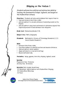
Shipping on the Hudson
Students track movements of ships, tugboats, and barges on the Hudson River estuary in order to practice addition and subtraction skills. They solve word problems by reading and interpreting data from a table. They calculate distances...
Curated OER
Floodplain Modeling
Students simulate the impact of fluctuating river volumes on structures and landforms. They experiment with table top-sized riverbed models and water. Students consider how human design can help mitigate the effects of a flood.
Curated OER
Early Explorers
Fifth graders study early explorers. In this World history lesson, 5th graders draw an outline of a map labeling each part, build geographical features out of dough, and paint each of the land and water features.
Curated OER
China - the Geography of European Imperialism - Spheres of Influence in China
Ninth graders create a map of China. They identify the various spheres of influence carved out by the Imperialist powers of Europe as well as locating geographical features of china and major cities. They explain the global impact of...
Curated OER
Considering Systems and Controls
In this systems and controls worksheet, students write the major function, identify three controls, and give examples of each system. Students do this for highways, school, desert ecosystem, and communication.
Curated OER
Elements of Civilization
Students create their own ancient civilizations based off of topographical maps of Egypt, Mesopotamia, the Indus Valley, and the Yellow River. In this social studies lesson, students are assigned one topographical map to use to create...
Curated OER
Counting on Cooperatives
Young scholars are introduced to the study of economics, including an introduction to basic business types and systems. They investigate about international, national and California history as they take a historical tour of cooperatives...
Curated OER
Too Cool for School-The Greenhouse Experiment
Students create a town model and analyze the type of greenhouse gases their town emits. In this earth science activity, students build greenhouses to investigate how trapped heat causes temperature change. They relate this activity to...
Red River Press
Remembrance Day, Lest We Forget
Have we forgotten? As part of their study of Remembrance Day, class members consider whether countries have kept their promise not to forget and create their own remembrance ceremony.
Curated OER
Social Studies: Migration and Immigration to the Columbia River Basin
Students examine the history of immigration in the Pacific Northwest. They make oral and written presentation about the historic effects of immigration in the Northwest.
Curated OER
Where is the Water?
Students explore freshwater ecosystems. In this geography lesson, students brainstorm all the lakes and rivers they know then mark them on a map. Students will then mark all the major freshwater resources on each of the seven continents,...
Curated OER
Beyond Chopsticks and Rice
Students explore the stereotypical American images of China. In this English and World History lesson, students read a novel to become familiar with China and its people. Students research various events in China's history and report...
Curated OER
Cities as Transportation Centers
Students work in small groups to identify some of the major transportation centers, recommending two as possible sites for a national political convention, based on population density and the travel networks available in 1835.
Curated OER
Glacial Climbing
Students plot the current distribution of glaciers around the Earth and see if there any major trends where glaciers appear to be either growing or shrinking at abnormally high rates.
Curated OER
Dark and Beautiful Caves
Young scholars research how caves form. They describe the major stone formations in caves by taking notes. They construct a clay model of a cave and mark each formation making it easy to identify in the legend.
Curated OER
Tides and Currents
Students research and describe how currents are formed. In groups, they relate specific terms to the formation of currents and locate different currents on a world map. They also examine tides, how they are formed and how they are...
Curated OER
Vietnam Revisited
Students explore the impact of the Vietnam War. In this Vietnam and popular culture lesson, students research and plot major events in the conflict. Students interview people regarding their memories of the war and watch the movie " The...


