Digital History
Digital History: Early Industrialization
Advances in technology affected manufacturing in the North and farming in the South. Read about how America turned from a country where most products were made in the home to an economic power that used factory production.
Digital History
Digital History: Roots of American Economic Growth: Transformation of the Rural
Read about the changes in the American economy between 1820 and 1860 that resulted in a market economy encouraged by technological advances in manufacturing.
Space.com
Space.com: "Nasa Spin Offs: Bringing Space Down to Earth"
This article from January 26, 2005, offers a video and a list of many common items used daily that exist because of NASA innovations. These include Cat Scans and MRIs, more precise and safer breast imaging, artificial limbs using...
Other
E Cycle Best: Making the Tablet Pc Eco Friendly
Do you know that tablets are now being manufactured to be environmental friendly? This article describes how tablets are being made to more eco-friendly.
Open Door Team
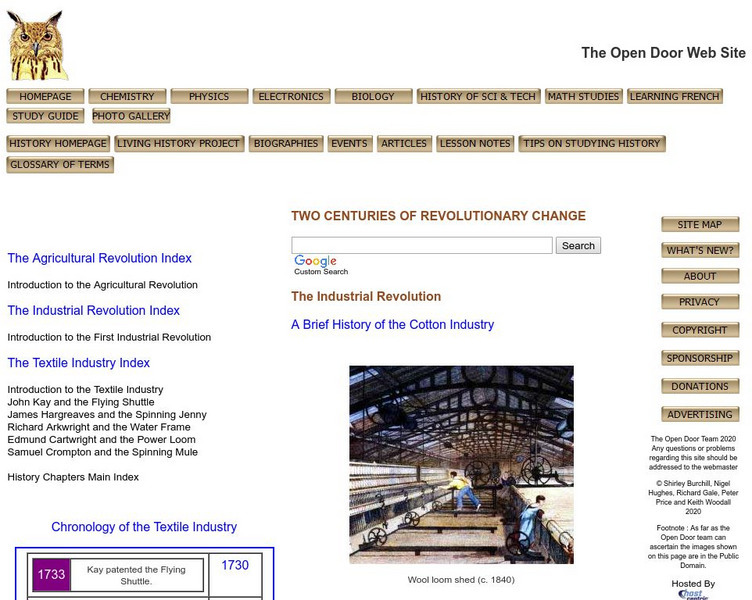
Open Door Web Site: Brief History of the Cotton Industry
General history overview of the development of the Cotton Industry. Read here to learn about the history and growth of the Cotton Industry.
PBS
Pbs Learning Media: Georgia Tech's Invention Studio: Live Exploration
Take a special trip to Georgia Tech's Flowers Invention Studio with GPB Education! This interactive virtual exploration offers students an inside look at the world's largest student-run makerspace as they learn about the engineering...
Digital History
Digital History: Foreign Competition
This site describes how by the 1970s, foreign manufacturers were embedded in the U.S. markets. For the U.S., this meant a loss of sales, a loss of jobs, and a loss of economic confidence.
Siteseen
Siteseen: American Historama: Industrial Revolution Inventions
The Industrial Revolution is a phrase that encompasses the massive changes in agriculture and manufacturing processes during the 18th and 19th centuries that transformed the United States from an agricultural to an industrial society....
Other
Try Nano: Applications: Applications of Nanotechnology
Article discusses promising applications of nanotechnology to computing and processing technologies and to the consumer goods, materials and manufacturing, energy, and transportation industries.
Curated OER
Educational Technology Clearinghouse: Maps Etc: Washington, 1904
A map from 1904 of Washington showing the capital, Olympia, principal cities and towns, Indian reservations, railroads, mountains, rivers, and coastal features. "Washington - Organized as a Territory in 1853. Admitted to statehood in...
Curated OER
Educational Technology Clearinghouse: Maps Etc: Wisconsin, 1904
A map from 1904 of Wisconsin showing the capital, Madison, principal cities and towns, railroads, rivers, and shoreline. "Wisconsin (The Badger State) - Was first settled by the French in 1660. Admitted to the Union in 1848. The...
Curated OER
Educational Technology Clearinghouse: Maps Etc: Iowa, 1904
A map from 1904 of Iowa showing the State capital of Des Moines, major cities and towns, railroads, and rivers. "Iowa (Hawkeye State) - The first white settlement was made in 1788. Admitted to the Union in 1846. Area, 66,025 square...
Curated OER
Educational Technology Clearinghouse: Maps Etc: Oregon, 1904
A map from 1904 of Oregon showing the capital of Salem, principal cities and towns, railroads, stage lines, mountains, rivers, and coastal features. "Oregon - Organized as a Territory in 1848; became a state in 1859. Area, 96,030 square...
Curated OER
Educational Technology Clearinghouse: Maps Etc: South America, 1898
A map of South America in 1898. The map shows capitals and major cities, railroads, terrain, rivers, and coastal features, and includes an insert map of the Isthmus of Panama. "The chief industries in South America are herding,...
Curated OER
Educational Technology Clearinghouse: Maps Etc: Utah, 1904
A map from 1904 of Utah showing the capital at Salt Lake City, counties and county seats, principal cities and towns, railroads, mountains, rivers, and the Salt Lake desert region. "Utah was organized as a Territory in 1850. Area, 84,970...
Curated OER
Educational Technology Clearinghouse: Maps Etc: Ontario, 1904
A map from 1904 of Ontario showing major cities and towns, railways, rivers, lakes, and the frontier with Quebec. An inset map shows the northwestern portion of the province along Lake Superior. "Ontario is the most important Province of...
Curated OER
Educational Technology Clearinghouse: Maps Etc: South China, 1971
"South China comprises the drainage basins of the middle and lower Yangtze River, the basin of the His Chiang (West River) in Kwangtung and Kwangsi; and the mountainous coastal provinces of Fukien and Chekiang. The division between the...
Curated OER
Educational Technology Clearinghouse: Maps Etc: Europe, 1898
A map showing Europe in 1898. "Europe is composed of twenty or more independent states or countries, in nearly every one of which the people differ from those of others in language, customs, and standards of living...In Europe [there...
Curated OER
Educational Technology Clearinghouse: Maps Etc: Atlanta, 1886
A city plan from 1886 detailing Atlanta, showing the city limits, streets and street names, Union train depot and the rail routes, the old and new State Capitol buildings and Governor's mansion, two large cotton manufacturing plants, the...
Curated OER
Educational Technology Clearinghouse: Maps Etc: Idaho, 1904
A map from 1904 of Idaho showing the capital of Boise City, counties, towns, railroads, mountain systems, lakes, and rivers. "Idaho was created as a Territory in 1863. Admitted to statehood in 1890. Gold discovered in 1860. Area, 84,290...
Curated OER
Educational Technology Clearinghouse: Maps Etc: Industrial Sections, 1898
A map from 1898 of the United States showing the Industrial Sections of the contiguous 48 states at the time. "Owing largely to differences in surface structure, climate, and soil, the great productions of our country are confined more...
Curated OER
Educational Technology Clearinghouse: Maps Etc: Kansas, 1904
A map from 1904 of Kansas showing the State capital of Topeka, major cities and towns, railroads, and rivers. "Kansas (Garden of the West) - Organized as a Territory in 1854; made a State in 1861. Area, 82,080 square miles; population,...
Curated OER
Educational Technology Clearinghouse: Maps Etc: Minnesota, 1904
A map from 1904 of Minnesota showing the capital of Minneapolis (St. Paul since 1849), major cities and towns, Indian reservations, railroads, lakes, and rivers. "Minnesota (Gopher State) - Was first settled in 1812. Admitted to the...
Curated OER
Educational Technology Clearinghouse: Maps Etc: Missouri, 1904
A map from 1904 of Missouri showing the capital of Jefferson City, major cities and towns, railroads, and rivers. An inset map details St. Louis. "Missouri - Organized as a Territory in 1812; admitted to the statehood in 1821. Its lead...


