Curated OER
New Perspectives
Students examine maps that are designed to give different perspectives. They create mental maps that illustrate their own perspectives and those of people from other parts of the world.
Curated OER
The Bozeman Trail
Eighth graders are introduced to the Bozeman Trail. Using the internet, they research the trail to discover the forts located on its path. They must also locate and label landmarks on a map using symbols they create. They answer...
Curated OER
China: Dim Sum: 3 Mapping Lessons
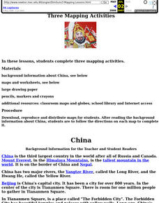
Fourth graders, after studying maps, draw a very large outline map of Asia and then a large map of China on it in the appropriate place. They label the appropriate information.
Curated OER
Breads Around the World
Pupils read about bread. In this lesson plan studying bread, students read about the history of bread and it's significance around the world. Pupils identify the three main crops used to make bread and ten common types of bread from...
Curated OER
Critical Literacy In The 21st Century
Students read the book Sitti's Secrets and complete prediction and comprehension activities. In this literacy lesson plan, students also write questions and comments they have on chart paper.
Curated OER
Longitude & Latitude
Seventh graders role play as ship's captains to study longitude and latitude.
Curated OER
The Stolen Smell
Third graders read the story The Stolen Smell, and complete language arts activities based on the book. In this The Stolen Smell lesson plan, 3rd graders complete activities such as discussion, reading, researching, drawing, role...
Curated OER
My Community
Learners identify how their school has changed. In this local community lesson, students listen to a brief history of their town and school and interview someone that graduated from their school. Learners then create a map of their...
Curated OER
SpellO': An Orienteering Lesson
Students participate in hands-on activities to practice orienting maps. Given activity cards, students accurately read maps and locate specific stations. Students collect information from the maps to spell a message when the activity...
Curated OER
Where Should We Put a Store?
Students analyze population data. They convert population data into simple density maps to help make decisions about their world. They select the best location for a school store based on population density. They present their maps...
Curated OER
The Continents and Oceans of the World
Students explore world mapping skills. In this world geography lesson, students identify and label the continents and oceans on a world map using the Visual Thesaurus. Students generate mnemonic devices to help memorize these terms.
Curated OER
Using Vegetation, Precipitation, and Surface Temperature to Study Climate Zones
Middle schoolers begin their examination of the climate zones found around the world. Using a software program, they identify the relationship between the vegetation, climate and temperatures of the different zones. They also plot...
Curated OER
Immigration and Ellis Island
Fourth graders explore family histories. For this social studies lesson, 4th graders identify the countries from which their ancestors came and locate them on a map. Students discuss the role that Ellis Island played in immigration in...
Curated OER
Maps
First graders look at their classroom or school setting. They use positional word to describe where things are located in the school. Students discuss a map and why they are important. They read the story "Taylor's New School" and...
Curated OER
Lesson 2: Mapping With Words
Students demonstrate an understanding of the personal relationship that Wabanaki peoples had with the land by analyzing selected Wabanaki place names. They practice map-reading and map-making skills.
Curated OER
Globe Raider: Part I
Learners research a Spanish speaking countries using the Internet and other appropriate resources. They work in groups to complete a computer based treasure hunt before completing a Globe Raiders worksheet. They use the research...
Curated OER
Where in the World War? Mapping WWII in the Pacific
Students study the geography of the Pacific theater of World War II. They study maps to examine the geography and features of the land.
Curated OER
You Can Find It!
Students locate different places including U.S. cities using longitude and latitude coordinates. In this longitude and latitude lesson plan, students locate 10 different locations.
Curated OER
Latitude and Longitude: Geography and Geometry!
Second graders use latitude and longitude coordinates to pinpoint an exact location on the map. In this geography lesson, 2nd graders utilize handouts from the Maritime Museum in order to gain practice in finding locations throughout the...
Curated OER
Vacation Matrix-Integrated Core
Students read aloud, "The Best Vacation Ever," by Stuart Murphy locate vacation spots on a map and describe their own vacations. Students illustrate their summer vacation spot and describe the vacation, placing it on a "vacation matrix"...
Curated OER
Primary Sources and Archaeology in the Study of Ancient Mediterranean Trade
Tenth graders begin the lesson by plotting trade routes, major empires and items traded. Using primary sources, they examine their own values regarding trading items for royality. They participate in a role-play exercise in which they...
Curated OER
Interactive Atlas
Second graders examine the different ways people move from place to place in a neighborhood. Using the interactive online atlas MapQuest, they identify the various ways people move around their own neighborhood by creating a map and...
Curated OER
LA CENERENTOLA (Cinderella)
Students investigate different cultures' versions of the Cinderella tale in comparison to the Rossini opera synopsis. They experience dramatizing a Cinderella tale and study about the group and individual process required for theatrical...
Curated OER
Charting Neptune's Realm: Profiles
Students identify and describe the importance of nautical profiles in early navigation. They draw a profile of a street or mall and explore the effectiveness of different types of directions.


