Curated OER
Introduction to the Globe
Young scholars investigate how to use a globe. In this map skills lesson plan, students define what a globe is and locate the various continents on the globe. Young scholars are also asked to locate the four oceans on the globe.
Curated OER
Matching the Globe with the Map
Young scholars examine how to use a globe. In this globe and map comparison instructional activity, students discuss how the globe and map are alike when looking at Africa and Antarctica. Young scholars investigate shapes and sizes of...
Curated OER
Globe Lesson 4 - Intermediate Directions
Pupils explore the concept of intermediate directions. In this geography skills lesson, students use map skills in order to identify intermediate directions as they complete a map activity.
Curated OER
Globe Lesson 13 - When the Day Changes
Students explore the patterns of day and night. In this geography skills lesson, students read brief selections and examine diagrams that note the transition of day and night around the world. Students respond to the questions included...
Curated OER
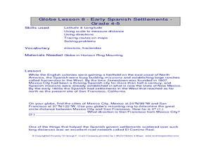
Globe Lesson- Early Spanish Settlements
Students use a globe. In this geography and early settlements lesson, students learn about the settlement of missions and haciendas in New Mexico. Students locate Mexico City and San Francisco on the globe and determine the distance...
Curated OER
Thematic Maps of Your School
Students are able to list the essential elements of a thematic map, understand and use scale effectively to represent a geographic area, use research skills to develop a body of information, plan and draw an accurate thematic map based...
Curated OER
Studying Snow and Ice Changes
Students compare the change in snow and ice over a 10 year period. In this environmental science activity, students use the live data on the NASA site to study and compare the monthly snow and ice amounts on a map of the entire Earth. ...
Curated OER
World Map and Globe-Equator, North Pole, and South Pole
Students identify the Equator, North Pole, and South Pole on a map. In this geography instructional activity, students use a world map and circle the North and South Pole. Students locate the Equator on a globe and use a map marker to...
Curated OER
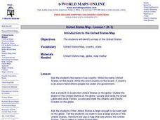
Introduction to the United States Map
Learners explore the United States using a map. In this map lesson, students discover how to use a United States map and a globe to locate places.
Curated OER
United States Map- Continent, Country, State
Pupils identify their continent, country, and state on a globe. In this geography lesson, students use a globe to identify the seven continents, the United States, and the state which they live in. Pupils define key terms.
Curated OER
A Map Mystery
First graders solve a mystery by following map clues. In this map clues lesson plan, 1st graders follow a computer program called Neighborhood Map Machine. In this program, it gives students directional and spatial clues in order to...
Curated OER
Through the Forest and Home Again: Maps Help Us Find Our Ways
Students read Little Red Riding Hood, focusing on her path home to Grandma's house. In this language arts and geography instructional activity, students perform a reader's theater, re-creating the walk home and possible routes that could...
Curated OER
Map Keys
Third graders examine maps and map keys. For this locating map features lesson, 3rd graders use crayons, markers and colored pencils to label maps. Students work in partners to read map keys and locate given places and things.
Curated OER
Me on the Map: Homes, Neighborhoods, and Communities
Students read a book about maps and identify the differences between a picture and a map. In this maps lesson plan, students also label maps of their home, neighborhood, and community.
Curated OER
Compass Rose for the New Millennium
Sixth graders are introduced to the concepts of a compass rose and how it used in relationship to reading maps in geography. The lesson is meant to build upon prior knowledge and skills.
Curated OER
Continents of the Globe
Students identify the continents on the globe. In this map skills lesson, students define the term "continent" and identify the seven continents on the globe.
Curated OER
The Globe and World Map
Students explore how to use maps for travel. In this map skills instructional activity, students read the text, With Love from Gran and discuss the places the character traveled. Students list the names of each city and country on chart...
Curated OER
MAP GRIDS, CLIMATES AND HEMISPHERES
Students compare/contrast the grid and latitude/longitude system used on a globe. They describe the areas which are considered to be a tropical, temperate, and polar, based on knowledge of climates.
Curated OER
American Civilization
Students review map and globe skills. They gather background to the story of Christopher Columbus' voyage.
Curated OER
World Map and Globe- Introduction to Symbols
Students investigate picture symbols. In this symbols lesson, students define symbols and discuss symbols that they see in everyday life. Students identify symbols on maps by using post-it notes.
Curated OER
Kid Maps: Reading and Creating Maps with Human Characteristics
Learners look at maps. In this map instructional activity, students listen to the book My Map Book by Sara Fanelli and they see the difference between human characteristics (buildings, etc.) and natural characteristics (rivers, etc.)....
Curated OER
Map Projections: The Grapefruit Activity
Students partcipate in activities in which they examine different map projections. They discover the positives and negatives of each type. They use grapefruits to help them with the different types of map projections.
Curated OER
Me on the Map Lesson 1
Students use maps, globes, geographic information systems and other
sources of information to analyze the nature of places at a variety of scales. They identify on a map and determine the population
of the city, county, state, country...
Curated OER
Mapping the Halifax Explosion
Students research the Halifax Explosion using historical maps.


