Curated OER
Map Creation
Second graders identify a map, symbol, key, and compass rose. Students create and print a map for teacher evaluation using the computer. Students identify the symbols on their map and orally present them to the class.
California Academy of Science
Which Way is North?
Who needs a compass to find cardinal directions? Just place a stick in the ground and record the movement of its shadow over the course of a day. Then, measure the shadow lengths in order to determine a north-south line. A simple...
Scholastic
Reading Characters
Philip Pullman's The Golden Compass provides the text for a study of how writers bring characters to life. Using the provided character mapping worksheets, readers respond to questions and then write a short character sketch.
Curated OER
Learning Directions on a Map
Students use north, south, east, and west to identify relative locations and provide directions.
Curated OER
Map your Schoolyard
Pupils practice their mapping skills by creating an accurate map of their schoolyard using an aerial photo from the National Map web site. Students include legends, a scale, and a north arrow on their maps.
Curated OER
Mapping Central Park
Students use the mapping skills to explore New York's Central Park. They examine a map of Central Park to discover its features. After discussing the characteristics of the park, students design their own dream park and draw it to scale.
Curated OER
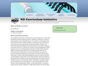
Maps as Models of Earth
Eighth graders use different types of maps to find locations and surface features. In this map-reading lesson students use a compass to find direction.
Curated OER
Lesson Design Archaeology- U.S. Map
Students examine the U.S. map and identify cultural areas. For this archaeology lesson, students locate cultural areas on the U.S. map and fill in the proper locations.
Curated OER
Lesson on GPS
Students investigate global positioning systems. In this technology and mapping lesson plan, students view a PowerPoint presentation in which they identify the features of a GPS, state its uses, and follow steps to find a waypoint.
Curated OER
Orienteering
Students acquaint with co-participants and identify the practice basic compass functions and orienteering procedures. They also work together to solve a small challenge. Students then identify how the challenge of orienteering relates...
Curated OER
Mapmaking
Students examine the craft of cartography and how the Lewis and Clark expedition created and used maps. They analyze maps, read a handout, create a map, participate in a mini expedition and map out a route based on travel directions,...
Curated OER
Wales: An Interdisciplinary Unit
Students practice basic map and geographic skills as they compare Oregon to Wales. Students color map of Wales and Oregon using color codes to distinguish between land, water, and bordering nations or states, listen to stories and...
Curated OER
TE Activity: Northward Ho!
Students design a simple compass. They examine how the Earth's magnetic field has both horizontal and vertical components. They determine how a compass works and work with cardinal directions.
Curated OER
People Change the Landscape
Young scholars examine ways in which humans have brought change to the natural environment. In this ecology and literacy instructional activity, students listen to the book Island Boy by Barbara Cooney. Young scholars observe and define...
Curated OER
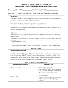
Following a Bearing
Students practice finding a bearing. In this orienteering lesson, students review how to use a compass and set a bearing. Students complete a worksheet where they practice finding a bearing and complete a group activity to practice...
Curated OER
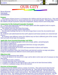
Our City
Second graders familiarize themselves with the town they live in by practicing their imagination, library research and writing skills.
Curated OER
United States: Physical Features Fun
In this map worksheet, learners color and trace eleven listed features on a map of the United States. Students answer six additional questions about the map. A United States map is not provided. However, websites are provided to find...
Curated OER
California Geography
Fourth graders explore geography of four distinct regions of California: mountains, coast, central valley, and desert. They locate California on map, identify state's boundaries and borders, and explore agriculture, a major economic...
Curated OER
North, South, East, and West
A basic lesson on the teaching of the cardinal directions awaits your class. They are directed to go to different parts of the playground and where they attempt to describe their location in relation to each other by using the cardinal...
Curated OER
Globe Lesson 4 - The Compass
Learners study compass' and their use in navigation. In this compass lesson, students use a compass and a globe to answer the questions about navigation.
Curated OER
Yo Ho, Yo Ho, A Pirate's Map for Me: An Original Story
Students read Blackbeard and brainstorm their knowledge of maps. In this language arts and geography lesson plan, students use landmarks on their playground to review north, south, east and west and discuss the compass rose. Students...
Space Awareness
How To Travel On Earth Without Getting Lost
Have you ever wanted to travel the world? Take a virtual trip with a geography lesson plan that uses longitude and latitude, the position of the sun, an astronomy app, and a classroom globe.
Curated OER
Do the Tallywalker
Students study the basics of mapmaking, then make a tally walker, (geographic location device used in secret).
Curated OER
Mapping the Local Community
Students review the symbols and legends of a map. In groups, they follow a set of directions to create a map showing the route to a specific place. They present their map to the class and review the basic components of a community.


