Curated OER
Louisiana's Major Folk Regions
Students study the three major folk regions of the state. They break the regions down into smaller folk regions or use the concept of three regions: North Louisiana, South Louisiana, and New Orleans. They identify some of the markers...
Curated OER
Building Bridges for Young Learners--Culture
Young scholars explore the concept of "culture." In this cross curriculum literacy and world history lesson, students listen to a letter written by a child from Namibia, then compare and contrast life in Africa with their own life. Young...
Curated OER
From Pirates to Pilots to Spies
Sixth graders enjoy this introduction to the world of map projections, globes, aerial photographs, and satellite images. This lesson instructs students on the advantages and disadvantages of each earthly representation.
Curated OER
Investigating Haiti
Young scholars engage in a lesson that is about the island of Haiti. They conduct research using a variety of resources. The information is used in order to help students locate the island on a map. They answer questions while...
Curated OER
Geo-Town
Second graders use a checklist to construct a Geo-Town map including a compass rose, a map key, and a paragraph about a walk around Geo-Town, using appropriate geometric and directional vocabulary to identify the two-dimensional figures...
Curated OER
Multi-cultural and Multiple Perspectives Literacy Lesson
Third graders compare their thoughts about Africa before and after reading an associated book. In this cultural understanding instructional activity, 3rd graders write down their thoughts about Africa. They receive information from the...
Curated OER
Studying the African Immigration Lesson Plan
Pupils read a narrative, conduct an interview and write an autobiographical piece highlighting their findings about an immigrant's experience leaving their country.
Curated OER
Instruments From Around the World
How much does the environment affect how and what man creates? Children explore the effect of the environment on primitive man as they research raw materials from a specific location. They use their findings to write a short essay about...
Curated OER
Radiation Comparison Before and After 9-11
Using the NASA website, class members try to determine if changes could be detected in cloud cover, temperature, and/or radiation measurements due to the lack of contrails that resulted from the halt in air traffic after the attacks of...
Curated OER
Terrabagga Activity Using a Magnetometer
Clever! Earth science learners construct a model of a planet containing a magnetic core. The planet, Terrabagga, is made out of a paper grocery bag, magnets, a dead D battery, and rubber bands. Pictures of each step of the construction...
Peace Corps
Family
Family traditions are the focus of a instructional activity that explores the lives of children in India and those in your classroom. Scholars examine their own family roles and traditions, then respond to an informative text detailing a...
Curated OER
Social Studies - Guessing Game
Focus on a particular geographic location with this resource. Learners use their social studies textbook to look up information about a specific place. They write down a list of facts and read them to the class. Classmates guess which...
Howard Hughes Medical Institute
EarthViewer
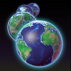
Can you imagine Washington DC and London as close neighbors occupying the same continent? Learners will be fascinated as they step back in time and discover the evolution of the earth's continents and oceans from 4.5 billion years ago to...
Curated OER
Using the Four Main Directions in the Classroom
Students use the four main directions to locate features in the classroom. For this direction lesson, students review the 4 main directions using a world map. Students use a magnetic compass to locate the north wall in their classroom...
Curated OER
Mapping the Village
Young scholars measure, weigh, and document the amount of trash and garbage generated by the school for one day. They brainstorm solutions for trash in the area and assist with the school-wide recycle program.
Curated OER
Introduction to Oceans
Students complete a variety of activities in preparation for a unit on oceans. They discuss their own proximity to the ocean, identify and name the oceans on a globe, and in small groups identify facts about a selected ocean. Students...
Curated OER
Flight Paths of Orbiting Satellites
Learners examine the path a satellite follows as it orbits the earth. In this space science lesson, students use a globe as they illustrate a satellite in its orbital plane, then plot points on the satellite's path on the globe to see...
Alabama Learning Exchange
The Sun and the Earth
Third graders study and diagram the positions of the Earth and sun during the four seasons. They predict weather for cities in the northern and southern hemispheres.
Curated OER
Exploring the World's Geography
Students discuss the seven continents of Earth and the diverse geography. After discussion, they create their own paper-mache globes which properly display all seven continents, the equator, and the prime meridian. They conduct research...
Curated OER
The Clever Monkey Rides Again
Students explore a West African folktale. In this folktale lesson, students read the book The Clever Monkey Rides Again and discuss the trickster characters from the tale. Students participate in a discussion about the folktale and...
Curated OER
Where Is Japan? How Are We Alike And Different?
First graders use literature, maps, and globes to explain how physical environments in various parts of the world are similar to and different from one's own, and that certain areas have common characteristics and can be called regions.
Curated OER
Celebrate Kwanzaa in the United States
Students explore and study the celebration of Kwanzaa in which African-Americans remember their heritage and remind people of the importance of sharing with family and friends. They participate in a chant about the seven continents and...
Curated OER
Ocean Planet: Sea Secrets
Students identify ocean features and draw a profile using data points on a map. Through discussion and research, they discover the importance of oceanography and plot a profile of the ocean floor in search for a vessel full of precious...
Curated OER
Landforms: Geomorphology of Arkansas
Second graders create large, salt dough maps of Arkansas and the natural regions in the state created by geographical and morphological features.


