Curated OER
Hawaii
Fourth graders become knowledgeable about Hawaii the state and Hawaii the island. They also work on reading maps of the islands. They come to know the customs, climates and other fun little facts. They also come to know the eight islands.
Curated OER
Canada's Landform Regions
Students identify and describe the processes that created the landform regions in Canada. They map the regions and research one region to discover more about it. They present their findings to the class.
Curated OER
Land Use Over Time
High schoolers view aerial photos and topographic maps of their local area. They compare and contrast major land use patterns over time by comparing these images to maps that are at least 50 years old. They analyze them using the four...
Curated OER
Explore Three-Dimensional Shapes
Students are assigned to shape groups and explore three-dimensional shapes. They review math skills and two-dimensional shapes.
Curated OER
Canada's Landform Regions
Students use a atlas to identify and describe Canada's Landform region. Using the information they collect, they create a thematic map of the region and describe all of the physiographic regions and the processes that formed them. They...
Curated OER
Science: Draining the Land - the Mississippi River
Students use topographic maps to identify parts of rivers. In addition, they discover gradient and predict changes in the channels caused by variations in water flow. Other activities include sketching a river model with a new channel...
Curated OER
Development Issues in the Northern Suburbs
Students demonstrate the ability to obtain geographic information from a variety of print and electronic sources. They use a variety of maps and data to identify and locate geographical features of Minnesota and Anoka County. in...
Curated OER
Where In the World Are We?
Fifth graders read postcards and find their locations on maps. They use the pictures and text on the postcards to write about imaginary vacations. They compute the mileage and compare it to TripMaker data.
Curated OER
Exploring Florida
Students explore the state of Florida. They study the basic facts associated with the state, such as : the capital, the state bird, and the state song. They locate places in Florida and about the climate, tourism, and agriculture.
Curated OER
Arctic cleanup
Ninth graders examine pollution problems and how it affects the community. In this arctic cleanup lesson plan students study ocean currents and how they affect pollution.
Curated OER
Building Bridges for Young Learners - Self
Students explore self analysis by investigating other cultures. In this personal characteristics lesson, students utilize the Internet to read about a child from Niger, and many other students around the globe. Students compare their own...
Curated OER
Take Me Out To the Ball Game
Students use a map to graph and locate major league teams of different sports. In groups, they analyze the population data of the United States and compare it with the amount and location of the major league teams. They share their...
Curated OER
Landmarks in Paris
Third graders create a map of France. They use computers to view an "in flight" movie about Paris. They research Paris using books and the internet. Students practice using the program "Comic Life." They import illustrations for each of...
Curated OER
An Introduction To Southeast Asia Today
Learners investigate the region of Southeast Asia. They research the history, geography, and spread of ethnicity throughout the region. The various lessons consist of class discussion and group work to find common themes shared in...
Curated OER
How Will I Use My Resource?
Students review information and characteristics of a businessperson. They work in teams, become a business for the day and practice decision making skills. They create a product from a given resource and make a report about their product.
Curated OER
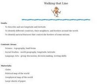
Walking that Line
Students attempt to describe and use longitude and latitude. They will identify different countries, their neighbors, and borders around the world. Included in the lesson the students identify natural features that control the borders of...
Curated OER
Locate and Name the bodies of water and the continents
Second graders locate the equator, bodies of water, and different continents on a globe. In this globe lesson plan, 2nd graders recall geographical information on a globe.
Curated OER
Four Main Directions
Students describe directions using a globe for north, east, south and west. In this mapping lesson students identify the north and south pole. Students understand the importance of the equator and the Prime Meridian. Students explain how...
Curated OER
Water Quest
Students visit the Hydrology Study Site, conduct a visual survey to discover info about local land use and water quality, and document their findings by mapping the water body. They use this investigation to raise questions for further...
Curated OER
Learning About the Equator, The Seven Continents and the Four Oceans
Students use a globe or map to locate the equator, oceans and continents. Using the internet, they spend time surfing through predetermined websites on continents and oceans. They write facts on different parts of the globe on index...
Curated OER
BIGGER AND BIGGER: (We Live in a family, a neighborhood, a city, and the United States)
Students discover that they are part of bigger and bigger groups. They begin with families and work up to belonging to North America as they initiate a study of the whole country.
Curated OER
Water Walk
Students follow the appropriate sampling protocol and take two measurements of a local water source. These measurements are Transparency and Temperature. This info about local land use and/or water chemistry issues may require further...
Curated OER
Rooster's Night Out
First graders complete interdisciplinary activities associated with a folktale from Cuba. In this Cuban folktale lesson, 1st graders read the Rooster's Night Out, before completing comprehension worksheets, make recipes, and...
Curated OER
And the Rains Came Down: A South American Rainforest
Students examine the characteristics of a South American tropical rainforest. They analyze maps, develop graphs, listen to the book, The Great Kapok Tree, and create a rainforest mural.


