Curated OER
Globe Lesson 4 - The Compass
Students study compass' and their use in navigation. In this compass lesson, students use a compass and a globe to answer the questions about navigation.
Curated OER
The O Zone-Code Read Alert
What are the effects of an air quality alert? Expert groups receive one component of air quality information resources to study. Pupils then jigsaw into new groups and share their knowledge. Finally, they draft a statement of what they...
Curated OER
Transportation
Engage in an 8-day study of different modes of transportation. Your students explore the concept of location and define the physical characteristics of places, such as, land forms, bodies of water, natural resources, and weather.
Curated OER
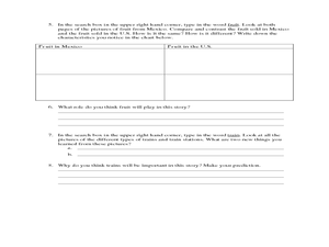
Esperanza Rising - Anticipation Guide
Learn about Mexican culture while simultaneously strengthening reading, writing and computer skills. In order to get the most out of Esperanza Rising, pupils should have prior knowledge of Mexican culture. Therefore, there are links to a...
Curated OER
Christopher Columbus
Help first graders gain an understanding of the beginnings of our nation by learning more about Christopher Columbus. They begin by listening to a read aloud of Christopher Columbus and His Voyage to the New World (another title could be...
Curated OER
The Global Grapefruit - Representing a 3-Dimensional Globe on a 2-Dimensional Map
Learners compare and contrast world maps and globes. They convert a 3-dimensional globe to a 2-dimensional map. They are introduced to the Mercator map projection. They observe map distortions of shape, area, distance, directions and angle.
Curated OER
MAP UNIT
First graders investigate how maps are used to identify different locations. They will also appreciate how there are different types of maps for their purposes. Finally students study how maps contain symbols that represent real places.
Curated OER
Globe Lesson 7 - Parallels and Meridians - Grade 6+
In this parallels and meridians worksheet, students read a 2-paragraph review of parallels and meridians and respond to 7 short answer questions.
Curated OER
Globe Lesson 5 - Latitude - Grade 6+
In this latitude learning exercise, students read a 3-paragraph review of latitude and respond to 12 short answer questions.
Curated OER
Mapping with a Compass: A Simulated Survey
Students use compasses and grids to map the locations of artifacts found in a simulated dig site. In groups, they role-play as future archeologists excavating a school site. Groups begin at their assigned datum and site the artifacts...
Curated OER
Countries of the World
Students identify countries on a world map. In this map skills lesson, students define the word "country" and use post-it notes to locate several countries on a world map.
Curated OER
Making Sense Of A Round World On A Flat Surface
Students engage in a lesson that is concerned with the development of geography skills. They take part in a number of activities that center around finding and traveling to different locations. The lesson has resource links that can be...
Curated OER
The Archer and The Sun
First graders explore Chinese folktales. In this Chinese folktale lesson ,students read Chinese folktales, locate China on a map, and color the Chinese flag. Students are given sentence strips to hold and must arrange themselves in the...
Curated OER
Where in the World
Students explore the global grid system. In this globe lesson, students identify latitude and longitude lines and how these can tell the coordinates of any place. They use the Internet to find the exact coordinates for their town.
Curated OER
How Many Ways Can You Say Merry Christmas?
Students create a multicultural holiday bulletin board map! students research and study saying Merry Christmas in different languages. They correctly locate the countries on a world map.
Curated OER
Introduction to the Civilization of Ancient Greece
Students explore Greece. In this introduction to ancient Greece instructional activity, students locate and circle the names of the bodies of water surrounding Greece, then underline the names of important cities in Greece on a world map...
Curated OER
Coming to America: U.S. Immigration
Students study immigration in the late 19th and early 20th century. In this immigration lesson plan, students participate in activities including creating maps, responding to non fiction text, memorizing and analyzing poetry, and...
Curated OER
Chart Making for Navigators
Students discuss the importance and function of nautical maps for sailors. They, in groups, take soundings of a simulated bay in a shoebox and develop a nautical chart that enable them to navigate the shoebox safely.
Curated OER
A Study of Alaska
Pupils explore Alaska. This lesson is gearing mostly for students who live in Alaska.
Curated OER
Spherical Geometry: A Global Perspective
Learners investigate spherical geometry using a globe and an apple. In this spherical geometry lesson plan, students translate Euclidean geometry terms to spherical geometry terms using a globe. They answer 3 questions about spherical...
Curated OER
Investigating Latitude and Longitude
Students examine the lines of latitude and longitude on a map, and explain why these lines might be useful. For this lesson students also explore websites that provide information to improve their understanding of how and why latitude...
Curated OER
Where in the World? :Understanding Latitude and Longitude
Students play a grid-based game and devise clues to help classmates locate spots on the globe in order to recognize the value of using longitude and latitude for identifying locations.
Curated OER
Where in the World? The Basics of Latitude and Longitude
Students are introduced to the concepts of latitude and longitude. In groups, they identify the Earth's magnetic field and the disadvantages of using compasses for navigation. They identify the major lines of latitude and longitude on a...
Curated OER
Pearl Harbor
Young scholars identify the location of Pearl Harbor and Hawaiian Islands on a map. In this map skills lesson, students use latitude and longitude coordinates to locate various places of importance of the Pearl Harbor attack.


