Curated OER
Exploring an Atlas
Students explore global geography by participating in an atlas activity. In this countries of the world lesson plan, students collaborate in small groups and analyze an atlas while researching continents, countries and demographics....
Curated OER
Using Vegetation, Precipitation, and Surface Temperature to Study Climate Zones
Middle schoolers begin their examination of the climate zones found around the world. Using a software program, they identify the relationship between the vegetation, climate and temperatures of the different zones. They also plot...
Curated OER
Where In the World Are You?
Fourth graders fill in blank copies of the United States Map and then the World Map.
Curated OER
Civil War Naval Strategy
Learners apply critical thinking skills to war strategy. In this Civil War map instructional activity, students use their knowledge of latitude and longitude as well as scale to respond to questions regarding Civil War battle strategies.
Curated OER
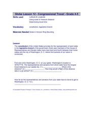
Congressional Travel
Students determine the distances traveled by the members of the legislative branch of the US Government. In this travel distance lesson, students locate Washington, DC on a globe using the longitude and latitude of the city. They...
Curated OER
My Community
Learners identify how their school has changed. In this local community lesson, students listen to a brief history of their town and school and interview someone that graduated from their school. Learners then create a map of their...
Curated OER
SpellO': An Orienteering Lesson
Students participate in hands-on activities to practice orienting maps. Given activity cards, students accurately read maps and locate specific stations. Students collect information from the maps to spell a message when the activity...
Curated OER
Where Should We Put a Store?
Students analyze population data. They convert population data into simple density maps to help make decisions about their world. They select the best location for a school store based on population density. They present their maps...
Curated OER
Matthew Henson
Discuss the work of Matthew Henson, an African American who traveled to the North Pole with Robert Peary. After reading the story "Matthew Henson" by Maryann N. Weidt, learners answer questions by drawing inferences and conclusions,...
Curated OER
Monarch Butterflies
First graders identify monarch butterflies and study their life cycles. They order the stages of the life cycle and create a monarch butterfly of construction paper. This well-designed instructional activity should be easy to implement...
August House
The Clever Monkey Rides Again
Use a West African folktale to practice several different skills in your first grade classroom. Learners read The Clever Monkey Rides Again and focus on rhyming words, reading comprehension, measurement, art, movement, and word order.
Curated OER
"The Drum"
Second graders read and discuss the folktale "The Drum" from India. They also answer story comprehension questions, complete an adjectives and verb worksheet, and label a map of India. Students sequence events from the story and make...
Curated OER
Barrels and Buckets: Access to Water - What Would It Be Like to Live in Africa?
Students compare water access in the United States with that of Africa. In this water access lesson, students located Ghana and Kenya on a globe before reading Peace Corps Volunteer accounts of the difficulty of accessing clean water....
Orange County Water Atlas
Location, Location, Location…
Young geographers discover not only how to read and recognize coordinates on a map, but also gain a deeper understanding of latitude and longitude and how climate changes can vary significantly across latitudes.
Curated OER
Endangered Ecosystems
Reading comprehension and note-taking skills are practiced as young ecologists embark on this journey. Explorers visit a website where they will read about three ecosystems that are in danger. They use interactive programs to build a...
National Endowment for the Humanities
Lesson 1: On the Road with Marco Polo: A Boy in 13th Century Venice
Learners investigate Marco Polo's life as a young boy in 13th century Venice. They analyze maps, explore various websites, complete a chart and answer discussion questions, and create a travel brochure about visiting 13th century Venice.
Curated OER
Searching for Stars
Positive character traits in literature are explored in this character development and literacy lesson plan. Learners listen to Cinderella by Charles Perrault and Little Gold Star by Robert D. San Souci, followed by a discussion...
Curated OER
Changing Planet: Fading Corals
Show the six-minute video, "Changing Planet: Fading Corals," and then demonstrate how calcium carbonate forms a precipitate in the presence of carbon dioxide. Separate your scientists into small groups to gather information about coral...
Curated OER
Where's the Water? Stream Side Science
After a whole-class discussion of water reservoirs, ten liters of water are given to each lab group to represent Earth's total amount of water. They divide the water into smaller containers, each representing one of those reservoirs. The...
August House
Go to Sleep, Gecko
Use this multidisciplinary lesson to delve into these subjects: English language arts, math, science, drama, and character education. After reading, discussing, and making interpretations about Go To Sleep, Gecko!: A Balinese Folktale by...
National Geographic
Altitude: What's in the Air?
Introuduce your scientists to the differences in air at varying altitudes with a colorful explanatory graph. After some discussion, they view unbelievable footage of mountain-climbing Leo Houlding and a narrative about how he might do...
National WWII Museum
“My Dear Little Boys…” Interpreting a letter home from the war
Letters have long been prized by historians as primary sources for what they reveal not only about events but also about the emotional responses of the writers to these events. "My Dear Little Boys," a letter written by Leonard Isacks on...
Curated OER
Cardinal Directions
Students draw items on a map in specific places to show their knowledge of cardinal directions. In this simple map skills lesson plan, students draw a cloud, a tree, a house, and a lake to show North, South, East, and West.
Curated OER
Where Is Japan? How Far Is That?
First graders use literature and hands-on activities with maps and globes to explain distance and tools used to measure distance. They select tools to measure various objects in the classroom, then apply those concepts to their map...


