Curated OER
Maps, Maps, and More Maps
First graders create a map and display an understanding of the cardinal directions. In this map skills lesson, 1st graders listen to stories where a map would come in handy, create their own map, and use the cardinal directions accurately.
Curated OER
Map It With Pixie
Fourth graders use the computer program 'Pixie' to create a topographic, detailed map for the state they live in. In this mapping skills lesson plan, 4th graders use Pixie to make a map of their state that includes topographic features,...
Curated OER
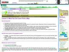
What You Can Learn From a Map
Students investigate the use of road maps, shadeded relief maps, and topographic maps.
Curated OER
Making Personal Maps
Young scholars study maps and become familiar with how to use one. In this investigative lesson students create a map of an area and provide a legend.
Curated OER
United States Map- Land Elevation
Students explore a physical map. In this map skills lesson, students discuss examples of elevation and investigate the symbols used to identify elevation on a map. Students use the map to identify various land elevations.
Curated OER
Yo Ho, Yo Ho, A Pirate's Map for Me: An Original Story
Students read Blackbeard and brainstorm their knowledge of maps. In this language arts and geography instructional activity, students use landmarks on their playground to review north, south, east and west and discuss the compass rose....
Curated OER
Our World With MapsQ
Young scholars examine and compare different types of maps. In this map skill lesson plan, students look at neighborhood and national maps on the overhead projector while making comparisons of the symbols and locations. They use a...
Curated OER
Learning about Maps and Colors
First graders discuss "Harold and the Purple Crayon" and his drawings. In this neighborhood geography lesson, 1st graders learn to detect and classify places on a map including their home. Students recognize their address as a specific...
Curated OER
Drake's West Indian Voyage 1588-1589
Learners investigate several maps detailing Sir Francis Drake's voyages. In this geography lesson, students practice reading maps and locating the precise locations of where Sir Francis Drake visited. Learners create an...
Curated OER
Learning to Use Map Legends
Fifth graders comprehend the purpose of and use map legends. They identify and use symbols and lines from legends on a general-purpose map and four topical maps to completely and accurately answer eight questions on a geography worksheet.
Curated OER
The Legend of the Indian Paintbrush: Native American Life
Students read," The Legend of the Indian Paintbrush" by Tomie dePaola and discuss the way legends are passed down orally. They then create their own legend and illustrate it on a simulated "Buffalo Skin" made from brown paper.
Curated OER
Waldseemuller's Map: World 1507
Seventh graders analyze various maps. In this Geography lesson, 7th graders create a large map as a whole class. Students write a letter to Mr. Waldseemuller.
Curated OER
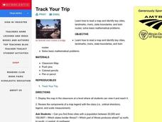
Track Your Trip
Fourth graders are shown how to read a map and identify key cities, landmarks, rivers, state boundaries, and train routes. They solve basic mathematical problems. Students reivew the componets of a map legend. They are asked to find...
Curated OER
WORLD GEOGRAPHY
Students identify and analyze map symbols and map grids by completing various worksheets and creating their own map using these skills. Students identify and analyze what latitude and longitude are on a map to play a game of Bingo....
Curated OER
Country Capitals
Students locate country capitals on a world map. In this map skills lesson, students review the definition of the word country and discuss what a capital is. Students locate and label capital cities on a world map using a map marker.
Curated OER
Spatial Connections
Students use maps, scales, and describe locations in order to learn about spatial sense. In this spatial sense lesson plan, students participate in many activities for this spatial sense unit that should last throughout the year.
Curated OER
Put Me in My Place: Using Alphanumeric Grids to Locate Places
Students practice locating points on a large wall grid and create and label a neighborhood map. In this geography lesson plan, students spell and discuss places as the teacher places them on the map. They discuss the concept of an...
Curated OER
Countries of the World
Learners identify countries on a world map. In this map skills lesson, students define the word "country" and use post-it notes to locate several countries on a world map.
Curated OER
Our 50 States
Students identify the location of the 50 states using an interactive map. They practice geography skills by playing a fun game. Pupils become familiar with the state abbreviations for the US states. Students become familiar with the...
Curated OER
Rescue!
Students explore movement and position concepts. They follow directions using left , right, up, down, North, South, East and West. Students draw and follow a path on a grid to show a route followed. They label and follow legends on a map.
Curated OER
Pacific Atolls and Island Groups
Young scholars construct, interpret and translate maps and geographic data. Given a worksheet, students identify an island, an atoll, a scale, and a compass rose. Young scholars grid systems, legends, and symbols. They use the map to...
Curated OER
How Do I Get There? Planning a Safe Route to School
One much-needed skill for young learners is direction giving. Have your class plan and draw a safe route for them to travel from home to school. They will also draw places and items that are in between home and school in order to build a...
Curated OER
Water Contamination Mapping Lab
Pupils are introduced briefly to the Biscayne Bay Ecosystem, observed microbe distributions and water current maps are introduced. They measure water current speeds to predict the movement of pollutants based on the type of the tidal flow.
Curated OER
Route To School Mapping Assignment
Students create a map showing the route from home to school. Students include a legend, compass, label buildings, and color the map route on the map. They write out specific directions.


