Curated OER
The Wild Wild Mid-West
Eleventh graders examine reasons for Louisiana Purchase and identify those who played key roles in it, create map of Louisiana Purchase and states that are part of it, and analyze overall importance of Louisiana Purchase.
Curated OER
Celebrating 100 Years of Negro Leagues Baseball
Ninth graders locate original locations of Negro Leagues Baseball teams using latitude and longitude, calculate distances between locations using maps and/or Internet resources, and use critical thinking skills to compare and contrast...
Curated OER
Weather Predictions
Students play the role of weather personalities by making five day forecasts based on data gathered from observations, weather instruments, and weather maps. Each day a small group makes a class forecast for the next day and reviews the...
Curated OER
Canada...A Visual Journey
Students work together to analyze the six natural regions of Canada. Using this information, they create a visual representation of each region on a large wall map and present it to the class. They must identify five key points of each...
Curated OER
Number the Stars
Students read Number the Stars. In this social studies lesson, students read the story and use a map of western Europe and identify the countries involved in the war. Students locate the cities of Denmark that are discussed in the story.
Curated OER
Absolute and Relative Location
Second graders understand the difference between relative and absolute location using the grid map as an example of an absolute location. They observe a class map showing longitude and latitude lines and learn that they provide exact...
Curated OER
Directionality
Second graders discuss the cardinal directions and intermediate directions and then look at the spooky map to locate different points on the map. They answer questions about where things are located in reference to another object and...
Curated OER
Outlandish Landforms
Seventh graders examine landforms. In this world Geography lesson, 7th graders research and create a physical model of a chosen landform. They then draw a 2-d paper map of that model.
Curated OER
Comparison of Snow Cover on Different Continents
Students use the Live Access Server (LAS) to form maps and a numerical text file of snow cover for each continent on a particular date. They analyze the data for each map and corresponding text file to determine an estimate of snow cover...
Curated OER
Slavery and the Underground Railroad
Students examine a map of the Underground Railroad. They trace the slaves journeys and calculate the mileage. They write an essay about the risks and penalties one faced in escaping. They work together in groups to name characteristics...
Curated OER
Weather, Migrations, and Plants
Students research the effects of day-to-day weather on animal migrations, plant growth and other seasonal events. They consult maps, observe and record local conditions, keep journals and use their collected data check hypotheses.
Curated OER
Lesson 11: Illinois History 1800's Dual Timeline
Students identify and research key event in the history of Illinois during the 1800's and create a dramatic skit or oral report based on the event.
Curated OER
Early Arkansas Geography
Seventh graders locate and describe historical Arkansas while using a historical map.
Curated OER
Weather Patterns and Acid Rain (or What is Chicago's acid rain doing in the Adirondacks?)
Students examine a color-coded map of U.S. acid rain precipitation intensity. Using EPA data table and the blank U.S. map, they record state-by-state values for magnitude of emissions and compare areas of emissions to areas with the most...
Curated OER
Europe
Learners examine the reasons how and why the European Union was formed. They locate Europe on a map and identify the countries in the European Union. They create a tourist brochure for one of the countries.
Curated OER
A Cowboy's Life
Students observe a photograph of a cowboy and brainstorm things a cowboy would do. They reveiw text about Wyoming and locate facts and information about a cowboys life then create a friendly letter containg key components found in a...
Curated OER
Bioregions of California
Students map out the bioregions of California by examining the species and environment in different areas of the state. They use information and pictures from a PowerPoint presentation to complete a map handout and play a trivia game.
Curated OER
The Bear Facts About Summarization
Students practice summarizing techniques in this lesson. They listen as the teacher reads from a non-fiction article, and the class creates a story map to highlight the most important facts from the article. They use the map to write a...
Curated OER
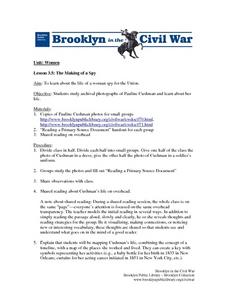
The Making of a Spy
Students study the life of a woman spy for the Union. They study archival photographs of Pauline Cushman and examine her life. They create a key with
symbols representing her activities (e.g., a baby bottle for her birth in 1833 in New...
Curated OER
Discovering the Physical Geography of Washington
Pupils develop a mental map of the state of Washington and draw it on paper. Using the Virtual Atlas, they identify the physical features of the state and draw them on their map. They also examine the populations and diversity of the...
Curated OER
Inference Lesson Plan
Students practice assessing graphics to infer and identify an author's implicit and explicit meaning in a piece of text. They evaluate the effectiveness of information found in maps, charts, tables, graphs, diagrams, cutaways and through...
Curated OER
The Early History of Haiti
Seventh graders make list of places Columbus explored on his first journey to Americas, locate island of Hispaniola on map, examine groups of people who have inhabited island, complete blank map and key of Hispaniola, and research early...
Curated OER
Born, Bread and Buttered in London
Students map points of interest and listen to an interview to become familiar with London. In this London lesson, students pair share what they pictured from the interview. Students discuss specific vocabulary and points of interest in...
Curated OER
Tooling Around Arizona: Measuring Distances
In this measurement activity, student measure the distances between Arizona cities by using a the scale on an Arizona Cities map. Students complete 15 problems.
Other popular searches
- Map Key and Legend
- Map Legends
- Map Key Legend
- Map Keys and Legends
- Map Key Legend Activities
- Map Legends and Symbols
- Map Legends First Grade
- Interpreting Map Legends
- Reading Map Legends
- Creating Map Legends
- Using Map Legends
- Semantic Map Legends


