Curated OER
Mapping Districts
Students use maps to learn about the U.S. Census. In this 2010 Census lesson plan, students visualize census data on maps, use map keys to read population maps, and explore the concept of population density.
Curated OER
Lesson 2: Mapping Sub-districts
Students learn more about the census. In this mapping sub-districts lesson plan, students visualize census data on a map, use a map key to read a population map, and better understand the concept of population density.
Curated OER
United States Map Lesson
Students explore basic map skills. In this United States geography lesson, students define "country" and "state," locate their state on a United States map, and identify and trace state boundaries defining their state and surrounding...
Curated OER
United States Map - Lesson 9
Students explore the concept of cardinal directions. In this geography lesson, students identify the compass rose on a large U. S. map and then discuss the cardinal directions.
Curated OER
Mapping It Out
This PowerPoint provides information about maps. Students discover the functions of legends, compasses, indexes, and scales on maps. Two resources links are provided, however one of them is broken.
Curated OER
How Big is the Playground: Creating a Map
Students create a topographical map of an area outside of the school. In this mapping lesson, students compile data on angles, distances, and key landmarks for a predetermined area on the school grounds to create a map using Geometer's...
EngageNY
How Do Dilations Map Angles?
The key to understanding is making connections. Scholars explore angle dilations using properties of parallel lines. At completion, pupils prove that angles of a dilation preserve their original measure.
Curated OER
Those Who Have Come Before Me
Class members are transformed into explorers as they work in groups to locate hidden items and map their journey along the way. They then leave clues for other groups of students to follow, and ultimately discover how past explorations...
Student Handouts
Geography of Dr. Martin Luther King, Jr.
Young geographers follow Dr. Martin Luther King's journey during the civil rights movement by identifying major events on a map of the eastern United States, such as his birth in Atlanta, Georgia and his famous "I Have a Dream" speech in...
Balanced Assessment
School Zone
Find the right house within walking distance from school. The short assessment has pupils determine the houses that are a given maximum distance from a school. Individuals then determine the shortest and longest walks from the homes that...
Curated OER
Underwater Mountains & Trenches
Students determine Earth's deepest trench, outline continents, major ocean mountains, and trenches on color-key map using Crayola Erasable Colored Pencils, identify oceans' geographic features, locate significant oceanic features around...
Curated OER
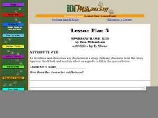
Sparrow Hawk Red - Attribute Web
A useful scaffold to help your class with character analysis and text interpretation. Questions about characters from Sparrow Hawk Red by Ben Mikaelsen guide your young readers to describe a character literally, along with interpreting...
Raymond C. Jones
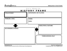
Story Mapping History Frame
Map out the conflicts throughout history with a graphic organizer. It includes a section for kids to list the participants in an event, the problems or goals, and the theme or lesson learned.
Curated OER
Treasure Hunt
First graders read and follow a map in a treasure hunt to find the location of the treasure. They demonstrate their knowledge/understanding of symbols, keys on a map, and directions by following the map with ease.
Curated OER
Making Maps
In this map making worksheet, students learn about the science of making maps, which is cartography. They then answer the 11 questions on the worksheet. The answers are on the last page.
Curated OER
Why We Count
Students visualize census data on a map and use a map key to read a population map. In this census lesson, students use a map of the Virgin Islands and corresponding worksheets to gain an understanding of population density.
Curated OER
Learning About the Map's Legend
Young scholars draw a map of a room in their house and place a legend on it. They explain the legend orally.
Curated OER
Mapping Community Values
Students discuss the origin of various maps focusing on the values behind them. Students also explore how human needs and geography influence community settlement patterns. Students extend learning by creating and mapping their own ideal...
Curated OER
Map Analysis Worksheet
In this map analysis worksheet, students decipher what type of map they are using based on a complete list of criteria. Students then answer multiple questions based on their discoveries.
Curated OER
Kinds of Maps
In this map activity, students match a set of descriptions with the names of different types of maps and answer true/false questions and short answer questions about using maps.
Curated OER
Mapping Puerto Rico
Students use maps to discover where Puerto Rico is located. In groups, they use the internet to research the vegetation. They also compare and contrast the relationship between the United States and Puerto Rico's government.
Curated OER
Map Skills
In this map worksheet, students use a map and key to complete a set of 7 questions. Answers are included on page 2, questions focus on miles and direction.
Curated OER
Waldseemüller’s Map: World 1507
Middle schoolers take a closer look at historical maps. In this primary source analysis instructional activity, students examine the first world map produced by Martin Waldseemuller. Middle schoolers complete the included map analysis...
Curated OER
Edible State Map
Fourth graders, using a map of a state for reference, make an edible map that shows the major cities in that state. Once the map is shaped, have students place the M&M's where each major city would be. Now this is a instructional...
Other popular searches
- Map Key and Legend
- Map Legends
- Map Key Legend
- Map Keys and Legends
- Map Key Legend Activities
- Map Legends and Symbols
- Map Legends First Grade
- Interpreting Map Legends
- Reading Map Legends
- Creating Map Legends
- Using Map Legends
- Semantic Map Legends


