T. Smith Publishing
Map Skills
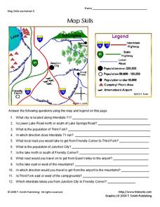
Help younger learners develop their map skills with this simple worksheet, which includes 12 questions utilizing a map legend that involves highway markers, population indicators, and other landmark signs.
abcteach
Street Mapping
What's around the block? Or down the street? Ask your pupils to tap into their map skills by drafting the area around their home and school.
Curated OER
Map Skills
In this history worksheet, students utilize a map and legend to answer eleven comprehension questions. Students check their answers when done.
Curated OER
Map Skills
In this history worksheet, students use a map and legend to answer nine comprehension questions. Students check their answers when done.
Curated OER
Map Keys
In this geography worksheet, students identify who a cartographer is and what they do specifically. They study an outline map of a fictitious island and then, respond to the three questions that follow. Finally, students add three more...
Institute for Geophysics
Understanding Maps of Earth
Here is your go-to student resource on primary geography concepts, including facts about the surface of the earth and its hemispheres, latitude and longitude, globes, types of maps, and identifying continents and oceans.
Curated OER
Topographic Mapping Skills
In this geography worksheet, learners read an excerpt about topographic maps and why they are useful for various jobs. They also respond to eleven questions that follow related to the excerpt and locating specific map points on the map...
Curated OER
Map Analysis Worksheet
In this map analysis worksheet, students decipher what type of map they are using based on a complete list of criteria. Students then answer multiple questions based on their discoveries.
Curated OER
The Roman Empire-Map Activity
In this Roman Empire worksheet, students complete a map activity in which they label and color civilizations, countries and physical features as instructed. There are no maps included.
Curated OER
Asia and the South Pacific: Political Map
For this Asia and the South Pacific map worksheet, learners examine national political boundaries and national capitals in this region of the world.
Curated OER
Asia and the South Pacific : Political Map
In this Asia and the South Pacific map worksheet, students examine the boundaries of the nations in this region of the world. Students also note the location of capital cities as they are denoted by stars. Major bodies of water are labeled.
Curated OER
USA: Physical Map
For this United States physical map worksheet, students investigate the major landforms and bodies of water located throughout the country.
Curated OER
USA Capitals Map
In this United States political map worksheet, students examine state boundaries and locations of each of the state capitals.
Curated OER
United States of America Map: Capitals
In this United States outline map worksheet, students note the political boundaries of the states that are labeled with postal abbreviation codes as well the labeled state capitals.
Curated OER
Mapping Exercise
For this mapping worksheet, students are given data of children exposed to health risks and their geographical location. Students plot each child's home and the risk factors using an (x, y) grid. They answer 2 questions about the...
Curated OER
Worksheet for Analysis of a Map
In this primary source analysis activity, students respond to 6 short answer questions that require them to analyze the maps of their choice.
Curated OER
How to Interpret a Map
In this social studies worksheet, learners find all the important facts on a map. Students find any map and fill out the chart and answer 12 questions about what they find.
Education World
Map Skills Worksheet 5
In this map skills practice worksheet, students practice reading a legend as they respond to 12 short answer questions regarding a legend and a map.
Curated OER
BOLTSS Map
In this geography worksheet, students identify the six features always used on maps. They identify each of these features by the acronym BOLTSS. Students examine the Melbourne Cricket Ground shown and respond to the 4 questions that follow.
Curated OER
USA: Average Precipitation and Temperature Map
In this United States map worksheet, students make note of the average precipitation and temperature in regions of the country.
Curated OER
Africa & Asia: Physical Map
In this African and Asian physical map worksheet, students investigate the major landforms and bodies of water located on the African and Asian continents.
Curated OER
California Regions Map
In this California regions outline map worksheet, students examine the coastal, mountain, central, and desert regions of the state.
Curated OER
World Climate Map
In this world climate map activity, students examine the tropical, dry, warm temperate, cool temperate, polar and subartic, and highland climate regions of the world.
Curated OER
Bermuda Triangle: Map Activity
In this Bermuda triangle worksheet, students complete a set of 4 questions using a given map of the Bermuda triangle. Answers are included on page 2.
Other popular searches
- Map Legends and Symbols
- Map Legends First Grade
- Interpreting Map Legends
- Reading Map Legends
- Creating Map Legends
- Using Map Legends
- Semantic Map Legends
- Teaching Map Legends
- Lessons on Map Legends
- Math Using Map Legends


