Curated OER
Where Am I, and How Do I Get Where I am Going?
Students describe geographical places through art, music, writing, and math. They compile information in booklets which may be published.
Curated OER
Investigating Our Place in the World
Students study the concept of geography in a year long unit. In this geography unit, students participate in different activities that explain the spatial sense of the world, the physical landmasses and bodies of water, geographic...
Curated OER
Gallery Walk Questions about Energy and Material Cycles
Students state the physical, chemical or biological processes associated with these environments: Pelagic ocean zone, California coat Cave, Indiana Barrier island beach, North Carolina Sand dune, Dunes National Park, Colorado Wetland and...
Curated OER
Yo-ho, Yo-ho a Viking's Life for Me
Students complete a unit of lessons on the Vikings. They analyze maps, read and discuss myths, summarize the main ideas from resource materials, watch videos, sing a song, draw a picture to illustrate Norse mythology, and define key...
Curated OER
Water, Water Everywhere, and Nary a Drop to Drink!
Students sing the continent song and locate oceans between the continents on a map. They read "They Earth is Mostly Ocean" and copy notes into their journals. They watch a demonstration of water and saltwater evaporated to see what is...
Curated OER
Modelling Ocean Currents
Students construct a replica of the Atlantic ocean given certain parameters. In this earth science lesson, students draw their own map of ocean currents. They answer questions related to the activity.
Curated OER
Earth and Space Science: Exploring Earthquakes
Students explore earthquakes. In this earthquake lesson, students research earthquakes and identify where they take place. Students use map skills to track down earthquake locations. There are internet sites suggested in this lesson.
Curated OER
Physical World Map
In this world map worksheet, learners practice their geography skills as they label the 7 continents and 5 oceans. Teachers may use this physical map for various classroom activities
Curated OER
Regions of South America
Students explore facts about South America in the four lessons of this unit. Booklets are created from the materials produced as the class delves into the topic.
Curated OER
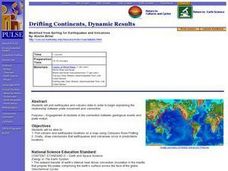
Drifting Continents, Dynamic Results
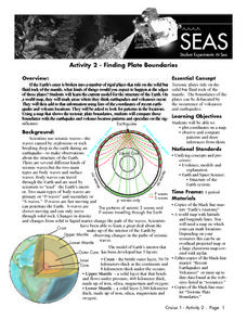
Students plot earthquake and volcano data using a Compass Rose Plotting. They explain the relationship between plate movement and connection. They draw conclusions that earthquakes and volcanoes occur in predictable locations.
Curated OER
Plates on the Move
Young scholars explore how Africa appears to be tearing apart from Asia and tha the other continents are moving and oceans are changing size.
Curated OER
Traveling Through North America
Students identify places and landmarks in North America, specifically Canada and the United States, by using and constructing maps. Six lessons on one page; includes test.
Curated OER
Where in the World Am I?
Learners are introduced to geography skills. They answer questions on a worksheet using the internet and maps. They examine the area of Japan as well.
Curated OER
Where in the World is Tacky the Penguin?
First graders complete activities related to they story they are reading in class. Through art and measurement activities, 1st graders relate a story from the "Tacky the Penguin Series" to everyday objects and ideas they encounter.
Curated OER
Global Perceptions: How Your Students View the World
Students examine their own perceptions and attitudes about places around the world. Using their mental maps, they compare and contrast it with a world map from different periods in history. They review the various types of map...
Curated OER
Reading Around the World
Students use the internet to identify the seven continents. Using maps, they locate and identify major physical features of Earth. They are read different books by various authors on the Earth and answer questions related to it. They...
Curated OER
Climate and Topography, What Is the Connection?
Fourth graders study Neumann's world continent map and explore topography and climate.
Curated OER
Landforms All Around
Students create a "Landform Dictionary". They develop an overlay map and participate in hands-on activities to identify the key characteristics of landforms. They discuss the plant and animal life of these areas. Handouts for the lessons...
Curated OER
Social Studies and Children's Literature
Young scholars write a journal in response to literature. The story that is read is about prairies. The subject of prairies becomes an object for research. The culminating activity is the making of a map where prairies exist in the...
Curated OER
Biome Web Quest
Third graders create paper mache globes, paint them and label the oceans and the continents. In groups, they research a biome, write about it and create an artistic visual representation of the biome and present it to the class.
Curated OER
Sea Secrets
Learners study the following: For centuries, people have been challenged by the mysteries that lie beneath the blue depths of our ocean planet. Very little was known about the ocean until late in the nineteenth century, although nearly...
Channel Islands Film
Island Rotation: Lesson Plan 1
How do scientists provide evidence to support the theories they put forth? What clues do they put together to create these theories? After watching West of the West's documentary Island Rotation class members engage in a series of...
Curated OER
Recent Volcanoes And Earthquakes:
Learners investigate the current model for the structure of the Earth. On a world map, they mark areas where they think earthquakes and volcanoes occur and compare those areas with earthquake and volcano location patterns.
Curated OER
Plate Tectonics & Land Forms
Fourth graders discuss the different interactions of plates and the ways mountains are created. In this plate tectonics lesson students complete an activity in groups.


