Curated OER
Scrambled States
Learners read or are read the story "Scrambled States". Using a map, they identify their states and time zones. They predict their states representation in the book and discuss it after the book is finished. They discvor the differences...
Curated OER
Rock Around the Map
Students research the geographical histories of various musical genres and make maps that note important places in music history. They Write geographical biographies about one of their favorite musical artists.
Curated OER
Mystery State #17
In this mystery state worksheet, students answer five clues in an attempt to identify the state in question. Then, they locate it on a map.
Curated OER
3-D Topographic Maps
Students create a 3-D topographic map. In this map building lesson, students use cardboard to create a topographic map of the Catskills mountain region.
Ashbrook Center at Ashland University
Ratification of the Constitution
How difficult was it to get everyone to agree on the contents of the Constitution? Historians analyze the task of the Founding Fathers in creating the United States Constitution. They research a directory of video clips, primary sources,...
Curated OER
Empire State-Building
Learners explore how empires around the globe have impacted the world in which they have existed. They analyze whether or not the United States is an imperialist nation and create their own empires based on their understanding of empires...
Curated OER
Song Mapping
Learners explore locations on the United States map. In this map skills activity, students recite the song This Land Is Your Land and locate various places listed in the song on the map.
Curated OER
Isla Story Map and Time-line
Fourth graders arrange five major events from the story Isla in correct order on a quiz. They represent the sequence of at least five story events through a story map based on the book, Isla.
Curated OER
Cinderella Map Key
Students design a map key in order to show where the different Cinderella stories have taken place. In this map key lesson plan, students place symbols on a map to show the diversity of the stories.
Curated OER
Making Topographic Maps and Mountain Profiles
Young scholars study how to mark inclines and construct a mountain profile. In this topographic map lesson students mark contour intervals and draw mountain profiles.
Curated OER
Puerto Rico: The 51st State?
Students examine the political status of Puerto Rico. In this global studies lesson plan, students explore Puerto Rico and consider the feelings of Puerto Ricans regarding their unique political status.
Curated OER
A Shuttle's Eye View
Students explore the goals of the Shuttle Radar Topography Mission as a springboard to exploring the topographical features of their own state or region. They synthesize their understanding of landforms and topography by mapping their...
Curated OER
Is the Hudson River Too Salty to Drink?
Students explore reasons for varied salinity in bodies of water. In this geographical inquiry lesson, students use a variety of visual and written information including maps, data tables, and graphs, to form a hypothesis as to why the...
Curated OER
From Hypothesis to Conclusion...Reading Maps to Understand Proofs
Tenth graders explore the concept of proof. In this proof lesson, 10th graders work in groups to collectively write proofs for directions to places on a map. Students give directions to specific places in big cities such as from the New...
Theodore Roosevelt Association
Roosevelt's Legacy: Conservation
The legacy of Theodore Roosevelt carries through modern American politics, economics, foreign policy, and society. But his proudest and most profound efforts were in the world of conservation, and in preserving the natural beauty of...
American Battlefield Trust
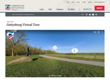
Gettysburg Virtual Tour
Step into one of the most iconic battlefields of the American Civil War with an educational interactive resource. Young historians learn about key moments, locations, soldiers, and turning points in the battle with a clickable map and...
Curated OER
Westward Expansion
Students locate California and New York on a map and explore available means of travel in the 19th century. Students explore the role of trade in pioneer America and simulate various barter transactions.
Curated OER
Lesson on Superlatives
Students practice basic Internet navigation skills, find and summarize information on a Web site, and explore tenement life in the 19th and early 20th Century.
Missouri University of science & Technology
General Overview History of the Panama Canal
Called the Eight Wonder of the World by some and the Big Ditch by others, the Panama Canal is indeed an engineering marvel. The long, complicated, and sometimes controversial history of the canal is captured in a presentation loaded with...
Curated OER
How Much Water is in That River?
Students practice measurement using the Hudson River. They calculate the discharge measurement at a location on the Hudson River using ingenuity and a topographic map.
Curated OER
Our State Road Trip
Learners take a virtual tour of the country of China instead of a state. Using the Internet, they examine the differences between a political and physical map and use latitude and longitude to locate specific places. They also research...
Curated OER
Mills of New Hampshire
Students locate mill sites on a New Hampshire map. They describe who worked in the mills and their working conditions. They examine the environmental impact of the mills and work together to find out more information about mills.
Curated OER
Regions of the US: Gulf Stream, States and Their Capitals
Fifth graders identify one way of dividing the US into geographical regions and then consider alternate ways of doing the same. They locate each of the fifty states and their capitals on a map. They research the Gulf Stream region.
Curated OER
United States Prepositions
In this prepositions worksheet, students use the clues to help them locate the positions of the state according to the prepositions given in each sentence.


