Montana State University
What's the Weather?
How many jackets do you need to stay warm and climb Mount Everest? An informatie resource covers the topic of Mount Everest, the resource helps young scientists discover the difference between climate and weather. Activities include...
Curated OER
We Live in an International Community
Learners locate the different countries from which their clothing originates. Using a blank map, they identify and color in those areas.
Curated OER
Climatic Zones
Third graders recognize and locate Frigid, Temperate, and Torrid climatic zones on the word map or globe. They explain that plants, animals, and human societies display adaptations to the climates they live in .
Curated OER
Wow! You're Eating Geography
Middle schoolers examine patterns of food producing areas, and identify foods that are grown locally, in the U.S., and around the world. They map and graph the major food crops of their local area, the U.S., and other countries, and...
Curated OER
Rain Forests: A Disappearing Act?
Students examine and locate rainforests on maps, and research the patterns of their destruction. They develop a bar graph of rainfall and temperature data, write a journal entry, and research the people, animals, and plants/products of...
Curated OER
Spice Up Your Life
Second graders identify major spices found in the world. They link spices with countries they are grown in and the uses for these valuable items.
Curated OER
Garb and Grub Across the Globe
First graders discuss what part of the world their ancestors came from. They locate the locations on a map and discuss the differences and similarities of each continent and their people. They become familiar with the traditional...
Curated OER
World Cities of 5 Million or More
Students consult online resources to identify and map the world's largest cities and metropolitan areas. They analyze birth rates, settlement patterns and other demographic data and make predictions for the future. They write essays...
Foreign Policy Research Institute
A Geography Lesson
Fewer and fewer people have a strong grasp of world geography, but this activity helps students understand geopolitics by creating their own original historical map. The activity requires selecting a country from the list provided,...
Curated OER
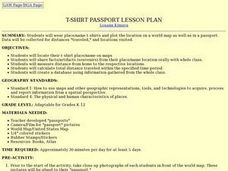
T-shirt Passport Lesson Plan
Students locate their t-shirt place/name on maps, then share facts/artifacts (souvenirs) from their place/name location orally with whole class. They create a database using information gathered from the whole class.
Curated OER
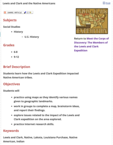
Lewis and Clark and the Native Americans
Students practice using maps and identifying landmarks on the Lewis and Clark expedition. They research Lewis and Clark's relationship with the Native Americans and report their findings to the class. They identify the impact of the...
Curated OER
Where Does Our Food Come From?
Fourth graders identify the state or country that a food product came from and locate it on a map. They identify products that are grown in Hawaii and the factors important in the location of economic activities.
Curated OER
Location, Location, Location: Civilization's Ultimate Advantage
Students discover how geographical advantages, locational and regional, ultimately led to western Eurasian societies' disproportionate accounting of world power and innovation. They utilize a workbook which can be downloaded within this...
Curated OER
Design Your Own Building
Students explore the use of design principles in the real world. They evaluate how problems can be solved using design principles. In groups, students design the floor plan for a building of their choice.
Curated OER
Corn Exports Visually
Learners study imports and exports and the countries that import the most corn from the U.S. They construct mini paper corn plants and label a map with these plants to represent the amount of corn the U.S. exports to countries around the...
Curated OER
Plotting A Hurricane Using latitude and Longitude
Students explore map and plotting skills by tracing the movement s of hurricanes through the Earth's systems. a hurricane map is developed from daily media reports.
Other popular searches
- World War Ii Map
- World War I Map
- World War 2 Map
- World War I Outline Map
- World Climate Map
- World Biomes Map
- World Outline Map
- Blank Map of the World
- World Political Map
- Ancient World Greece Map
- World Time Zone Map
- Deciduous Forests Map World


