National Endowment for the Humanities
The New Order for "Greater East Asia"
Sometimes the New Order becomes synonymous with its implications for European countries, but what about its consequences for East Asia? The final instructional activity in a four-part series teaches scholars about World War II. High...
Curated OER
Around the World in 180 Days
Where did I come from? How did I come to be in this classroom? Using curriculum from Kidspiration, class members research the homelands of their ancestors, as well as the journeys that began from many parts of the world and ended with...
PHET
Mapping the Field of a Dipole Magnet
High school scientists build their own magnetometer and use it to map the field surrounding a bar magnet. Excellent background resources is included, as well as a diagram of how to build the magnetometer.
Curated OER
Children Around The World
Learners read a multicultural book called "This Is the Way We Go to School" by Edith Baer and Steve Bjorhman. They become culturally aware of the different nationalities around the world and different ways that they may do things on a...
Sea World
Saving the Wild: Conservation Around the World
Enhance your unit on conservation, ecosystems, or migration with a series of lessons about ways to save the wild around the world. Kids research types of conservation, such as recycling, and use their geography skills to map the...
US Environmental Protection Agency
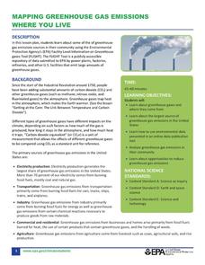
Mapping Greenhouse Gas Emissions Where You Live
After investigating the US Environmental Protection Agency's climate change website, your environmental studies students discuss greenhouse gas emissions. They use an online interactive tool to look at data from power production...
Curated OER
Exploring an Atlas
Students explore global geography by participating in an atlas activity. In this countries of the world lesson plan, students collaborate in small groups and analyze an atlas while researching continents, countries and demographics....
Curated OER
World Projections
Learners identify map projections and examine polar maps. In this map skills lesson, students use a flat world map to identify various projections and calculate the distances between locations by using a map scale.
Curated OER
Political Legends and Map Symbols
Students identify the legend and map symbols. In this map skills lesson, students use a world map to find various locations using a map key.
Curated OER
Cities of the World
Students identify the symbol for cities on a political map. In this world map lesson, students identify specific cities on the World Political Map. Students should identify the country in which the city is located. Students discuss the...
Curated OER
Where in the World War? Mapping WWII in the Pacific
Students explore the Pacific Theatre of War. In this World War II lesson plan, students use reference material to access information about significant locations in the Pacific Theatre of War. Students identify the locations of the listed...
Curated OER
Map Studies
Students analyze maps of Europe, and research and discuss current wars in Europe, and compare them to World War I and World War II.
Curated OER
Latitude on World Maps - World Map Activity 2
Learners explore the concept of latitude. In this geography lesson, students discover the global grid system and complete a map activity which require them to record the latitude of various cities in the world.
Curated OER
The Global Grid System-World Map Activity
Students demonstrate how to use the global grid system. In this map skills lesson, students use a world map to locate various locations. Students identify locations based on the global grid system. Students complete a worksheet as an...
Curated OER
Exploring the USA and the World with Cartograms
Middle schoolers investigate cartograms in order to explore the different countries on Earth. In this world geography activity, students use the Internet to analyze data on different cartograms. Middle schoolers compare data, such as...
Curated OER
Map Reading in the 21st Century
Students interact with MapPoint tools to view maps of the past and the present in multiple ways. They participate in mini-lessons aimed at locating certain points of interest or famous routes taken in history.
Curated OER
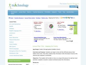
Mapping the Family
Students research the locations where their fathers have lived. In this map skills activity, students identify the locations their fathers have lived in the world as they create charts and maps that note the information.
Curated OER
Seven Wonders of the World
Students recognize "The Seven Wonders of the Ancient World." In this world history instructional activity, students research various architectures on the Internet and construct a PowerPoint presentation.
Curated OER
Mapping Puerto Rico
Pupils use maps to discover where Puerto Rico is located. In groups, they use the internet to research the vegetation. They also compare and contrast the relationship between the United States and Puerto Rico's government.
Curated OER
Mapping Community Values
Students discuss the origin of various maps focusing on the values behind them. Students also explore how human needs and geography influence community settlement patterns. Students extend learning by creating and mapping their own ideal...
Curated OER
Waldseemüller’s Map: World 1507
Learners take a closer look at historical maps. For this primary source analysis lesson, students examine the first world map produced by Martin Waldseemuller. Learners complete the included map analysis worksheet and then write letters...
Curated OER
Book: First Encounters Between Spain and the Americas: Two Worlds Meet
Students, after reading Chapter 1 in the book, "First Encounters Between Spain and the Americas: Two Worlds Meet," design and create a map of the Aztec Empire at the time of the first contract with the Spanish. They create the map from...
Curated OER
Places in My World
Second graders explore where they are located on the globe. In this maps and globes lesson, 2nd graders use a map to show where they live and show the cardinal directions. Students identify characteristics of mountains, flat land,...
Curated OER
Santa Claus Around the World
Students investigate how students in various countries celebrate their winter holiday traditions, locate various countries on a map, and draw and tell about various Santa Claus legends.
Other popular searches
- World War Ii Map
- World War I Map
- World War 2 Map
- World War I Outline Map
- World Climate Map
- World Biomes Map
- World Outline Map
- Blank Map of the World
- World Political Map
- Ancient World Greece Map
- World Time Zone Map
- Deciduous Forests Map World


