EngageNY
Grade 9 ELA Module 4, Unit 1, Lesson 15
The Haitian Revolution takes center stage as class members analyze a passage from Sugar Changed the World and consider how the authors select, present, and organize events to show how the tensions between the concerns for freedom and...
University of Pennsylvania
From the Dreyfus Affair to the World Today
Historical events do not occur in a vacuum. Such is the case of the Dreyfus Affair, where the connection between Captain Alfred Dreyfus, Emile Zola, and Hannah Arendt is fused by the events of the early 20th century. The informative...
Curated OER
Using the Four Main Directions in the Classroom
Students use the four main directions to locate features in the classroom. In this direction lesson, students review the 4 main directions using a world map. Students use a magnetic compass to locate the north wall in their classroom and...
Curated OER
Introduction to the United States Map
Students identify the United States of America and it's states on a map. In this mapping activity, students examine a globe and find the United States as well as a few land marks (Florida and the Great Lakes). Students then look at a...
Curated OER
Roman Empire: Physical Framework - Location, Borders, Dimensions
Students relate the classical world to the modern world. For this map skills lesson, students turn a blank map into a colorful complete map by following step-by-step directions. This lesson allows students to connect our current...
Curated OER
Land Elevation
Students investigate land elevation. In this map skills instructional activity, students use a physical map to identify various elevations of the land. Students find landform features such hills and coastlines.
Curated OER
Name That Continent
Students practice locating the seven continents, four hemispheres, and four oceans using a large world map and a review song. They also import a world map to the Kid Pix computer program then type in proper labels on the map. There are...
Curated OER
Put Me in My Place: Using Alphanumeric Grids to Locate Places
Students practice locating points on a large wall grid and create and label a neighborhood map. In this geography lesson, students spell and discuss places as the teacher places them on the map. They discuss the concept of an...
Curated OER
The Sands of Arabia
Sixth graders apply geographic information to the study of World History. In this Geography instructional activity, 6th graders create a political/physical map of the Middle East, develop questions and answers about the culture of the...
Curated OER
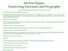
Ancient Egypt: Connecting Literature and Geography
Students brainstorm prior knowledge of Ancient Egypt, locate Egypt on map of Africa and on world map, watch King Tut film, discuss term biography, and map geographical information mentioned in stories and documentaries about Ancient Egypt.
Curated OER
Where In the World Are We?
Fifth graders read postcards and find their locations on maps. They use the pictures and text on the postcards to write about imaginary vacations. They compute the mileage and compare it to TripMaker data.
Curated OER
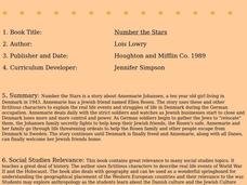
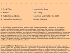
Number The Stars
Students read a book about prejudices that occur in our daily lives. They describe characters in the book. Students discuss real life events of World War II and the Holocaust. Students simulate hiding Jews from the German soldiers. ...
Curated OER
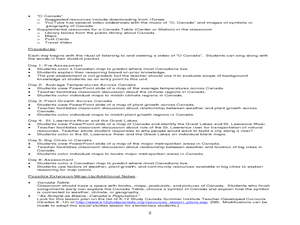
Where Do Canadians Live?
Students investigate Canadian people by researching the geography of the country. In this world geography lesson, students identify locations within Canada with large populations based on their access to waterways. Students view and...
Curated OER
Where's the Sand?
Middle schoolers identify the characteristics of deserts. In this geography lesson plan, students discuss the characteristics of a desert and label a map with the names of deserts.
Curated OER
Stop Hunger Now
Students explore the problem of world hunger by reading and discussing a United Nations report on world hunger. They brainstorm ideas for programs to end the cycle of poverty and hunger worldwide.
Curated OER
Number the Stars
Students read Number the Stars. In this social studies lesson, students read the story and use a map of western Europe and identify the countries involved in the war. Students locate the cities of Denmark that are discussed in the story.
Curated OER
Where the Parks Are
Students research major league baseball in United States and Canada. In this baseball history lesson, students use a map of the United States and Canada to find and label each major league team. Students then color the home cities of the...
Curated OER
Continents
Students investigate World Geography by researching the different continents. In this Asian Geography lesson, students discuss the continent of Pangaea and color a worksheet of the continents. Students locate China on the map worksheet...
Curated OER
Continents and Oceans
Students identify oceans and continents and their locations on a map. They color-code and label their own map of the world's continents and oceans. They play the game Continents and Oceans to identify specific areas.
Curated OER
Bring on the World: Football Around the World
Students explore the existence of football in the world. In this current events lesson, students examine how football is played using an interactive whiteboard. Students compare its existence in the United Kingdom and in African nations.
Curated OER
Region Reality
Eighth graders compare and contrast world regions and explore the theme of world regions. In this world geography lesson, 8th graders name regions in the U.S. and mark them on a map. Students discuss the cultural and physical...
Curated OER
President Wilson and the League of Nations
Students examine Wilson's ideals of world peace and world order and the conflict between these ideals and the U.S. Senate's policy of isolationism. Wilson's visionary stance and its significance in forming the policies of our government...
Curated OER
WWII Website
Tenth graders research a topic related to World War II. They explore the causes and legacy of WWII, the European Theater of Operations, the Pacific Theater of Operations, Diversity in WWII, Women in WWII, and the Homefront. Students...
Curated OER
Grades 6-8 Lesson Plan - Cities as Transportation Centers
Middle schoolers examine maps of the 1800's and 1900's. In this geography skills lesson, students collaborate to read core maps and identify transportation centers and travel networks.
Other popular searches
- World War Ii Map
- World War I Map
- World War 2 Map
- World War I Outline Map
- World Climate Map
- World Biomes Map
- World Outline Map
- Blank Map of the World
- World Political Map
- Ancient World Greece Map
- World Time Zone Map
- Deciduous Forests Map World


