Curated OER
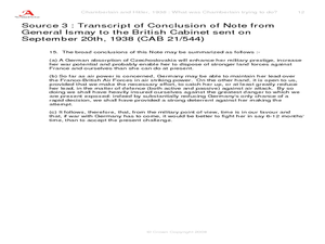
Chamberlain and Hitler, 1938--What Was Chamberlain Trying To Do?
Explore events prior to World War II. Learners view replicas of authentic photographs and hand written documents representing the viewpoints of Adolf Hitler and Neville Chamberlain. They discuss alternate viewpoints, consider historical...
Curated OER
Mapping the New World Lesson Plan
Young scholars compare two maps of the same area from different time periods. In this American History lesson, students look at two maps of the English colonies from 1636 and 1651. They discuss why the maps changed and predict maps from...
Curated OER
Waldseemuller's Map: World 1507
Learners investigate the 1507 word map. In this world geography lesson, students examine the details of each section of the map and then draw conclusions about how the people of 1507 understood the world. Learners are evalated on...
Curated OER
Countries of the World
Students identify countries on a world map. In this map skills lesson, students define the word "country" and use post-it notes to locate several countries on a world map.
Curated OER
Draw a Map
Students draw a map. In this map drawing lesson students draw a map to show where a character is from and where they are going in the story. Students are writing an odyssey.
MENSA Education & Research Foundation
Connecting Africa: A Project-Based Learning Adventure
Mission Possible: Your task is to design a new highway route from Tunis, Tunisia to Cape Town, South Africa. If you accept the challenge, you must create a small map of the route that has already been rejected, a rationale for rejection...
Curated OER
Oil: The Problem or Solution to the World's Economic Future
Students map the major oil producing and consuming countries and regions. They identify current and future topographic and political problems that could affect the production and transportation of oil.
Curated OER
Leapin' Landmarks: Locating 10 man-made landmarks around the world
Third graders engage in a lesson which addresses their curiosity about some of the outstanding people-made landmarks of the world. They explore the geographical themes of location and place through literature.
Curated OER
Where in the World Is That Volcano?
Identify the Earth's major volcanoes with an earth science lesson plan. Elementary and middle schoolers locate major volcanoes on a world map. Then, in groups, they research how the volcano affects the region in which it is located.
Curated OER
Map Your Favorite Sports Team's Next Road Trip
Students track a sports team across the country. They use a map scale to calculate the number of miles traveled by their sports team on a trip, conduct Internet research, and calculate how much it would cost them to go along on the trip.
Curated OER
Mapping Your State's Role in the Vietnam War
Students recognize reasons to celebrate Memorial Day. Students create a map of victims of the VIetnam War. Using the internet, students research information about soldiers from their state who were killd in action in Vietnam. Students...
PHET
Mapping the Field of Multiple Dipole Magnets
So you built a magnetometer, now what? High school scientists use their magnetometer made in a previous lesson to map the union of magnetic fields of dipole magnets. They experiment with different alignments and draw conclusions about...
PHET
Mapping the Ambient Magnetic Field
No GPS allowed! High school scientists continue to explore magnetic fields with a hands-on activity. After mapping the ambient magnetic field in the classroom and completing data analysis, they write about the similarities and...
Curated OER
If the World Were a Village...
Your class members explore concept that the world is a large place, examine how statistics can be used to help in understanding the world and its people, and create illustrations or graphs of statistics found in the award-winning...
Curated OER
Santa Claus Around the World
Learn about the legend of Santa Claus around the world in ESL holiday plan. In it, learners explore the many ways that Santa Claus is depicted in cultures around the world. There are some excellent masters included in the plan that help...
Curated OER
Action Through Art
How can we make the world a better place? Help your class members become world citizens, active in philanthropy and the community around them. Use a comic book (included) to discuss the idea of philanthropy. Then, using the superhero...
Social Studies School Service
Ancient China: Introduction, Map
What a great resource for introducing your youngsters to the world of ancient China and the earliest stages of its timeline. Included are creative ideas for organizing your room, as well as an engaging lesson, anticipatory set, and map...
National Endowment for the Humanities
The New Order for "Greater East Asia"
Sometimes the New Order becomes synonymous with its implications for European countries, but what about its consequences for East Asia? The final instructional activity in a four-part series teaches scholars about World War II. High...
Curated OER
Around the World in 180 Days
Where did I come from? How did I come to be in this classroom? Using curriculum from Kidspiration, class members research the homelands of their ancestors, as well as the journeys that began from many parts of the world and ended with...
PHET
Mapping the Field of a Dipole Magnet
High school scientists build their own magnetometer and use it to map the field surrounding a bar magnet. Excellent background resources is included, as well as a diagram of how to build the magnetometer.
Curated OER
Children Around The World
Learners read a multicultural book called "This Is the Way We Go to School" by Edith Baer and Steve Bjorhman. They become culturally aware of the different nationalities around the world and different ways that they may do things on a...
Sea World
Saving the Wild: Conservation Around the World
Enhance your unit on conservation, ecosystems, or migration with a series of lessons about ways to save the wild around the world. Kids research types of conservation, such as recycling, and use their geography skills to map the...
US Environmental Protection Agency
Mapping Greenhouse Gas Emissions Where You Live
After investigating the US Environmental Protection Agency's climate change website, your environmental studies students discuss greenhouse gas emissions. They use an online interactive tool to look at data from power production...
Curated OER
World Map and Globe
Students explore symbols. In this beginning map instructional activity, students identify common picture symbols. Students place post-it notes with symbols drawn on them in the appropriate place on a map.
Other popular searches
- World War Ii Map
- World War I Map
- World War 2 Map
- World War I Outline Map
- World Climate Map
- World Biomes Map
- World Outline Map
- Blank Map of the World
- World Political Map
- Ancient World Greece Map
- World Time Zone Map
- Deciduous Forests Map World


