Curated OER
Mapping Shakespeare
Twelfth graders read a Shakespearean play focusing on a character. They create "Mind Maps" of their characters and act out a selection of the play.
Curated OER
Mapping A Stream
Students participate in mapping an actual waterway. They include reach lengths, transects, compass reading, and scale determinations. They include windfalls, plant cover, types of streambed composition, and landmarks such as trees and...
Curated OER
The Science of Weather: How Doppler Radar reads weather
Students read about how radar detects changes in the weather. In this lesson on weather reporting, students read a diagram that shows how radar reads weather. This lesson includes discussion questions and an individual activity that can...
Curated OER
Silly Sally: Love Two Teach
In these reading and writing skills worksheets, students complete a packet about a story titled 'Silly Sally.' Students create popsicle stick characters to retell the story, create their own alliteration name and draw themselves silly,...
Curated OER
Promoting tourist attractions in Los Angeles
Students develop a tourist brochure for a recreational activity in Los Angeles. They read brochures and maps and identify key components.
Curated OER
Chinese Classroom Internet Activity
Students use the internet to complete an online activity in Chinese. Using the weather section, they research the weather conditions in Hong Kong and other popular cities in China. They answer Chinese questions in Chinese about the...
Curated OER
Finding My Way
Students determine a route from their home to the Stones River National Battlefield. In this map work lesson, students use a detailed city map of Murfreesboro to locate a route to the Stones River National Battlefield. They follow...
Curated OER
The Holocaust: Mapping Survivor Stories
Students explore the Holocaust through the eyes of survivors. In this Holocaust lesson, students talk with Holocaust survivors and create timelines that feature their stories.
Curated OER
Cultural Mapping
Students are introduced to the cultural diversity in Australia. Using new vocabulary, they define multiculturalism and explore their own cultural backgrounds. In groups, they complete a series of worksheets to develop a better sense of...
Curated OER
Science: Reading a Compass
Students demonstrate how to take bearings using a compass. In pairs, they select objects in the classroom then write down its first initial and bearing. They exchange papers and try to disciver their partner's object.
Curated OER
All Aboard!
Students research the history and background of snowboarding as well as the two main types of competition; the Giant Slalom and the Halfpipe. They find the schedule of past and future events and plot the locations of as many of these...
Curated OER
The Eighty Yard Run
Students read and explore the themes of the book The Eighty Yard Run. In this literature lesson, students discuss their observations and predictions. Students develop their own story which is similar to that of The Eighty Yard Run.
Curated OER
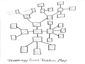
Wayne County Public Schools: Motto - Opening Minds...
Students use research, planning, and organizational skills to devise a technology crisis solution for the given school's problem. In this mapping and planning activity, students read through the letter about the technology crisis for a...
Curated OER
Weather Reporter
Fourth graders explore the components of a weather map, mark cities on the map and place the appropriate temperatures and weather conditions occurring in the cities on the weather map created.
Curated OER
Possible Locations
Students create maps with cutout pieces of paper that represent caverns. They develop a scale for their map and decide where the best location is to live. They discover the importance of map reading skills.
Curated OER
Topo Triangulation
Students investigate how to read a topographical map and triangulate with just a map. They convert a compass measurement to a protractor measurement, reverse a bearing direction, and using a worksheet take a bearing of certain landmarks...
Curated OER
Weather Observations
Students record the weather using an outdoor thermometer. In this weather lesson plan, students compare their recordings to that on the weather map online. Students explain the differences of each weather reading. Students continues...
Curated OER
Topos, Compasses, and Triangles, Oh My!
Students triangulate using a compass, topographical (topo) map and a view of outside landmarks. They take a field trip to another location away from school and mark discernible landmarks (like mountains or radio towers) and changes in...
Curated OER
Corps of Discovery: Voyaging with Lewis and Clark
Young scholars include maps, drawings, and personal reflections in a journal they keep while "accompanying" Lewis and Clark on their famous expedition of the Louisiana Territory.
Curated OER
Life During the Civil War for Women and Civilians
Students follow an overview of the American Civil War from a film, the text and/or teacher direct instruction. They create a timeline with a large map of the U.S. in the 1860's available for student reference as they do the spider activity.
Curated OER
Inuit and Arctic Animals
Students will explore the animals and people living in the Arctic. In this science instructional activity, students locate Alaska on a globe, discuss its climate and geographical features, and identify common arctic animals. Students...
Curated OER
Blackout!
Students read news reports and first-person accounts of a blackout in a large city and keep weblogs or journals. They take on different roles of people who live in the city or commute there to work and then use their journal accounts to...
Curated OER
Spin Me a Story
Students examine the motif of spinning and weaving in myths and folktales. They read various myths, complete a WebQuest, develop a mind map of story elements, and write an original "spider" story.
Curated OER
Shipping on the Hudson
Students track movements of ships, tugboats, and barges on the Hudson River estuary in order to practice addition and subtraction skills. They solve word problems by reading and interpreting data from a table. They calculate distances...


