Curated OER
Trouble With Trolls
Students listen to The Trouble With Trolls and discuss fables. For this story elements lesson, students work on reading skills. Students participate in different reading activities.
Curated OER
Working With Electronic Topography Maps
Junior geologists examine topographic maps online and learn how to read them. they answer seven associated follow-up questions. This lesson plan is only a general outline and does not provide the details or the websites that you would...
Mary Pope Osborne, Classroom Adventures Program
Mummies in the Morning Egyptian pyramids, hieroglyphics
Visit the Magic Treehouse and take your class on a trip through time with a reading of the children's book Mummies in the Morning. Using the story to spark an investigation into Egyptian culture, this literature unit engages...
Curated OER
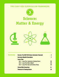
Science: Matter and Energy
Designed to use when teaching adults preparing for their high school equivalency exam, the resource integrates reading practice, writing, and analytical thinking in every lesson. The unit covers 23 topics, but it only includes three...
Constitutional Rights Foundation
Refugees from the Caribbean: Cuban and Haitian “Boat People”
Should refugees fleeing poverty be allowed the same entrance into the United States as those fleeing persecution? High schoolers read about US foreign policy in the late 20th century regarding refugees from Cuba and Haiti, and engage in...
Echoes & Reflections
Rescuers and Non-Jewish Resistance
What does it mean to be a rescuer during the time of the Holocaust? Learners consider the role of those who resisted the Nazi invasions, including hiding Jewish people, throughout Europe. Activities include listening to the testimony of...
Echoes & Reflections
The Children and Legacies Beyond the Holocaust
Using video testimony, primary source documents that detail international agreements, and structured discussions, learners consider the precarious position of children during the Holocaust and other international conflicts, and how to...
Curated OER
Thinking Critically about Geography
In this map reading worksheet, students answer 2 critical thinking questions about a map shown. Page has links to additional resources.
Curated OER
Designing a Hiking Trail
Put your students' map skills to the test with this engaging cross-curricular project. Given the task of developing new hiking trails for their local community, young cartographers must map out beginner and intermediate paths that meet a...
PHET
Mapping the Ambient Magnetic Field
No GPS allowed! High school scientists continue to explore magnetic fields with a hands-on activity. After mapping the ambient magnetic field in the classroom and completing data analysis, they write about the similarities and...
Curated OER
Animal Farm Chapter 2 Discussion Notes and Mini-Project
Imagine having the opportunity to create your own country. After responding to questions about chapter two, readers of George Orwell's dystopian classic are given a chance to design a utopia for one-million people, complete with...
Curated OER
Western Civilizations, Chapter 5: Roman Civilization
Investigate Ancient Rome with this comprehensive online western civilizations website. While designed for use alongside the Western Civilizations textbook, the tools on this site can be used to emphasize any study. A chapter quiz...
Roy Rosenzweig Center for History and New Media
The Battle of Trenton
The Continental Army's victory at the Battle of Trenton marked a turning point in the American Revolution. Young historians examine maps, read primary source materials, and create a timeline of events to understand why the victory was so...
Curated OER
Using Color as a Pre-Writing Tool
To better understand how to compose a clear and well-organized paper, learners read short passages, write summaries, and make colored graphic organizers. This is a fully developed three-day lesson with suggested assessments.
Curated OER
Drake's West Indian Voyage 1588-1589
Young scholars investigate several maps detailing Sir Francis Drake's voyages. In this geography instructional activity, students practice reading maps and locating the precise locations of where Sir Francis Drake visited. Young...
Curated OER
Reshaping the Nation
Students learn why the census makes a difference. In this U.S. Census lesson plan, students learn how to read and use a cartogram while they explore new ways to represent data.
Curated OER
Places on the Planet: Latitude and Longitude
Middle schoolers locate different places on globes and maps by learning about latitude and longitude lines. In this latitude and longitude lesson plan, students identify specific locations based on the degrees of latitude and longitude.
Curated OER
Making Maps
In this map making worksheet, students learn about the science of making maps, which is cartography. They then answer the 11 questions on the worksheet. The answers are on the last page.
Curated OER
Is the Hudson River Too Salty to Drink?
Students explore reasons for varied salinity in bodies of water. In this geographical inquiry lesson, students use a variety of visual and written information including maps, data tables, and graphs, to form a hypothesis as to why the...
Curated OER
Reading a Local and National Weather Map
Young scholars investigate weather maps. In this weather lesson, students discover the meaning of different weather icons and symbols. Working independently, young scholars use the local forecast to correctly label a state map.
Curated OER
Map Skills
Young scholars construct a road map using map pieces precut by the teacher. They apply geometric terms such as rotation and turns. Students apply the use of ordinal directions. They apply a variety of map keys.
Curated OER
"Potato Mountain": Reading/Understanding Topographic Maps
Students investigate how to read topographic maps. In this map reading lesson plan students complete a topographic map activity.
Curated OER
Learning About the Map's Legend
Young scholars draw a map of a room in their house and place a legend on it. They explain the legend orally.
Curated OER
Introduction to the United States Map
Students identify a map of the United States. In this United States map lesson, students study a map of the United States and find various locations on the map. Students then locate and list the state that touches their state.


