Science Matters
Finding the Epicenter
The epicenter is the point on the ground above the initial point of rupture. The 10th lesson in a series of 20 encourages scholars to learn to triangulate the epicenter of an earthquake based on the arrival times of p waves and s...
Curated OER
Pioneer Values in Willa Cather's My Antonia
Included in this resource are a variety of activities to do while reading Willa Cather's My Antonia. The activities, which range from mapping out Nebraska to writing activities about pioneer living, are all designed with one...
National Wildlife Federation
I Speak for the Polar Bears!
Climate change and weather extremes impact every species, but this lesson focuses on how these changes effect polar bears. After learning about the animal, scholars create maps of snow-ice coverage and examine the yearly variability and...
Anti-Defamation League
Impact of the U.S. Expansion on Indigenous People and Stereotypes About Native American People
The 2004 U.S. bicentennial sparks a discussion about its meaning and importance to United States history. Readings, maps, tables, and reflective writing prompt small groups to explore the westward expansion, Lewis and Clark, and how...
Global Oneness Project
A Collapsing City Skyline
Have your high schoolers learn about the modern history of Myanmar by close-reading an article about the city and people of the city Yangon. As they'll learn, the country is going through some dramatic transitions. After...
Baylor College
People and Climate
Model how the sun's energy strikes the planet and help your class relate it to a climate map. Assign small groups an individual climate zone to discuss. They reflect on and research how humans survive in the assigned climate and write a...
Facing History and Ourselves
Social Media and Ferguson
How can social media help or hinder civil dialogue? How can information shared on social media be verified? As the investigation of media reports of the events surrounding the shooting of Michael Brown continues, class members read...
Curated OER
Reading distance on maps
Eighth graders complete worksheets on reading the distance on maps in miles or kilometers. In this maps lesson plan, 8th graders use a calculator and ruler.
Curated OER
Topo Map Mania!
Seventh graders describe the major features of maps and compasses. They read a topographical map. They take a bearing using a compass. They practice using scales on a map.
Curated OER
Mapping Districts
Students become literate in their use of maps. In this 2010 Census lesson plan, students visualize census data on maps, use map keys to read population maps, and explore the concept of population density.
Curated OER
Mapping Districts
Students use maps to learn about the U.S. Census. In this 2010 Census lesson plan, students visualize census data on maps, use map keys to read population maps, and explore the concept of population density.
Curated OER
Lesson 2: Mapping Sub-districts
Learners learn more about the census. In this mapping sub-districts lesson plan, students visualize census data on a map, use a map key to read a population map, and better understand the concept of population density.
Curated OER
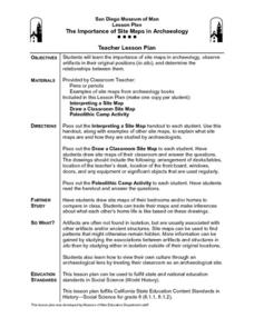
The Importance of Site Maps in Archaeology
Learners consider the importance of site maps in archeology. They interpret site maps, draw site maps of their classroom and home and then participate in simulated Paleolithic archeological camp activity.
Curated OER
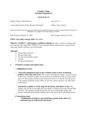
States On A Map
Third graders locate the states of Main and Kansas on a map. In this state location lesson plan, 3rd graders read the book Sarah, Plain and Tall and discuss what states she traveled through.
Curated OER
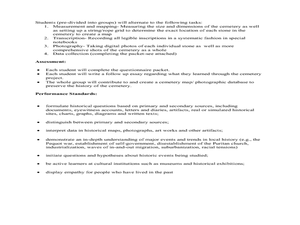
Cemetery Mapping Lesson
Eighth graders explore historical records. In this cemetery mapping lesson, 8th graders analyze local community data as they examine gravestones and read epitaphs.
Curated OER
Relief Maps
Students study geographical maps and their functions. In this geography lesson students work in groups to build a map to scale.
Curated OER
Making Topographic Maps and Mountain Profiles
Students study how to mark inclines and construct a mountain profile. In this topographic map lesson students mark contour intervals and draw mountain profiles.
Curated OER
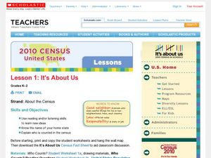
2010 Census Lesson 1: It's About Us
Students analyze data from the 2000 census to learn how the census works. In this civics lesson, students read a story to find out about the census, then use a map and census data to analyze changes. Lesson includes related resources...
Curated OER
The Amazing Race
Students improve their directional awareness by locating sites and symbols on a map. They increase their heart rates while traveling to each site and performing the specified task/exercise at each site.
Curated OER
Welcome to My World!
Students use maps to locate information. They read the story, "It Looked Like Spilt Milk", view images of the continents and discuss the various continents. Afterward, they make their own Atlas to record information that they can later...
Curated OER
Cardinal Directions
First graders study cardinal directions on maps. In this geography lesson, 1st graders determine and show where North, South, East, and West are on various maps.
Curated OER
From Claws to Jaws: Atlantic Regions of the United States
Students explore New England, Mid-Atlantic, and southeastern regions of the United States. In this social studies thematic unit, students research a state and make a regional quilt. Students wrte a book report and read two novels...
Curated OER
Johnny Appleseed Walkabout
Second graders calculate mileage for a journey. In this place value and measurement lesson, 2nd graders read Johnny Appleseed, work in groups to locate his birthplace on a map, locate the other states he stopped in, and measure the...
Curated OER
Wales: An Interdisciplinary Unit
Learners practice basic map and geographic skills as they compare Oregon to Wales. Students color map of Wales and Oregon using color codes to distinguish between land, water, and bordering nations or states, listen to stories and...


