Roald Dahl
Matilda - The Reader of Books
The titular Matilda from Roald Dahl's famous novel adored books above all things. Discuss why it is important to read stories from across cultures and around the world using the first chapter from the ever-loved story Matilda.
Curated OER
All Aboard the Freedom Train!
Young historians identify Harriet Tubman, her character traits, and role as a conductor on the Underground Railroad. They create an escape map using map legends and the Cardinal directions. This plan utilizes one of my favorite video...
Museum of Tolerance
Where Do Our Families Come From?
After a grand conversation about immigration to the United States, scholars interview a family member to learn about their journey to America. They then take their new-found knowledge and apply their findings to tracking their family...
Rainforest Alliance
Protecting the Critical Habitat of the Manatee and Loggerhead Turtle
Explore ocean habitats with a instructional activity that showcases the home of manatees and loggerhead turtles in Belize. Here, pupils compare and contrast the homes of ocean animals to those of humans, listen to an original...
Curated OER
Journey to Gettysburg
Young scholars use latitude and longitude to map the path of the Battle of Gettysburg.
Melissa Institute for Violence Prevention and Treatment
Concept Muraling
Concept muraling helps learners improve their comprehension of a text by giving them a way to organize their understanding of the key concepts in that text. Introduce readers to this process with a carefully scaffolded lesson that models...
Curated OER
Life in Old Babylonia: The Importance of Trade
Students read maps and artifacts for information indicating the existence of a trade network in Old Babylonia and beyond. They list goods imported to and exported from Babylonia. They indicate trading centers on a map of ancient...
Curated OER
How To Write a Social Studies Outline
One of the keys to success in school is organization. This resource leads learners through the process of creating an outline for a chapter from a social studies text. In addition, they review facts they have learned in their class...
EngageNY
Grade 9 ELA Module 4, Unit 1, Lesson 2
The second instructional activity in a unit about how writers develop their central ideas and use evidence to support their arguments focuses on the role that scholars at Jundi Shapur, "The World's First True University," played in the...
Curated OER
Theme Map- The Rainforest
Students use graphic organizers to relate information. They read an article and insert information from the article to the theme map using a word processing program.
Curated OER
Mapping an Empire
How did the expansion of the Roman Empire during the first century contribute to its downfall? Using a map of the Roman Empire in 44 BC and one of the Roman Empire in 116 AD as references, class member use critical reading skills to...
Curated OER
Learning about Maps and Colors
First graders discuss "Harold and the Purple Crayon" and his drawings. In this neighborhood geography lesson, 1st graders learn to detect and classify places on a map including their home. Students recognize their address as a specific...
Curated OER
Me on the Map Lesson 2
Students analyze and interpret maps, globes and geographic information systems to define and identify cities, counties, states, countries and continents to create a booklet called me on the map. They also determine and calculate the...
Curated OER
Mapping the Human Movement
Students research data on African-American emigration, place the data in a chart and create a human movement map. They also create another map using research on current immigration information.
Curated OER
Case Study: Hutu and Tutsi
Students analyze the ethnic conflict between the Hutu and Tutsi in Rwanda and Burundi. They identify the three elements of ethnic conflict, read a handout and answer questions, examine a timeline, conduct research, and write an essay.
Curated OER
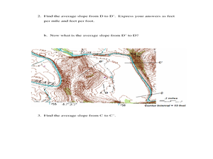
Slope and Topographic Maps
Learners investigate slopes as they study topographic maps. In this algebra lesson, students discuss and apply the concept of slopes to graphing and analyzing data.
Curated OER
Where We Live
Students forecast future population growth of the U.S. Virgin Islands. In this U.S. Census lesson plan, students explain the factors that influence population density on the U.S. Virgin Islands, including geography and economic activity.
Curated OER
Weather Forecasting
Learners discover how to read a current weather map. In this weather forecasting instructional activity, students view weather maps from three consecutive days and observe how quickly weather moves and changes. Learners review key...
Curated OER
Open Sesame: A Magical World of Reading
Third graders, through six lessons, study tales of Ali Baba and the Forty Thieves and Aladdin and the Lamp from The Arabian Nights.
Curated OER
A Child's Daily Life in South Africa
Students compare the life of a child in South Africa to the life of a child in America. In this multicultural education instructional activity, students read the book Not So Fast Songololo and discuss the differences and similarities...
Core Knowledge Foundation
Columbus Sailed the Ocean Blue
Young adventurers embark on a journey, setting sail along the blue ocean with Christopher Columbus. Teachers will find that this unit makes their lesson planning smooth sailing!
Curated OER
Sunderland: Discovering Cities
Scholars investigate a local city (Sunderland) by participating in a discussion. They explore the different elements of the UK city by identifying the industrial and economic aspects. They also read an interview of two people speaking...
Curated OER
Create a Math Road Trip
Students create a Road Trip. They work in small groups. Students are given a road map for each group. They plan a road trip between two cities on opposite edges of the map, estimating a reasonable distance to travel each day. Students...
Curated OER
Map It!
Fourth graders collect and explore different maps and their uses before using the program Pixie to create maps of geographic features, political features, and economic information for the state in which they live.


