Curated OER
Rescue!
Students explore movement and position concepts. They follow directions using left , right, up, down, North, South, East and West. Students draw and follow a path on a grid to show a route followed. They label and follow legends on a map.
Curated OER
CASTLE ROCK PUEBLO: A TRIP THROUGH TIME
Students use a map to respond to a series of questions. They determine how much time it would take to travel to Castle Rock Pueblo from different pueblos and locate modern pueblos on the Indian Country map.
Curated OER
Australian Travel Adventure
Seventh graders are introduced to the states and territories within Australia. Using the internet, they bookmark sites and take notes on what they want to share with their classmates. They also complete a map study on the country to...
Curated OER
Lindenwald: Martin Van Buren
Students examine maps, readings, photos, drawings and political cartoons in order to describe the personality and character of Martin Van Buren as reflected by his lifestyle. They identify Van Buren's political views and political issues...
Curated OER
Las Vegas Mormon Fort
Students use maps, readings, letters, photos and drawings to identify why Mormons came to the Las Vegas area and what they hoped to accomplish by establishing an outpost. They consider the roles of early women pioneers and outline their...
Curated OER
Rivers Bridge State Historic Site
Students use maps, readings, illustrations and photos to analyze the Civil War Rivers Bridge battlefield and describe how geography affected the outcome of the battle. They explore and explain the causes for the battle's heavy human...
Curated OER
Map the Path in My Father's Dragon
Students listen to Ruth Stiles Gannett's book My Father's Dragon. They predict the outcome of the story. They discuss the events in the story. They sequence the events in the story.
Curated OER
The Grand Excursion GPS Map
Eighth graders investigate the uses of a global positioning system. They create waypoints and have to find them using the system. Students must review the geographical concepts of latitude and longitude. The media requirements of the...
Curated OER
Maps: Latitude and Longitude
Pupils visit interactive sites focusing on latitude and longitude. They participate in activities about the prime meridian, time zones, and equator. They view the coordinates of states and cities.
Curated OER
Oregon Trail Maps
Fourth graders explore the Oregon Trail. In this Oregon Trail lesson, 4th graders collaborate to conduct Internet research regarding states along the Oregon trail route. Students present their findings to their peers.
Curated OER
Balanced Literacy: Presidents
Students participate in a unit (all lessons on the same page) to explore the Presidents of the United States. They choose one President to write a mini-book about, create a puppet and an original puppet show to perform about their chosen...
Curated OER
Read a Transportation Story
Third graders research the building of a transcontinental road. In this railroad history lesson plan, 3rd graders discuss past and present transportation. Students look at historical photos and compare and contrast photos from today.
Curated OER
Primary Sources and Archaeology in the Study of Ancient Mediterranean Trade
Tenth graders begin the lesson by plotting trade routes, major empires and items traded. Using primary sources, they examine their own values regarding trading items for royality. They participate in a role-play exercise in which they...
Curated OER
Mapping the Circulatory System
Learners investigate the circulatory system in human beings. In this human body instructional activity, students create an outline of a human body using colored markers and butcher paper. Learners use red and blue colors to...
Curated OER
Cultural Mapping
Students are introduced to the cultural diversity in Australia. Using new vocabulary, they define multiculturalism and explore their own cultural backgrounds. In groups, they complete a series of worksheets to develop a better sense of...
Curated OER
Folktales around the World (Middle, Reading/Writing)
Students analyze, synthesize, and use the elements of various US cultural folk tales to describe the elements of fiction in general and in folk tales specifically.
Curated OER
Organizing Your Ideas Into an Effective Outline
Students explain the components of a speech outline and write an interesting speech.
Curated OER
Science: Reading a Compass
Students demonstrate how to take bearings using a compass. In pairs, they select objects in the classroom then write down its first initial and bearing. They exchange papers and try to disciver their partner's object.
Curated OER
Using Charts and Graphs to Study East Asia's Modern Economy
Learners examine East Asia's modern economy. In groups, classmates use the internet to compare the resources, products, and economy of specified countries. After collecting the data, pupils create charts, tables and graphs. They...
Curated OER
Mapping River Statistics
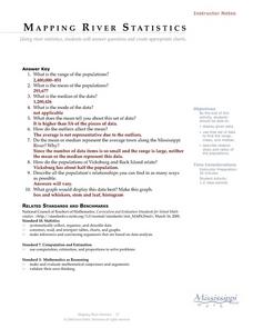
Students research different statistics to do with the Mississippi River. They answer questions about finding data and collect it by conducting research. The research is used to construct a data table. Then students use the table to...
Curated OER
Hurricanes As Heat Engines
Students examine sea surface temperatures to see how hurricanes get heat from the oceans surface. In this hurricanes lesson students use the Internet to find data and make line plots.
Curated OER
Lesson 1 Activity 1: Tools of the Ancients
Students examine how Christopher Columbus determined his latitude.
Curated OER
Separate Vacations
Students plot the migration paths of birds using latitude and longitude data from a table.
Curated OER
Ancient Egypt
Pupils complete a series of activities to discover life in ancient Egypt. They create want ads for pyramid workers, design vocabulary flash cards and dictionaries, and research famous Egyptians. They also research the "Curse of the...


