Curated OER
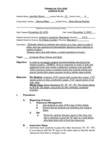
Compass Rose: Dance and Quilt
Fourth graders identify the cardinal directions by listening to a song entitled, "Stand," and by reviewing the lyrics to that song. They notice the cardinal directions that are posted around the classroom. They perform the motions as...
Curated OER
How Much Further Is It?
Fifth graders use estimation to solve problems and assess the reasonableness of their answers. They may use an odometer, a map with a legend, MapQuest, or a map without a legen. They estimate 4 to 5 different scenarios.
Curated OER
May We Present Planet Earth?
Students draw a map to scale. They illustrate knowledge of how to use DOGS TAILS on a map. Students identify the main parts of a map. They identify and illustrate the major features necessary for sustaining a quality of life for a society.
Curated OER
Can You Dig It?
Students investigate a fossil site and diagram a site map. They role play as paleontologists.
Curated OER
Stream Gages and GIS
students interpret recent regional-scale climate events based on current stream flow, monitor changes in time, and to consider additional interpretations that could be derived if other data were in map form.
Curated OER
Exploring Infrared Image Technology
Students view infrared images of a blowing hair dryer, a Popsicle, and a toaster. They discuss the images and ways they are different than visible light images. Students view a temperature scale and discuss which parts of the item are...
Curated OER
Astronomy Teamwork
Students work together in groups to complete an astronomy project. In the classroom, they find real objects to represent various objects in the solar system. After going outside, they practice using a distance scale and use their...
Curated OER
Site vs. Situation: Location! Location! Location!
Students examine places with a similar latitude to Alabama, and discuss the importance of a location's site versus its situation. They analyze maps, create a chart, and write a paragraph on the difference between site and situation.
Curated OER
Exploring History Through Photographs
Fifth graders compare and contrast photographs from the 1800s to those of 2003. In groups, they create drawings of how society has changed over time and use maps to locate local streets. Individually, they practice measuring the...
Curated OER
Architectural Buildings
Fifth graders explore various styles of architecture. They work together to create a town with clay buildings that come together in order to form this small town. They discuss maps, layouts, and the structure of buildings.
Curated OER
Regional Economics in the United States
Students describe and provide examples of the primary factors
behind the regional pattern of economic activity in the United States. They create maps showing regional economics patterns
in the US and examine those patterns in comparison...
Curated OER
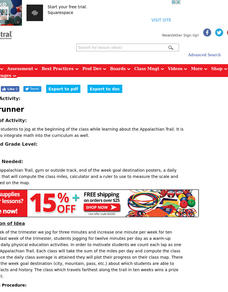
Ridgerunner
Students jog for three minutes at the beginning of the class, increasing one minute per week for ten weeks. They count each lap as one mile on the Appalachian Trail, computing the class average and plotting their progress on a class map.
Curated OER
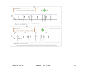
Where Should You Turn?
Fourth graders complete activities to study decimal numbers. In this decimal numbers lesson, 4th graders study decimal numbers to express numbers less than one and intervals. Students complete map and location activities to study the...
Curated OER
Researching the World's Oceans
Students research and compare important features of the oceans based on current data. They examine the globe or map, determine the major oceans of the world, and record their names on the data sheet.
Curated OER
The Slave Trade
Students map and explore a possible slave trade route. In this slave trade mapping lesson, students calculate the distance and amount of time it would take for African slaves to arrive in America.
Curated OER
Earthquakes and Seismic Waves
Students investigate the Richter scale and seismology in a teacher-led lab in which they are introduced to the concept of seismic waves and epicenter location. They further investigate the inner workings of a seismograph and practice...
Curated OER
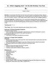
So -- What's Happening Here? On this Old Christmas Tree Farm
Pupils take a field trip to an old Christmas tree farm near their school. In groups, they gather data at the site and analyze the data in an attempt to discover what happened to the area. They identify human activities that led to the...
Curated OER
Lewis and Clark
Fourth graders research the Lewis and Clark expedition and the Corps of Discovery. They explore a variety of websites and complete a WebQuest, analyze maps, and answer comprehension questions. Students also write journal entries and...
Curated OER
Castles and Forts of Wales and Oregon
Students compare a castle in Wales to a fort in Oregon and design and build a castle or fort. In this structure study lesson, students complete activities to study castles in Wales to forts in England. Students then design their own fort...
Curated OER
Body and Mindscapes
Third graders view artwork by Robert Harris of landscapes and mountains. Using a map, they locate and identify the physical features of the Canadian province they live in. In groups, they use one of his paintings and add music to...
Curated OER
Tour De Texas
Students are given a budget and an alternative-fuel vehicle. Using a map of Texas, they are given a starting point and determine how to arrive at their destination within 72 hours. They use the internet to research the alternative fuel...
Curated OER
Tracking Satellites Using Latitude and Longitude
Students investigate how to track satellites using latitude and longitude. They investigate what man learns from all the satellites currently being studied today. Students analyze the four basic types of satellite orbits.
Curated OER
Science: Hurricanes As Heat Engines
Pupils conduct Internet research to track the path of Hurricane Rita. They record the sea surface temperature of the Gulf of Mexico during and after the hurricane and draw conclusions about how hurricanes extract heat energy from the...


