Curated OER
What do Maps Show?
Eighth graders practice the skill of reading maps. In this geography instructional activity, 8th graders participate in a classroom lecture on how to read a map.
Curated OER
A Map of the Big Race
Students read a novel and practice putting the events into the correct sequence. Using the text, they create a map showing the events of the race in order and a legend. They must use vocabulary from previous chapters and make their map...
Curated OER
Solve for Scale Factors Using Proportions
Eighth graders solve problems using proportions with scaled drawings. They work with maps and blue-prints discussing scales and plans and examine different polygons and figure out the scale factors or proportions they have been changed by.
Curated OER
Me on the Map Lesson 1
Students use maps, globes, geographic information systems and other
sources of information to analyze the nature of places at a variety of scales. They identify on a map and determine the population
of the city, county, state, country...
Curated OER
Drawing A Map
Young scholars discuss any information they already know about maps. As a class, they draw a map of a park following written directions making sure to include a compass rose and key. They are graded based on a rubric and discuss the need...
Curated OER
Map It With Pixie
Fourth graders use the computer program 'Pixie' to create a topographic, detailed map for the state they live in. In this mapping skills lesson, 4th graders use Pixie to make a map of their state that includes topographic features, state...
Curated OER
Orienteering - Lesson 4 - Distance and Height
Pretend that you've been dropped onto a mountain, in the middle of nowhere, and all you have to find your way is a topographical map and a compass. Could you find your way to the nearest town? Orienteering teaches the skills of map...
Curated OER
The Crash Scene
Fifth graders explore geography by participating in a mapping activity. In this engineering lesson plan, 5th graders identify the differences between latitude and longitude and practice locating precise points on a globe or map. Students...
Curated OER
Metrics And Measurements
Students engage in a study of measuring distances between geographical locations on a map. They are able to define and use the map scale in conjunction with the metric system. For this lesson they make their own maps and measure the...
Curated OER
TE Activity: The Trouble with Topos
Students study the uses of topographical maps including the many forms that they take. They discover that the map features show its intended use such as city maps, wilderness maps, and state maps. They complete a worksheet in which they...
Curated OER
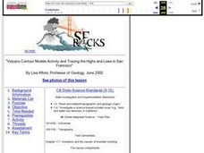
Volcano Contour Models Activity and Tracing the Highs and Lows in San Francisco
Students investigate how to draw topographic contours and read topographic maps.They examine the topography of San Francisco and contrast the elevation of different points within San Francisco.
Science Matters
Finding the Epicenter
The epicenter is the point on the ground above the initial point of rupture. The 10th lesson in a series of 20 encourages scholars to learn to triangulate the epicenter of an earthquake based on the arrival times of p waves and s...
Curated OER
once and future MOON
Beyond the phases of the moon, this comprehensive lesson plan covers geologic history and geology. Amateur astronauts examine photos of the lunar landscape, experiment with the creation of craters, and delve into information about the...
Edgate
Great Grids
Learners use grid boxes as a measurement tool and discover how grids are used for mapmaking and scaling down an area. They begin by attempting to draw a model shape drawn by the teacher by using the gridding process. At the conclusion of...
Curated OER
Scale Drawings
Pupils discuss the importance of scaling drawings. In this math lesson, students create a scaled drawing of circuit boards. They explain why accuracy is very important when scaling.
Curated OER
Generate an Accurate Landscape Profile from a Topographic Map
Students enerate an accurate landscape profile from a topographic map. They determine the correct interval needed to accurately graph the change in elevation on a single piece of graph paper.
Curated OER
An Early American Culture
Students identify the locations of the Hopewell culture. In this map skills instructional activity, students use a globe to mark several locations of the Hopewell culture.
Curated OER
The Landscape of a Novel
Students, after reading a novel, utilize geographic skills to map out the places described in the novel. They collect data, envision spatial features and then design a map to work off of to complete their assignment. Each student also...
Mathematics Assessment Project
Calculating Arcs and Areas of Sectors of Circles
Going around in circles trying to find a resource on sectors of circles? Here is an activity where pupils first complete an assessment task to determine the areas and perimeters of sectors of circles. They then participate in an...
Mathematics Assessment Project
Evaluating Statements About Enlargements
Double, toil ,and double linear dimensions. Learners first complete an assessment investigating how doubling linear dimensions affects the area of pizzas and the volume of popcorn containers. They then complete an activity investigating...
Curated OER
China Quest
Read and research information on China. Young researchers complete a knowledge hunt about China then locate and describe each location using directional words. They recognize the word meaning through context clues and application practice.
Carnegie Mellon University
International Perspectives to Climate Change 1
After a lecture about how the first industrial revolution triggered the path to climate change, your environmental studies class discusses what the impacts are. In a culminating activity, they get into groups and identify countries on a...
Science 4 Inquiry
Edible Plate Tectonics
Many people think they can't observe plate tectonics, but thanks to GPS, we know that Australia moves at a rate of 2.7 inches per year, North America at 1 inches per year, and the Pacific plate at more than 3 inches per year! Scholars...


