Curated OER
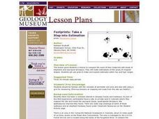
Footprints: Take a Step into Estimation
Compare sizes of student footprints with those of elephants and sauropod dinosaurs! Upper graders make estimations of the areas of irregular shapes; students use grids to make and explain estimates within low and high ranges.
Curated OER
Our Solar System - Comparing Planetary Travel Distances
NASA presents a mini-unit on distances in our solar system. It incorporates scientific concepts of gravity, mass, density, and payload while your aspiring astronauts also employ mathematics skills. They calculate speed, they determine...
Channel Islands Film
Island Rotation: Lesson Plan 1
How do scientists provide evidence to support the theories they put forth? What clues do they put together to create these theories? After watching West of the West's documentary Island Rotation class members engage in a series of...
Agriculture in the Classroom
Pumpkins... Not Just For Halloween
Celebrate fall with four pumpkin themed hands-on activities! After learning about pumpkins, scholars complete two activity sheets that reinforce estimation and word problems. They then plant pumpkin seeds and bake a pie in...
Curated OER
Earth's Water
If the majority of our planet is covered with water, why do we need to bother conserving it? With a thorough and varied investigation into the location and types of water on the earth, learners will gain an understanding of why this...
Cornell University
Too Much of a Good Thing?
Continuing their study of beneficial insects, young entomologists discover where in the world some of these bugs are. By labeling, coloring, and using the scale on a map, pupils explore the territories and arrival of the Asian lady...
NOAA
Sediments
Calcareous ooze ... what an interesting name! The 15th installment of a 23-part NOAA Enrichment in Marine sciences and Oceanography (NEMO) program focuses on sediments found on the ocean floor. After viewing the slideshow lecture,...
The Alamo
The Alamo
Remember the Alamo! Scholars investigate the Battle of San Jacinto during the Texas Revolution. Using models, maps, quotes, biographies, and the Oath of Allegiance, the Alamo comes to life as the stories of those who fought and died in...
Curated OER
How Much Water is in That River?
Students practice measurement using the Hudson River. They calculate the discharge measurement at a location on the Hudson River using ingenuity and a topographic map.
Curated OER
The Amazing Race -- Africa
Students conduct research and gather information regarding various cities in Africa. They discover what it would take to travel to and through Africa and plan a trip through various regions of the continent. They present their itinerary,...
Curated OER
Where in the World Am I: Latitude And Longitude
Learners demonstrate their knowledge in using latitude and longitude measurements to find locations on a map, especially places in Hawaii.
Curated OER
Families and Neighborhoods
Students distinguish where their homes are in relation to the city of Pittsburgh. In this geography lesson, students read the book All Families Are Specialand find their city on a map of Pennsylvania. Students locate Pittsburgh...
Curated OER
Scaling the Map
Middle schoolers practice determining map distances using the map scales. They discover how much an area represents on the map in relation to the actual area. They decide on the best place to build their cavern.
US Institute of Peace
Advanced Mediation Practice
What will become of the giraffes of Amali? Pupils participate in a large scale role-playing activity to study the art of conflict mediation. The instructional activity engages participants in the struggle between two countries and the...
Curated OER
Navigating Your Community
Students draw a map from memory describing the route between their classroom and the gym including a legend, a compass rose, a map scale, symbols, and a landmark at every change of direction. They then retrace their steps in their maps...
Curated OER
TE Activity: Nidy-Gridy
Students make a grid and coordinate system map of their classroom as they investigate why it is important to have a common map making system. They look at how landmarks are used for navigating an area.
Curated OER
TOPSY TURVY MAPS
Eighth graders use the data analyzer and motion detector to collect data and measure distances. They create topographic maps drawn to scale of a given setup and relate the concepts to the creation of historical ocean maps.
Curated OER
Discovering New Mexico
Seventh graders discuss the elements of maps and using basic linear measurement. They calculate the distance between the cities and create a simulated journey around New Mexico using a road map. They write out the directions for their...
Curated OER
Design an Island
Students make a map of an imaginary island using the topographic symbols provided from a worksheet. Students place lakes, dwellins, reefs, etc. in areas where they would logically be located from understanding how the topography of an...
Curated OER
Globe Skills Lesson 4 The Colonial Period
Middle schoolers practice their map skills. In this Colonial geography lesson, students complete an activity that requires them to locate English colonial locations using latitude and longitude coordinates.
Curated OER
Flat Earth Society
Students explore map distortion. In this geography lesson, students compare Mercator projection maps to globes in order to understand the strengths and weaknesses of projection maps.
Curated OER
Earth on the Earth
Fourth graders plot points on a graph and transfer those coordinates onto a large scale model resulting in an outline of the Western Hemisphere. They identify the major geographical landforms of the Western Hemisphere.
Curated OER
Measure Up!
Students examine parallax and angular measurements. In this investigative lesson students calculate distances of objects and map their results.
Curated OER
Globe Skills Lesson 8 Dust Bowl Travelers
Students develop their globe and map skills, In this geography lesson, students examine the Dust Bowl as they complete an activity that requires them to plot latitude and longitude.


