Curated OER
Language Families
Fourth graders identify and locate the three language families of North Carolina. They calculate the physical area covered by each language family and label them on a map.
Curated OER
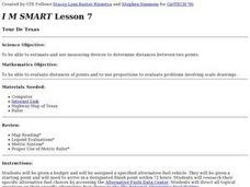
Tour De Texas
Students are given a budget and an alternative-fuel vehicle. Using a map of Texas, they are given a starting point and determine how to arrive at their destination within 72 hours. They use the internet to research the alternative fuel...
Curated OER
What Do We Do With A Dirty Bomb?
Learners examine composition of dirty bomb and its possible effects on a city, and investigate simulations of such an event; students use computational and problem solving skills to assess damage and prepare report proposing solution to...
Curated OER
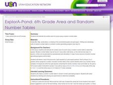
ExplorA-Pond: 6th Grade Area and Random Number Tables
Sixth graders estimate surface area of a pond using a random number table.
Curated OER
ExplorA-Pond: 1st Grade Shapes
Young explorers review the basic shapes (circle, triangle, square, rectangle) and practice putting them together to make new shapes. Given an outline of a pond, they recreate it by combining other shapes.
Curated OER
Eye From the Sky
Students are introduced to the concept of aerial perspective and scale. Students will use satellite technology to view their neighborhoods and sketch the area surrounding their schools. They will take part in a neighborhood walk to view...
Curated OER
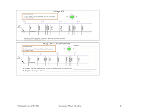
Where Should You Turn?
Fourth graders complete activities to study decimal numbers. In this decimal numbers lesson, 4th graders study decimal numbers to express numbers less than one and intervals. Students complete map and location activities to study the...
Curated OER
How Does Your Garden Grow?
Students create a design for a school garden. For this garden design lesson, students analyze what plants grow best in their school's climate and work in teams to design a garden. Students measure the existing space, determine the...
Curated OER
TE Activity: Nidy-Gridy
Middle schoolers make a grid and coordinate system map of their classroom as they investigate why it is important to have a common map making system. They look at how landmarks are used for navigating an area.
Curated OER
Houses
Third graders use a number of problem solving strategies in this unit of lessons. They determine how to draw and model three-dimensional objects, use co-ordinate systems, determine probability of events, and identify paths of simple...
Curated OER
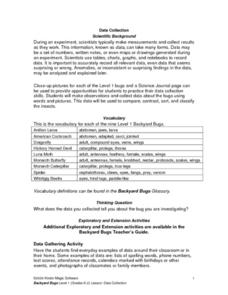
Science: Backyard Bugs Data Collection
Young scholars practice data collection skills by observing common bugs found in their local environment. Once the data is collected they complete data sheets to compare, contrast, sort, and classify the insects. The lesson includes...
Curated OER
Analysis of Atmospheric Conditions for a High Mountain Retreat
Learners examine the relationship between altitude, atmospheric pressure, temperature and humidity at a particular location. They practice science and math in real world applications. They write reports detailing their scientific...
PBS
Home, Sweet, Home!
Young scholars investigate the local history and architecture of their community. They draw maps, conduct Internet research, discuss varied architectural designs, take a walking tour of their town and work in teams to record their...
Curated OER
Scenario challenge
Fifth graders become familiar with the geography of New Hampshire and the importance of specific sites in history. In this New Hampshire lesson, 5th graders create a brochure including points of interest and showing distances between...
Curated OER
Real Life Application of Area and Perimeter
Fifth graders explore real-life situations of area and perimeter. They develop a list of real-life applications of area and perimeter, select a situation, and write a step-by-step procedure and diagram on graph paper for solving the...
Curated OER
High and Low Tides
Students collect real world data from the Web regarding high and low tides at various locations in the United States. They find a function which models this data and make predictions on tide levels based on the information found.
Curated OER
Arrange the Classroom (Part 1 of 3)
Fifth graders arrange the classroom using all the moveable objects and through the exploration of area and perimeter. They determine the area of the classroom, create and label model pieces of furniture using graph paper, and create a...
Curated OER
A Bird's Eye View of our 50 States
Third graders focus on state birds as they learned absolute location (latitude/longitude) of each state, as well as their relative location (bordering states).
Curated OER
High Mountain Retreat
Young scholars explore and analyze atmospheric conditions for a high mountain retreat. They examine the relationship between altitude, atmospheric pressure, temperature and humidity at a particular location. In addition, they write...
Curated OER
Jelly Bean's Galore
Students investigate the origins of the Jelly Bean. They complete a Scavenger Hunt using the jellybean website. Pupils create a bar graph using information collected about jelly beans. Students discuss the time of year that Jelly Beans...
Curated OER
Temperature in a Cultural Context
Fourth graders investigate the effects of temperature on Native American lifestyle and culture. In small groups they conduct research on cultural practices showing a connection to the climate and create a poster displaying their...
Alabama Learning Exchange
Coral Reefs
Study explore coral reefs. In this coral reef lesson, 4th graders examine the physical structure of coral reefs. Students consider why coral reefs need to be protected and ways to protect them.
Curated OER
Castle Builder
Fifth graders discuss the importance of castles in medieval times. Using the internet, they research the parts of a castle and design their own using the components. They use everyday materials to build the castle to a specific scale.
Curated OER
What Are The Characteristics of Your Neighborhood?
Students make a mental map of their neighborhood. Using a software program, they make an aerial and digital map of their school and locate their school on given maps. In groups, they calculate the distances to various locations and...


