Curated OER
Map Adventures
Students explore the relationship between a scale drawing and actual distance. For this mapping lesson, students use an amusement park map to determine distances and what they would be like in real life.
Curated OER
Introduction to Field Mapping with a Compass and Pace
Students practice using compass and calibrate their own pace, take field measurements of pre-set course with compass and pace, convert measurements into map, using angles and vectors, and make composite class map by adjusting different...
Curated OER
Math with Maps and Globes
Students round out their math skills with these ‘round the world' ideas. In this math and geography lesson, students try out time zone sticks, a polar race, and tic-tac-globe to engage them in learning more about globes and the...
Curated OER
Draw an Inch, Walk a Mile
Students work in small groups to solve the problems presented. The main project, mapping the classroom, use these discussions to collaborate in creating a tangible demonstration of their understanding.
Curated OER
Our Solar System - Comparing Planetary Travel Distances
NASA presents a mini-unit on distances in our solar system. It incorporates scientific concepts of gravity, mass, density, and payload while your aspiring astronauts also employ mathematics skills. They calculate speed, they determine...
Science Matters
Finding the Epicenter
The epicenter is the point on the ground above the initial point of rupture. The 10th lesson in a series of 20 encourages scholars to learn to triangulate the epicenter of an earthquake based on the arrival times of p waves and s waves....
EngageNY
Getting a Handle on New Transformations 2
Use 2x2 matrices to move along a line. The second day of a two-day lesson plan is the 28th installment in a 32-part unit. Pupils work together to create and solve systems of equations that will map a transformation to a given point. The...
Curated OER
Colonial Vacation Planner
Looking for a good lesson on the Colonial Period for your upper-elementary class? Then, this lesson is for you! They use website designs, U.S. travel publications, and maps to plan a family vacation to states which were part of the...
Curated OER
Essential Elements of Habitat
First graders compare their local area with the Belize landscape. They construct maps of the school area, adding descriptive information. They write haiku poems about their favorite outside places.
Curated OER
Exploring the Hudson in 1609
While this lesson focuses on a study of the Hudson River, it could be used as a template for a discussion of map skills, converting measurements, and plotting a route. The lesson includes vocabulary and other resources to make it a...
WindWise Education
What Factors Influence Offshore Wind?
What is that out in the water on the horizon? Teams work together to study the coastline using maps to determine the best and worst locations to place an offshore wind farm. The teams then build a scale model wind farm to see what it...
Curated OER
Mapping the Bone Field: An Area and Scale Exercise
Here is an excellent cross-curricular lesson. Learners relate multiplication to area by making a grid on graph paper, and then creating the same grid in real space outside in the school yard.
Curated OER
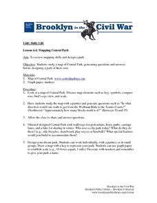
Mapping Central Park
Students use the mapping skills to explore New York's Central Park. They examine a map of Central Park to discover its features. After discussing the characteristics of the park, students design their own dream park and draw it to scale.
Curated OER
Solve for Scale Factors Using Proportions
Eighth graders solve problems using proportions with scaled drawings. They work with maps and blue-prints discussing scales and plans and examine different polygons and figure out the scale factors or proportions they have been changed by.
Edgate
Great Grids
Learners use grid boxes as a measurement tool and discover how grids are used for mapmaking and scaling down an area. They begin by attempting to draw a model shape drawn by the teacher by using the gridding process. At the conclusion of...
Curated OER
Measurement 4: Linear Measure
In this measurement worksheet, young scholars use a ruler to measure, in inches, the distance of various line segments. Then, using the scale drawing, they determine the actual distance in miles. Students may use their knowledge of...
EngageNY
Informal Proofs of Properties of Dilations
Challenge the class to prove that the dilation properties always hold. The lesson develops an informal proof of the properties of dilations through a discussion. Two of the proofs are verified with each class member performing the...
Mathematics Assessment Project
Calculating Arcs and Areas of Sectors of Circles
Going around in circles trying to find a resource on sectors of circles? Here is an activity where pupils first complete an assessment task to determine the areas and perimeters of sectors of circles. They then participate in an activity...
Curated OER
Mathematics of Cartography
Students practice their math skills as they explore maps. In this cartography lesson, students calculate distance, scale, coordinate systems, and projection as they work independently reading online maps.
Curated OER
Johnny Appleseed Walkabout
Second graders calculate mileage for a journey. In this place value and measurement lesson, 2nd graders read Johnny Appleseed, work in groups to locate his birthplace on a map, locate the other states he stopped in, and measure the...
Curated OER
How Far Away
Students investigate how a historic map drawn in the early days of interstate automobile travel represented distances. They measure distance within their personal space.
Curated OER
The Pilgrims
Students use distance measuring tools to follow directions and chart the path the pilgrims made from Plymouth, England to Boston, Massachusetts. In this Pilgrim voyage lesson, students use a map to chart the distance traveled by the...
Curated OER
TOPSY TURVY MAPS
Eighth graders use the data analyzer and motion detector to collect data and measure distances. They create topographic maps drawn to scale of a given setup and relate the concepts to the creation of historical ocean maps.


