Curated OER
Exploring the Hudson in 1609
While this lesson focuses on a study of the Hudson River, it could be used as a template for a discussion of map skills, converting measurements, and plotting a route. The lesson includes vocabulary and other resources to make it a...
WindWise Education
What Factors Influence Offshore Wind?
What is that out in the water on the horizon? Teams work together to study the coastline using maps to determine the best and worst locations to place an offshore wind farm. The teams then build a scale model wind farm to see what it...
Curated OER
Mapping the Bone Field: An Area and Scale Exercise
Here is an excellent cross-curricular lesson. Learners relate multiplication to area by making a grid on graph paper, and then creating the same grid in real space outside in the school yard.
Curated OER
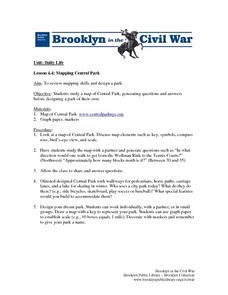
Mapping Central Park
Students use the mapping skills to explore New York's Central Park. They examine a map of Central Park to discover its features. After discussing the characteristics of the park, students design their own dream park and draw it to scale.
Curated OER
Solve for Scale Factors Using Proportions
Eighth graders solve problems using proportions with scaled drawings. They work with maps and blue-prints discussing scales and plans and examine different polygons and figure out the scale factors or proportions they have been changed by.
Edgate
Great Grids
Learners use grid boxes as a measurement tool and discover how grids are used for mapmaking and scaling down an area. They begin by attempting to draw a model shape drawn by the teacher by using the gridding process. At the conclusion of...
Curated OER
Measurement 4: Linear Measure
In this measurement worksheet, young scholars use a ruler to measure, in inches, the distance of various line segments. Then, using the scale drawing, they determine the actual distance in miles. Students may use their knowledge of...
Noyce Foundation
Photographs
Scaling needs to be picture perfect. Pupils use proportional reasoning to find the missing dimension of a photo. Class members determine the sizes of paper needed for two configurations of pictures in the short assessment task.
Mathed Up!
Enlargements
Make enlargements with and without centers. Pupils work through seven problems dealing with dilations or enlargements. The first couple items are strict enlargements without centers, while the others have centers. Class members also...
EngageNY
Informal Proofs of Properties of Dilations
Challenge the class to prove that the dilation properties always hold. The lesson develops an informal proof of the properties of dilations through a discussion. Two of the proofs are verified with each class member performing the...
Mathematics Assessment Project
Calculating Arcs and Areas of Sectors of Circles
Going around in circles trying to find a resource on sectors of circles? Here is an activity where pupils first complete an assessment task to determine the areas and perimeters of sectors of circles. They then participate in an activity...
Curated OER
Mathematics of Cartography
Students practice their math skills as they explore maps. In this cartography lesson, students calculate distance, scale, coordinate systems, and projection as they work independently reading online maps.
Curated OER
Make a Map
In this mapping activity worksheet, students finish the map by following the 5 directions and using the map key. Students the map key, scale, and an inch ruler for help.
Curated OER
Johnny Appleseed Walkabout
Second graders calculate mileage for a journey. In this place value and measurement lesson, 2nd graders read Johnny Appleseed, work in groups to locate his birthplace on a map, locate the other states he stopped in, and measure the...
Curated OER
How Far Away
Students investigate how a historic map drawn in the early days of interstate automobile travel represented distances. They measure distance within their personal space.
Curated OER
The Pilgrims
Students use distance measuring tools to follow directions and chart the path the pilgrims made from Plymouth, England to Boston, Massachusetts. In this Pilgrim voyage lesson, students use a map to chart the distance traveled by the...
Curated OER
TOPSY TURVY MAPS
Eighth graders use the data analyzer and motion detector to collect data and measure distances. They create topographic maps drawn to scale of a given setup and relate the concepts to the creation of historical ocean maps.
Curated OER
Math and Measurement
Students use the correct tool to measure distances. In this geometry lesson, students use an odometer and ruler correctly as they study maps. They describe how far way something is.
Curated OER
Inches Away
Students are introduced to maps, scale representations, ratios and cartography. They plot the itinerary for their family's dream vacation or a trip across the United States. Using maps, they determine the short route and second longer...
Mathematics Vision Project
Module 7: Connecting Algebra and Geometry
The coordinate plane links key geometry and algebra concepts in this approachable but rigorous unit. The class starts by developing the distance formula from the Pythagorean Theorem, then moves to applications of slope. Activities...
Curated OER
Scale Drawings
Students discuss the importance of scaling drawings. For this math lesson, students create a scaled drawing of circuit boards. They explain why accuracy is very important when scaling.
Curated OER
Introducing the Concept: Proportions
Students measure distances. In this proportions lesson, students use a map to find how far it is between different cities. Students use their knowledge of measurement, multiplication and fractions to find the distances.
Curated OER
Reading distance on maps
Eighth graders complete worksheets on reading the distance on maps in miles or kilometers. In this maps lesson plan, 8th graders use a calculator and ruler.
Curated OER
Coordinate Grid: Mapping Archeological Sites
Fourth graders discover how to apply the Cartesian coordinate system by figuring out the length and width of their school playground. They determine that pacing is an important tool for the initial mapping of a site. Students conduct a...


