Curated OER
Environment: Water & Air
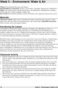
The introduction to the lesson mentions a sailor's limited capacity to store drinking water on his ship. Pupils then set up an overnight experiment to remove freshwater from salt water by distillation. There is a math and map activity to...
Curated OER
Ratio Relationships
Students solve for the different ratio and proportion of a problem. In this geometry lesson plan, students show their knowledge of how to solve proportional relationships. They convert between percent, decimals and fractions.
Curated OER
Congressional Travel
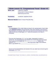
Students determine the distances traveled by the members of the legislative branch of the US Government. In this travel distance instructional activity, students locate Washington, DC on a globe using the longitude and latitude of the...
Curated OER
Track Your Trip
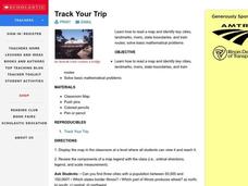
Fourth graders are shown how to read a map and identify key cities, landmarks, rivers, state boundaries, and train routes. They solve basic mathematical problems. Students reivew the componets of a map legend. They are asked to find...
University of Colorado
Are All Asteroids' Surfaces the Same Age?
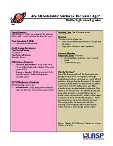
Did you know scientists can tell the age of an asteroid by looking closely at its craters? This final lesson of a six-part series focuses on two asteroids, Gaspra and Ida, in order to demonstrate the concept of dating asteroids. Scholars...
Curated OER
Location, Location
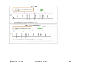
Third graders draw and interpret simple scale maps, use maps to move around efficiently or plans to propose actions. They use of a compass to specify and find directions. They display and discuss a map of the local region.
Curated OER
Gridding a Site
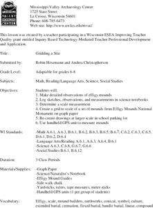
Young scholars make observations of effigy mounds and record them in a notebook. In groups, they must determine the scale of measurement and create their own grid to scale part of the Effigy Mounds National Monument. They also practice...
Curated OER
"it's All in the Cellar"
Seventh graders examine the process of constructing a site plan map at archaeological sites. They discuss the process of mapping techniques and calculation of percentages, create a plan site map of a cellar at Jamestown, and calculate...
Curated OER
Travels Of A Florida Migrant Child
Middle schoolers discuss the story Amelia's Road by Vickie Leigh Krudwig in this cross-curricular Math lesson for the middle-level classroom. Elements of the social sciences are addressed. Cooperative learning groups are suggested for...
Curated OER
Where Should You Turn?
Fourth graders complete activities to study decimal numbers. In this decimal numbers lesson, 4th graders study decimal numbers to express numbers less than one and intervals. Students complete map and location activities to study the...
Curated OER
An American Spy with Money To Spend
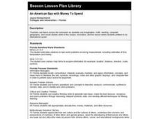
Sixth graders use their imagination, math, reading, computer, geography, and social studies skills in this unique, innovative, and fun instructional activity where students pretend to be international spies!
Curated OER
Give Me The C and D Canal!!!
Young scholars estimate the distance from Baltimore to Philadelphia via the water route before the Chesapeake and Delaware Canal was built. Students study canals and how transportation and economic necessities dictate the building of a...
Curated OER
Science: Backyard Bugs Data Collection
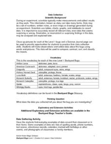
Young scholars practice data collection skills by observing common bugs found in their local environment. Once the data is collected they complete data sheets to compare, contrast, sort, and classify the insects. The lesson includes...
Curated OER
Language Families
Fourth graders identify and locate the three language families of North Carolina. They calculate the physical area covered by each language family and label them on a map.
Curated OER
Quad Squad
Young scholars pretend they have visited a forest research station on an overnight field trip. They study forest fires, use compass directions, read maps, interpret imagery, and think about the impact of fire on ecosystems.
Curated OER
Landforms
Students study how landforms affect all aspects of a community. Students work in groups to identify landforms from other works of art. In cooperative groups Students select a work of art depicting a particular land form and create a poem.
Curated OER
Scatter Plots
Seventh graders investigate how to make and set up a scatter plot. In this statistics activity, 7th graders collect data and plot it. They analyze their data and discuss their results.
Curated OER
Ocean Currents and Sea Surface Temperature
Students use satellite data to explore sea surface temperature. They explore the relationship between the rotation of the Earth, the path of ocean current and air pressure centers. After studying maps of sea surface temperature and ocean...
PBS
Home, Sweet, Home!
Young scholars investigate the local history and architecture of their community. They draw maps, conduct Internet research, discuss varied architectural designs, take a walking tour of their town and work in teams to record their...
Curated OER
Mapping It Out - Great Lessons For Geography
Through geography lesson plans students can learn about history, science, and a variety of other subjects.
Curated OER
A Bird's Eye View of our 50 States
Third graders focus on state birds as they learned absolute location (latitude/longitude) of each state, as well as their relative location (bordering states).
Curated OER
The Appearance of a Graph
Sixth graders understand that the appearance and increment used on the x and y axis in a graph change how it looks. In this graphing lesson, 6th graders work in pairs and interpret graphs using different axes. Students collect graphs...
Curated OER
Measurement and Data Collecting using Image Processing
Students trace the route of the historical event and measure the distance over which the people involved journeyed. A data sheet be constructed outlining the location of events, and the speed with which the journey occurred.
Curated OER
High Mountain Retreat
Young scholars explore and analyze atmospheric conditions for a high mountain retreat. They examine the relationship between altitude, atmospheric pressure, temperature and humidity at a particular location. In addition, they write...


