Curated OER
States and Capitals - Lesson 4 - U.S. Political Map
In this U.S. state capitals worksheet, learners identify the capital cities of the 50 states using the latitude and longitude coordinates provided.
Curated OER
Animal Word Maps
In this animal vocabulary word mapping instructional activity, students study a list of 8 animal names. In an opposite column, students are provided with blank word maps. Students match the words and place them into the map.
Curated OER
Blank Map: The United States of America
In this map worksheet, students use the blank outline map of the United States to label the 50 states or for any other study purpose. Each state boundary is shown with no name labels.
Curated OER
Word Maps With "ai" Words
In this vowel sound word map worksheet, students study a word bank of 5 words containing "ai." Students place each word into a word map and then write the word on the line provided.
Curated OER
Circular Story Map
In this story elements map worksheet, students use the blank graphic organizer to plan a story they will write. Students will write a story that takes place in the country they choose to study. Students think of the setting, characters,...
Curated OER
The Extent of Alexander's Empire
In this ancient empires worksheet, students read an article about Alexander the Great and then respond to 7 short answer questions.
Curated OER
Europe Map
In this world geography activity, students study the map of Europe and locate the 48 countries within the continent. Students write the names on the provided lines.
Curated OER
Globe Lesson 9 - Around the World - Grade 6+
In this geography skills worksheet, learners read 5-travel scenarios and use their problem solving skills to respond to 9 short answer questions.
Teach Engineering
What's Wrong with the Coordinates at the North Pole?
Here is an activity that merges technology with life skills as individuals use Google Earth to explore the differences between coordinate systems and map projections. The self-guided instructional activity is the fourth segment in a...
Curated OER
MAP Practice
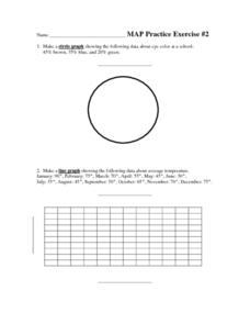
In this geometry worksheet, students create circle, line and bar graphs using different comparisons of events. There are 24 questions with an answer key.
Laboratory for Atmospheric and Space Physics
Charting the Progress of New Horizons
In 2006, New Horizons began its mission to fly to Pluto. As it continues its journey, scholars track its progress with the help of an informative website, all the while reinforcing measurement concepts with the construction of a scaled...
Laboratory for Atmospheric and Space Physics
Planetary Distances on the Playground
There's no need to stay inside; get out of the classroom and create a scaled map of the solar system on your playground field! In collaborative groups, scholars identify the distance between the sun and other planets, place planet...
Curriculum Corner
Book Study: The Polar Express
All aboard! Pair a reading of The Polar Express by Chris Van Allsburg with a set of literacy activities. The packet of worksheets includes task cards, sorting activities, a synonym match, comparing and contrasting activities, writing...
Curated OER
1890's Vienna: Creative Activity
The Ringstrasse is one of the most famous places to visit in Vienna. It is a circular street frequented in the 1890's by many historic figures. After a study of Brahms, your class can complete this fun and creative activity. They color,...
Shmoop
ELA.CCSS.ELA-Literacy.SL.9-10.2
What are diverse media formats? Have your class figure this out on their own through small-group brainstorming. The resource includes two related activities about different kinds of data that will help your class get a grasp of media...
Mathematics Assessment Project
Arithmetic with Polynomials and Rational Expressions
It all starts with arithmetic. An educational resource provides four items to use in summative assessments. The items reflect the basic skill level required by the standards in the domain and are designed to have...
Curated OER
Viewpoints
In this latitude and longitude worksheet, students complete 10 matching questions identifying key features or locations on a map. Students also use lines of latitude and longitude to identify the time in 4 different places.
Curated OER
Latitude and Longitude
In this latitude and longitude worksheet, students complete 4 activities to demonstrate understanding. Students use a protractor to measure angles on a map of the earth. Students fill out a latitude and longitude chart after studying a...
Curated OER
Degrees and Minutes
In this latitude and longitude worksheet, students place 9 cities on a map using the latitude and longitude of each. Once cities are placed in the correct location, students complete 2 short answer follow-up questions.
Curated OER
Musical Plates-Earthquakes
In this plotting earthquake data worksheet, students use a large world map and given web sites showing the latitude and longitude for the epicenter of recent earthquakes around the world. Students plot 2 weeks of earthquake data...
Texas State Energy Conservation Office
Investigation: Tour de Texas
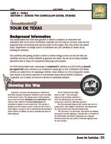
Teams of Texas tourists gather into groups to analyze what they can do with $50 worth of an alternative fuel. They write checks, keep a balance sheet, and map out their sight-seeing route taking into consideration the location of...
Curated OER
Travel in Europe
In this European travel worksheet, students respond to 11 short answer questions that require them to research travel throughout the countries in Europe.
Curated OER
Creating a Concept Map
In this concept map instructional activity, students learn the steps of creating a concept map to show the relationship between concepts. Students create a concept mapping using the 5 steps.
Curated OER
Breaking News English: Map Shows Chinese Discovered America
In this English learning exercise, students read "Map Shows Chinese Discovered America," and then respond to 47 fill in the blank, 7 short answer, 20 matching, and 8 true or false questions about the selection.
Other popular searches
- Map Skills Lesson Plans
- Map Skills Worksheets
- Elementary Map Skills
- Geography Map Skills
- Basic Map Skills
- Social Studies Map Skills
- Globe and Map Skills
- Beginning Map Skills
- United States Map Skills
- Map Skills, Continents
- Early Explorers Map Skills
- Free Map Skills Worksheets


