Curated OER
Breaking News English: Map Shows the Chinese Discovered America
For this English worksheet, students read "Map Shows the Chinese Discovered America," and then respond to 47 fill in the blank, 7 short answer, 20 matching, and 8 true or false questions about the selection.
Curated OER
United States Map: March 31
In this calendar dates worksheet, students learn that March 31st was the day the first map of the United States was published. Students then create a map of either their classroom or school.
Curated OER
Longitude and Latitude Lines
In this geography worksheet, middle schoolers examine the map and focus on the concept of latitude and longitude by finding the locations.
Curated OER
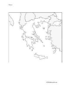
Map And Flag of Greece
In this Greece instructional activity, students color and study a Greek flag. Students also color and label a map of Greece. This could be used in writing a report.
Curated OER
10 Biggest Islands Map Quiz
In this online interactive geography quiz worksheet, students respond to 10 identification questions regarding the biggest islands in the world.
Messenger Education
Look But Don’t Touch—Exploration with Remote Sensing
Mars is home to the tallest mountain in our solar system, Olympus Mons. In this set of two activities, learners review geologic land formations through the analysis of aerial maps. They then apply this knowledge to aerial maps of objects...
Statistics Education Web
The United States of Obesity
Mississippi has both the highest obesity and poverty rate in the US. Does the rest of the data show a correlation between the poverty and obesity rate in a state? Learners tackle this question as they practice their skills of regression....
It's About Time
Present-Day Climate in Your Community
So what exactly is climate? This first installment of a six-part series introduces the concept of climate using real-world data tables and topographic maps. The timely lesson includes a comprehensive overview of climate, as well as...
Illustrative Mathematics
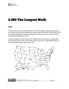
The Longest Walk
How long of a line can you draw within this activity? Learners pick two points outside and within the map to create the longest line they can. After drawing 10 lines, learners plot the length of each line on a line plot. Then they...
It's About Time
The Changing Geography of Your Community
Lead your class in exploring their local communities as well as the general environment. As they determine continental distributions by investigating minerals, rocks, and fossils located in their local region, pupils construct...
Bridges In Mathematics
Kindergarten Assessments and Scoring Checklists, Common Core State Standards
Whether or not your school has adopted Common Core standards, this resource provides great tools for assessing kindergartners' key numeracy and computation skills.
Curated OER
Definitions by Context
Use this two-page resource either with your English language learners or your upper elementary native speakers. There are eight questions that test your learners' ability to use the context of a sentence to define an unknown word....
Geophysical Institute
Latitude and Longitude with Google Earth
Travel the world from the comfort of your classroom with a instructional activity that features Google Earth. High schoolers follow a series of steps to locate places all over the earth with sets of coordinates. Additionally, they...
Laboratory for Atmospheric and Space Physics
Where Are We Going?
Come take a ride on the space bus! Scholars go on an imaginary trip to pick up their peers from the inner and outer planets while reinforcing math skills. First, learners round decimals to identify each planets' distance from Earth....
United Learning
The Great Age of Exploration (1400-1550)
Delve into the Age of Exploration with this activity-packed resource! Complete with a pre-test, discussion questions and quiz for a 30-minute video on the period, map activities, timeline of discoveries, vocabulary, etc. this is a...
GCSE Modern World History
Mao's China
Here is a great textbook chapter on China's establishment as a communist state in 1949 and the effects of World War II on the nation. The first page prompts learners to complete a timeline activity as they read the material,...
Center for Learning in Action
Investigating Physical and Chemical Changes
Super scientists visit ten stations to predict, observe, and draw conclusions about the physical and chemical changes that occur when different states of matter—liquid, solid, and gas—are placed under a variety of conditions. To...
Curated OER
Analogies
Analogies demonstrate how words relate to each other and crafting analogies is a good way to encourage learners to develop their understanding of the layers of meanings in words. This worksheet provides pupils practice completing and...
Sunburst Visual Media
Clouds
Support science instruction with a combination of engaging activities and skills-based worksheets that focus on clouds. Learners take part in grand discussions, write an acrostic poem, complete graphic organizers, solve word...
EngageNY
Getting a Handle on New Transformations 2
Use 2x2 matrices to move along a line. The second day of a two-day lesson is the 28th installment in a 32-part unit. Pupils work together to create and solve systems of equations that will map a transformation to a given...
Fluence Learning
Writing Informational Text: Lemonade Stand
Use a performance task to assess third graders' ability to read informational text. After they plan a lemonade stand business, young entrepreneurs implement that plan through informational writing. The task assumes learners can...
Curated OER
Compass Rose Activity
Which direction is which? Use this compass rose labeling instructional activity to practice with basic directions as learners fill in the compass themselves. They use cardinal and intermediate direction abbreviations. Consider using...
Curated OER
Compass Rose
Keep it simple and visual when practicing directions using this compass rose labeling worksheet. Learners fill in the compass themselves, using cardinal and intermediate direction abbreviations. North is done for them. Consider using...
Core Knowledge Foundation
Columbus Sailed the Ocean Blue
Young adventurers embark on a journey, setting sail along the blue ocean with Christopher Columbus. Teachers will find that this unit makes their lesson planning smooth sailing!
Other popular searches
- Map Skills Lesson Plans
- Map Skills Worksheets
- Elementary Map Skills
- Geography Map Skills
- Basic Map Skills
- Social Studies Map Skills
- Globe and Map Skills
- Beginning Map Skills
- United States Map Skills
- Map Skills, Continents
- Early Explorers Map Skills
- Free Map Skills Worksheets


