Curated OER
Freeform Pennsylvania Map
In this Pennsylvania map worksheet, students research, study and label twenty important cities, physical attributes and the neighbors that surround Pennsylvania on a Pennsylvania map.
Curated OER
World Map Labels
In this geography skills worksheet, students identify the countries and bodies of water labelled on the maps of the world, Africa, Asia, Canada, Europe, the Caribbean, the Middle East, North America, Australia, and South America.
Curated OER
United States Map Quiz
In this online interactive geography quiz learning exercise, students respond to 50 identification questions about the shapes of countries shown. Students have 5 minutes to complete the quiz.
Curated OER
Oceania Map Quiz
In this online interactive geography quiz worksheet, students respond to 14 identification questions about Oceania. Students have 2 minutes to complete the quiz.
Curated OER
Australia Cities Map Quiz
In this online interactive geography quiz worksheet, students respond to 17 identification questions regarding Australian cities. Students have 3 minutes to finish the timed quiz.
Curated OER
Chinese Cities Map Quiz
In this online interactive geography quiz instructional activity, students respond to 10 identification questions about Chinese cities. Students have 3 minutes to complete the quiz.
Curated OER
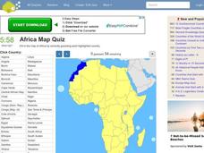
Africa Map Quiz
In this online interactive geography quiz worksheet, students respond to 53 identification questions about the countries of Africa. Students have 6 minutes to complete the quiz.
Curated OER
Spanish Cities Map Quiz
In this online interactive geography quiz worksheet, students respond to 11 identification questions about Spanish cities. Students have 3 minutes to complete the quiz.
Curated OER
Europe Map Quiz
For this online interactive geography quiz worksheet, students respond to 45 identification questions about the countries located in Europe. Students have 5 minutes to complete the quiz.
Curated OER
Linear Systems Review for Exam 1
In this math activity, students practice reviewing for the exam that focuses upon the concept of linear systems. They draw a concept map for the review topics listed.
Curated OER
May 25 - National Bike Month
In this writing prompt worksheet, learners learn that May 25th is 'National Bike Month.' Students write about a bicycle path they would create through their neighborhood or town and where it would lead. Learners include a description of...
National Center for Case Study Teaching in Science
Mask of the Black God
Finally, an astronomy lesson for the high schooler! Explorers are able to read star maps for finding objects in the night sky by determining celestial coordinates. In particular, they locate the Pleiades and read about a Navajo legend...
It's About Time
Energy from Coal
If plastic is derived from fossil fuels and fossil fuels come from dead dinosaurs, does that mean that plastic dinosaurs are made from real dinosaurs? This lesson goes into depth about coal and other fossil fuels. First the instructor...
Curated OER
Viewing Earth and Sky
For this earth and sky worksheet, students review terms associated with map reading. Students also review topographic maps and how contour lines represent elevation. This worksheet has 5 matching, 5 true or false, 5 fill in the blank,...
Curated OER
Oil Spill ESI Maps
In this environmental science instructional activity, students study and read ESI maps on oil spills and complete 8 short answer questions that follow.
Curated OER
Organizing your Research
In this research worksheet, students read about how to organize themselves when doing research. They read about a student who had a topic to research but had difficulty coming up with books about his topic. Students suggest ways to...
Curated OER
Working with Contour Maps
In this contour maps worksheet, high schoolers use contour maps to determine the slope and steepness of different land masses. This worksheet has 16 fill in the blank questions.
Curated OER
Physical and Human Geography Review Worksheet and Study Guide
In this geography skills worksheet, students respond to 30 short answer questions pertaining to physical and human geography.
Curated OER
Graphic Organizer-- Spider Map
In this graphic organizer worksheet students may use this helpful tool to organize facts on any subject. The spider map refers to the way this looks with a center main topic and specific facts coming out on the "legs".
Curated OER
Miss Nelson is Missing! Love Two Teach
In these reading and math skills worksheets, students complete a series of activities for the story Miss Nelson is Missing! Students create a missing poster, a Venn Diagram, a story map, activities for multiplication, addition,...
Curated OER
3rd Grade Social Studies Core Skills (Reference Books)
In this reference materials activity, students complete the 20 multiple choice questions pertaining to the correct book needed to find the answer in each situation. Included are dictionary, atlas, encyclopedias, newspapers and maps.
Curated OER
Frayer Model
In this Frayer model worksheet, students use the Frayer model to complete a chart about a word study. Students complete 5 steps in the model.
Curated OER
Rhode Island State Map
In this geography of Rhode Island worksheet, students color and label a map with the major cities and physical features. Students also study a U.S. map to learn the location of the state of Rhode Island.
Curated OER
English Skill Sheet 2
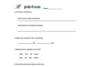
In this spelling skills worksheet, students respond to 4 questions in which they correct misspelled words, identify word families, and rhyme words.
Other popular searches
- Map Skills Lesson Plans
- Map Skills Worksheets
- Elementary Map Skills
- Geography Map Skills
- Basic Map Skills
- Social Studies Map Skills
- Globe and Map Skills
- Beginning Map Skills
- United States Map Skills
- Map Skills, Continents
- Early Explorers Map Skills
- Free Map Skills Worksheets


