Curated OER
Historical Map - United States: The Changing Frontier
In these United States frontier worksheets, students study the map of the United States frontier for various sections of time in the history of the United States. Students then finish a crossword puzzle using the various parts of the...
Curated OER
Northern Africa Map Quiz
In this online interactive geography quiz worksheet, students respond to 18 identification questions regarding the nations of Northern Africa.
Curated OER
Central Africa Map Quiz
In this online interactive geography quiz worksheet, students respond to 15 identification questions regarding Central African countries.
Curated OER
Atlantic Ocean Map Quiz
In this online interactive geography quiz worksheet, students respond to 7 identification questions regarding the Atlantic Ocean.
Curated OER
Defining a Cultural Region Worksheet
For this cultural regions worksheet, students click on the webpage names listed to find information about the different cultures and cultural regions in Louisiana that may be used for research purposes.
Curated OER
Pacific Ocean Map Quiz
In this online interactive geography quiz worksheet, students respond to 5 identification questions regarding the Pacific Ocean.
Curated OER
Canada Map Quiz
In this online interactive geography quiz instructional activity, students respond to 12 multiple choice questions regarding Canadian countries.
Curated OER
North American Lakes Map Quiz
In this online interactive geography quiz activity, students respond to 11 identification questions regarding North American lakes.
Curated OER
North American Mountain Ranges Map Quiz
In this online interactive geography quiz instructional activity, students respond to 7 identification questions regarding North American mountain ranges.
Curated OER
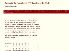
A Walk in Winchester
In this Winchester activity, students determine the number of different routes to a determined location. This one-page activity contains 1 problem. The answer is provided at the bottom of the page.
Curated OER
World's Longest Rivers Map Quiz
In this online interactive geography quiz worksheet, students respond to 40 identification questions about the world's largest rivers.
Curated OER
World Lakes Map Quiz
In this online interactive geography quiz worksheet, students respond to 15 identification questions regarding major world lakes.
Curated OER
World Mountains Map Quiz
In this online interactive geography quiz worksheet, students respond to 10 identification questions regarding some of the world's mountain ranges.
Curated OER
Europe Map Quiz (Easy)
In this online interactive geography quiz worksheet, learners respond to 35 identification questions regarding the countries of Europe.
Curated OER
Eastern Europe Map Quiz
For this online interactive geography quiz worksheet, learners respond to 25 identification questions regarding the nations of Eastern Europe.
Curated OER
Western Europe Map Quiz
In this online interactive geography quiz worksheet, students respond to 35 identification questions regarding the countries of Europe.
Curated OER
Europe Lakes Map Quiz
In this online interactive geography quiz worksheet, learners respond to 10 identification questions about major lakes located in Europe.
Curated OER
North America Map Quiz
In this online interactive geography quiz activity, students respond to 19 identification questions about the countries located in North America.
Curated OER
North America Capitals Map Quiz
In this online interactive geography quiz worksheet, learners respond to 16 identification questions regarding capital cities of North American countries.
Curated OER
United States Capitals Map Quiz
In this online interactive states and captials quiz instructional activity, students examine the 50 pictured states and try to name all of the state capitals.
Curated OER
The Story Map
In this literacy worksheet, students identify the setting, theme, summarize different parts of the story, and use the questions in order to create a map for a story that guides the reader into the real meaning.
Curated OER
Earth's Features
In this geography worksheet, students label a map of the world with the Arctic Circle, Tropic of Capricorn, Tropic of Cancer, Equator, North Pole, South Pole, and the Antarctic Circle.
Curated OER
Continents and Islands Map Quiz
In this online interactive geography quiz worksheet, students respond to 17 identification questions about the continents and islands of the world.
Curated OER
World Continents Map Quiz
In this online interactive geography quiz worksheet, students respond to 7 identification questions regarding the continents of the world.
Other popular searches
- Map Skills Lesson Plans
- Map Skills Worksheets
- Elementary Map Skills
- Geography Map Skills
- Basic Map Skills
- Social Studies Map Skills
- Globe and Map Skills
- Beginning Map Skills
- United States Map Skills
- Map Skills, Continents
- Early Explorers Map Skills
- Free Map Skills Worksheets


