Curated OER
Asia Seas Map Quiz
In this online interactive geography quiz learning exercise, students respond to 18 identification questions regarding the seas of Asia.
Curated OER
Middle Eastern Lakes and Rivers Map Quiz
For this online interactive geography quiz worksheet, students respond to 8 identification questions regarding specific lakes and rivers in the Middle East.
Curated OER
Asian Mountains Map Quiz
For this online interactive geography quiz worksheet, students respond to 17 identification questions regarding the mountain ranges of Asia.
Curated OER
Europe Map Quiz (Hard)
In this online interactive geography quiz worksheet, students respond to 40 identification questions regarding European countries.
Curated OER
Europe Capitals Map Quiz
In this online interactive geography quiz worksheet, students respond to 40 identification questions regarding capital cities of European countries.
Curated OER
Europe Mountain Ranges Map Quiz
For this online interactive geography quiz worksheet, students respond to 6 identification questions regarding the mountain ranges of Europe.
Curated OER
Canada Capitals Map Quiz
In this online interactive geography quiz worksheet, students respond to 14 identification questions regarding the Canadian capital cities.
Curated OER
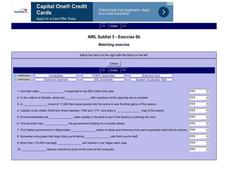
English Vocabulary Skills: AWL Sublist 8 - Exercise 4b
In this online interactive English vocabulary skills worksheet, students answer 10 matching questions which require them to fill in the blanks in 10 sentences. Students may submit their answers to be scored.
Curated OER
Telling Direction - Compass Rose
Keep it simple when practicing directions using this compass rose labeling worksheet. Learners read a brief text describing the cardinal and intermediate directions, then fill in the compass themselves. They can get immediate feedback...
Curated OER
Ancient Middle East Geography
As part of a study of ancient Middle East geography, kids locate seas, rivers, regions, and cities on a map of the region.
Eastconn
Learning to Analyze Political Cartoons with Lincoln as a Case Study
Discover the five main elements political cartoonists use—symbolism, captioning and labels, analogy, irony, and exaggeration—to convey their point of view.
Have Fun Teaching
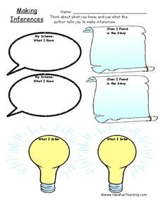
Making Inferences (17)
Here's a bright inference worksheet that can enlighten the study of any text. Readers fill in a thought bubble with what they know about a story, then map on a scroll clues they found in the text, and record their insights on...
Desert Discoveries
The Sonoran Desert
Elementary schoolers study the geographic location of the Sonoran Desert. They pay close attention to the characteristics of the plants and animals found in this desert environment. The student handouts embedded in this plan are...
Curated OER
Any Small Goodness
Are you thinking of reading Any Small Goodness with your students? Engage them with these worksheets. Sharpen prediction and response skills, in addition to creating a character analysis map. Also included, are some thoughtfully-written...
Curated OER
Urban Geo Worksheet
In this urban geography worksheet, students respond to 20 short answer questions about urban geography after they have read a related article. The article is not included.
Curated OER
Learn the States and Postal Abbreviations
If you are preparing to cover the 50 states with your class, you don't want to miss this resource. It includes an excellent set of worksheets through which learners practice identifying states from their abbreviations and placing those...
Curated OER
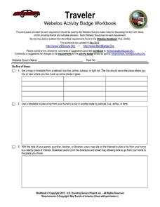
Traveler: Webelos Activity Workbook
This three-page worksheet is designed to be used by the Weblos of Boy Scouts of America. They are given 13 choices of academic activities that involve the use of maps, geography, math, and money. They must complete five of the activities...
Curated OER
Knights of the Round Table
As an exploration of the Knights of the Round Table, this activity helps students organize their information and check for understanding by using the comprehension questions. This packet would be a terrific supplement to a unit on this...
Curated OER
Literature Study Guide - The Prince and the Pauper
Offering several reading comprehension activities, such as a character map and a plot flow chart, this book report form will help your class through Mark Twain's Prince and the Pauper. The activities in the lesson lend well to...
Curated OER
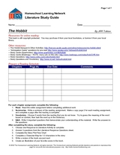
Literature Study Guide - The Hobbit
With several online resources for J.R.R. Tolkien's The Hobbit, as well as many reading and literary analysis activities, this novel study guide is a great way to keep your young readers organized during a book report. The guide...
Curated OER
Label the Southern States
During your study of the United States, challenge your class to label the seventeen Southern states. Can they do it without the key? The answer sheet is included.
Curated OER
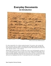
Everyday Documents
Almost more of a lesson than a activity, this particular resource has learners examine different types of historical documents. There is a historical docment embedded in the activity that learners study, and they also bring in documents...
Curated OER
The Class Trip
Mrs. Moore's class is trying to earn money for a trip to the science museum, but how much more do they need? Solve this problem with your own class as they develop their ability to model real-life situations algebraically. As an added...
Curated OER
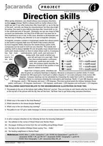
Direction Skills
In this geography worksheet, learners read an excerpt on what directions tell someone. They respond to 6 short answer questions related to the neighborhood illustration found on the second page of the worksheet.
Other popular searches
- Map Skills Lesson Plans
- Map Skills Worksheets
- Elementary Map Skills
- Geography Map Skills
- Basic Map Skills
- Social Studies Map Skills
- Globe and Map Skills
- Beginning Map Skills
- United States Map Skills
- Map Skills, Continents
- Early Explorers Map Skills
- Free Map Skills Worksheets


