Curated OER
Mapmaker, Mapmaker, Make Me a Map!
Young scholars evaluate the different types of historical and geographical information that one can gather through close study of historical maps from the 16th through the 19th centuries. They create their own maps.
Curated OER
Analyzing Two Dances and Making a Dance Map: The Nutcracker
Students discuss dance elements and create a dance map. They choose a dance theme and incorporate movement into their dance maps and choreography. They also experiment with different types of music.
Curated OER
Mapping Colonial New England: Looking at the Landscape of New England
Students understand the similarities and differences between English and Native American conceptions of the land and town settlement. They understand how the colony of Massachusetts developed and expanded. Students understand the...
Curated OER
Map Making
In this map making activity, students draw a map of their home including a map key. In this drawing activity, students create one map.
Curated OER
The Water Nearby
Learners explore water located near where they live. In this map skills maritime lesson, students use Google Maps to find their school and the body of water closest to them. Learners research the body of water and answer questions about it.
Curated OER
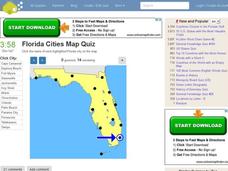
Florida Cities Map Quiz
For this online interactive geography worksheet, students examine a map of Florida and identify the 12 noted cities on the map using a pull down menu within 3 minutes.
Curated OER
Texas Cities Map Quiz
In this online interactive geography activity, students examine a map of Texas and identify the 15 noted cities on the map using a pull down menu within 3 minutes.
Curated OER
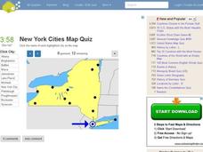
New York Cities Map Quiz
In this online interactive geography worksheet, students examine a map of New York and identify the 11 noted cities on the map using a pull down menu within 3 minutes.
Curated OER
South America Map Quiz
In this online interactive geography quiz worksheet, students examine the map that includes all of South America's countries. Students identify the 13 countries in 2 minutes.
Curated OER
Middle East Map Quiz
In this online interactive geography quiz worksheet, students examine the map that includes 26 Middle Eastern countries. Students identify the names of the countries in 4 minutes.
Curated OER
Central America Map Quiz
In this online interactive geography quiz worksheet, students examine the map that includes 22 Central American countries. Students identify the names of the countries in 3 minutes.
Curated OER
Canada Map Quiz
In this online interactive geography quiz activity, students examine the map that includes 13 Canadian provinces and territories. Students identify the names of the provinces and territories in 2...
Curated OER
California Cities Map Quiz
In this online interactive geography quiz instructional activity, students examine the map that includes 12 California cities. Students identify the names of the cities in 3 minutes.
Curated OER
Michigan Cities Map Quiz
In this online interactive geography instructional activity, students examine a map of Michigan and identify the 14 noted cities on the map using a pull down menu within 3 minutes.
Curated OER
Map Your Community
Students study their community's assets and needs to create a service project that would meet the needs. In this community project lesson, students research their community and look for the strengths and weaknesses of the community. As a...
Curated OER
The Country of Venezuela
In this map skills of Venezuela worksheet, students use an outline map to find an label important cities landforms, and bodies of water. Students label and color code 10 answers.
National History Day
“Saving the Bear”: The Russian Expeditionary Force of World War One
How have Russian politics affected countries on a global stage? The discussion of the Russian Revolution and World War I begins with an analysis of primary resource letters. Learners finish with a project where they create a timeline of...
TED-Ed
A Digital Reimagining of Gettysburg
Why would Robert E. Lee order Pickett's Charge, an action that changed the course of the Civil War? Geographer and historian Anne Knowles uses digital technology to explain what she thinks is the missing piece in trying to understand...
Echoes & Reflections
The Children and Legacies Beyond the Holocaust
Using video testimony, primary source documents that detail international agreements, and structured discussions, learners consider the precarious position of children during the Holocaust and other international conflicts, and how to...
Curated OER
Vocabulary Review and Map Skills
Learners, when given the name of a community, identify a food, a craft, a custom, language and music, unique to that community 100% of the time. They find similarities and differences between this community and their own in four...
Curated OER
Map your Schoolyard
Students practice their mapping skills by creating an accurate map of their schoolyard using an aerial photo from the National Map web site. Students include legends, a scale, and a north arrow on their maps.
Curated OER
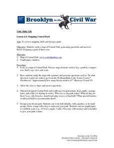
Mapping Central Park
Students use the mapping skills to explore New York's Central Park. They examine a map of Central Park to discover its features. After discussing the characteristics of the park, students design their own dream park and draw it to scale.
Curated OER
Mathematics of Cartography
Students practice their math skills as they explore maps. In this cartography lesson, students calculate distance, scale, coordinate systems, and projection as they work independently reading online maps.
Curated OER
Introducing Topographic Maps: Guiding Students from Concrete Models to Graphic Representations
Students interpret topographic maps and infer human activity as it is influenced by the landscape.
Other popular searches
- Map Skills Lesson Plans
- Map Skills Worksheets
- Elementary Map Skills
- Geography Map Skills
- Basic Map Skills
- Social Studies Map Skills
- Globe and Map Skills
- Beginning Map Skills
- United States Map Skills
- Map Skills, Continents
- Early Explorers Map Skills
- Free Map Skills Worksheets


