Mathed Up!
Translations
Introduce translations as transformations that move figures in horizontal and vertical distances with a video that shows how to translate the figures. A second video covers how to determine the translation that has occurred. Pupils work...
California Education Partners
Linflower Seeds
How does your garden grow? Use proportions to help Tim answer that question. By using their understanding of proportional relationships, pupils determine the number of seeds that will sprout. They create their own linear relationships...
Teacher's Corner
Hey Batter, Wake Up!
Does jet lag affect a baseball team's performance in games? Read about how a baseball team's chance of winning a game can be affected by traveling over one, two, and three time zones. Readers then respond to five short answer questions...
Western Education
Math Poems
The logic, rhythm, and beauty of math sometimes get lost amidst numbers and variables. Amplify math's lyricism with a poetry project that uses metaphors and similes to compare mathematical concepts to other images.
Macmillan Education
White Fang
Jack London's adventurous novel White Fang may seem removed from students' everyday lives, but with an engaging set of reading activities, learners can relate to the story's themes. A three-page assignment delves into the novel before,...
Curated OER
Physical World Map
In this world map worksheet, students practice their geography skills as they label the 7 continents and 5 oceans. Teachers may use this physical map for various classroom activities
Curated OER
Breaking News English: Iran to Replace 40 Ambassadors
In this English worksheet, students read "Iran to Replace 40 Ambassadors," and then respond to 47 fill in the blank, 7 short answer, 20 matching, and 8 true or false questions about the selection.
Curated OER
Breaking News English: Japanese-Russian Peace Treaty Still Remote
In this English activity, students read "Japanese-Russian Peace Treaty Still Remote," and then respond to 47 fill in the blank, 7 short answer, 20 matching, and 8 true or false questions about the selection.
Curated OER
State Nicknames Quiz
In this online interactive geography quiz worksheet, students examine the chart that includes the names of 49 states. Students identify the nicknames of the states in 6 minutes.
Curated OER
USA National Parks Quiz
In this online interactive geography quiz worksheet, learners examine the chart that includes 58 state names. Students identify the names of the national parks in the listed states in 5 minutes.
Curated OER
Suburbs Quiz
In this online interactive geography quiz worksheet, students examine the chart that includes details about 18 major world suburbs. Students identify the names of the suburbs in 3 minutes.
Curated OER
Endangered Giant Pandas
In this giant panda activity, students read and complete 5 pages of information and activities pertaining to the giant panda. Students study maps of the area, read fun facts about pandas, cut and paste life cycle sequencing, and read...
Curated OER
Countries w/ Biggest Armies Quiz
In this online interactive military quiz worksheet, students examine the chart that includes details about the number of troops in 20 countries. Students identify the names of the countries in 4 minutes.
Curated OER
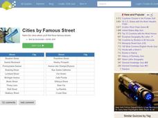
Famous Streets Quiz
For this online interactive geography quiz worksheet, learners examine the chart that includes the names of 18 famous streets in the world. Students have 4 minutes to identify the names of the cities where the streets are found.
Curated OER
Biggest Cities in Canada Quiz
In this online interactive geography quiz worksheet, students examine the chart that includes the population of 20 Candian cities. Students identify the names of the largest cities in Canada in 4 minutes.
Curated OER
Highest Mountain Countries Quiz
In this online interactive geography quiz worksheet, students examine the chart that includes the elevations of 20 world mountains. Students identify the names of the mountains in 4 minutes.
Curated OER
Biggest Cities in Each State Quiz
In this online interactive geography quiz activity, students examine the chart that includes the names of 50 U.S. states. Students identify the names of the two largest cities in each state in 8 minutes.
Curated OER
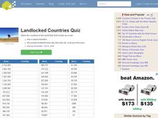
Landlocked Countries Quiz
In this online interactive geography quiz worksheet, students examine the chart that includes details about the population in 44 landlocked countries. Students identify the names of the countries in 5 minutes.
Curated OER
Famous Lakes Quiz
In this online interactive geography quiz worksheet, students examine the chart that includes details about 15 famous world lakes. Students identify the names of the lakes in 3 minutes.
Curated OER
Regions of Countries Quiz
In this online interactive geography quiz worksheet, students examine the chart that includes details about 20 world regions. Students identify the names of the countries where the regions are located in 4 minutes.
Curated OER
Country Flags Quiz
In this online interactive country flag quiz worksheet, students examine the 20 pictured country flags and try to name all of the countries represented in 4 minutes.
Curated OER
World's Biggest Lakes Quiz
In this online interactive geography quiz worksheet, students examine the chart that includes the area of 20 of the world's largest lakes. Students identify the names of the lakes in 4 minutes.
Curated OER
Biggest Cities in India Quiz
For this online interactive geography quiz worksheet, students examine the chart that includes the population of 20 Indian cities. Students identify the names of the largest cities in India in 4 minutes.
Curated OER
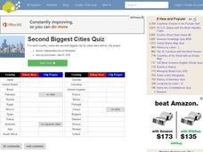
Second Biggest Cities Quiz
For this online interactive geography quiz worksheet, students examine the chart that includes details about 20 major cities in the world. Students identify the names of the cities in 4 minutes.
Other popular searches
- Map Skills Lesson Plans
- Map Skills Worksheets
- Elementary Map Skills
- Geography Map Skills
- Basic Map Skills
- Social Studies Map Skills
- Globe and Map Skills
- Beginning Map Skills
- United States Map Skills
- Map Skills, Continents
- Early Explorers Map Skills
- Free Map Skills Worksheets


