Cornell University
Too Much of a Good Thing?
Continuing their study of beneficial insects, young entomologists discover where in the world some of these bugs are. By labeling, coloring, and using the scale on a map, pupils explore the territories and arrival of the Asian lady...
CK-12 Foundation
Direction on the Earth: Using a Compass
Navigate the world of orienteering in an informative interactive. Earth science scholars learn practical direction skills, such as proper polar coordinates and pairing compasses with maps. The interactive map allows them to practice...
Channel Islands Film
Arlington Springs Man: Lesson Plan 4
West of the West's documentary Arlington Springs Man introduces viewers to the remarkable finds on Santa Rosa Island. Archaeologist have discovered on this small island that is part of the Channel island chain, human and pygmy mammoth...
Tidewater Community College
Assignment: The “Big Mac” Index
Young economists learn about the method of predicting changes in the exchange rate with Big Macs in an instructional video. After an understanding the index, learners write a post on a discussion board and respond to class members' posts...
National Endowment for the Humanities
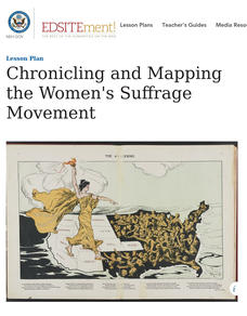
Chronicling and Mapping the Women's Suffrage Movement
While women's suffrage is often believed to be the result of a single constitutional amendment, the effort of women to secure the vote spanned decades and continents. Using primary sources in online archives, class members explore the...
Beyond Benign
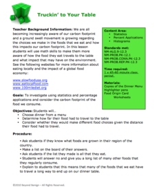
Truckin’ to Your Table
Food takes a trip to the table. Class members choose a meal from a menu and calculate the total cost of the meal including tax and tip. Using a food origin card, pupils determine how far each of the ingredients of a meal traveled to end...
Social Skills Central
Photo Cartoons: Being Polite
Have you ever been left out of plans your friends were discussing? This photo cartoon will help your learners recognize that being polite can go beyond just saying please and thank you by making sure others feel included and...
SciShow Kids
Create Constellation Flash Cards #sciencegoals
Get the inside scoop on constellations from Jessi and Sam the Bat in a captivating video that also supports study skills using flashcards.
United K12
Jan Brett Author Study
Expose young children to the wonderful works of author and illustrator Jan Brett using a few of her stories such as Armadillo Rodeo, The Mitten, or Daisy Comes Home through a unit study.
University of Pennsylvania
Using Political Postcards to Teach a Revolution of Political Thought
Discuss how political postcards affected everyday people's thoughts and beliefs. Pupils continue a unit on the Dreyfus Affair as they engage in class discussion, watch a video, view a PowerPoint presentation, and fill out worksheets to...
University of Pennsylvania
From the Dreyfus Affair to the World Today
Historical events do not occur in a vacuum. Such is the case of the Dreyfus Affair, where the connection between Captain Alfred Dreyfus, Emile Zola, and Hannah Arendt is fused by the events of the early 20th century. The informative...
Houghton Mifflin Harcourt
Surprise!: Extra Support Lessons (Theme 2)
Surprise! is the theme of a unit covering such topics as consonants, blending, short vowels sounds, high frequency words, and number words. The unit's lessons also include teachable moments covering story structure, illustrations,...
Flipped Math
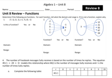
Unit 8 Review: Functions
Let's finish a functional review. Pupils work through 31 items to review the concepts learned in Unit 8. Scholars determine whether a mapping is a function and identify the domain and range. Using function notation, individuals then...
Curated OER
What do Maps Show?
Eighth graders practice the skill of reading maps. In this geography lesson, 8th graders participate in a classroom lecture on how to read a map.
Curated OER
Silk Roads Big Map
Students create an oversized map from Europe to East Asia. They include information such as Silk Roads, geographical features, major cities and cultural information on their map.
Curated OER
Mapping Roxaboxen
Fourth graders read Roxaboxen and draw a map of the Roxaboxen community. In this language arts and geography lesson, 4th graders use specifications given, adding features to the map as described in the book and creating a legend.
Curated OER
North America Outline Map
In this blank North America outline map worksheet, students study the political boundaries of the continent. This outline map may be used for a variety of geographic activities.
Curated OER
Yo Ho, Yo Ho, A Pirate's Map for Me: An Original Story
Students read Blackbeard and brainstorm their knowledge of maps. For this language arts and geography lesson, students use landmarks on their playground to review north, south, east and west and discuss the compass rose. Students read...
Curated OER
Maps, Charts, and Graphs
Students define key geographic terms and track a hurricane on a map. They examine various types of maps and find locations on them,including rivers, cities and mountains.
Curated OER
ESL Map Conversation Activity
In this ESL conversation worksheet, students take turns asking and answering questions about a map shown. Students ask and respond to "Where is the...?" questions.
Curated OER
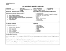
Organizing Doesn't Have to Be a Puzzle
High schoolers review writing process, prepare cluster maps, organize events of their lives on an outline, and utilize graphic organizers to write autobiographical essays.
Curated OER
Equator, North Pole, and South Pole
Students identify the Equator, North Pole, and South Pole on the globe. In this map skills lesson, students use a globe marker to locate specific locations on the globe. Students find where they live in relation to the Equator.
Curated OER
Cardinal Directions
Students draw items on a map in specific places to show their knowledge of cardinal directions. In this simple map skills lesson plan, students draw a cloud, a tree, a house, and a lake to show North, South, East, and West.
Curated OER
Geography: Continents
First graders identify basic geographical facts about the world they live in and distinguish between land and water on a globe. They research the continents and information associated with each one focusing on building their map skills.
Other popular searches
- Map Skills Lesson Plans
- Map Skills Worksheets
- Elementary Map Skills
- Geography Map Skills
- Basic Map Skills
- Social Studies Map Skills
- Globe and Map Skills
- Beginning Map Skills
- United States Map Skills
- Map Skills, Continents
- Early Explorers Map Skills
- Free Map Skills Worksheets


