Montana State University
Everest Extremes: Biodiversity
How many animals can live in a climate as cold as Mount Everest's? Find out with a science instructional activity all about biodiversity. Activities include research, presentations, group work, coloring maps, and a simulation of a food web.
California Department of Education
Roadmap to Success
Life is a highway ... where will yours lead? Scholars pave the way toward success in the fourth of five college and career readiness lesson plans. Using the SMART system, individuals begin mapping out the steps they will follow to...
Stanford University
Ruby Bridges
A two-part lesson features Civil Rights hero, Ruby Bridges. Part one focuses on the heroic actions of Ruby Bridges then challenges scholars to complete a Venn diagram in order to compare themselves to her. Part two begins with a...
American Battlefield Trust
Experiencing the Battle of Franklin
Scholars watch videos, study an animated map, and read a firsthand written account to explore the impact of the Battle of Franklin during the Civil War. Academics analyze images, complete worksheets, and create journal entries to...
Health Smart Virginia
Mental and Emotional Health
The first lesson in a social and emotional health unit is designed to help seventh graders develop the skills they need to cope with disappointment and manage stress. Groups practice stress reduction techniques and share ideas for how to...
Newseum
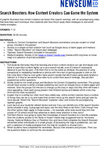
Search Boosters: How Content Creators Can Game the System
Scholars examine the techniques content creators use to boost their search rankings. After watching a short "Search Boosters" video, groups select a story from the "News or Noise? Media Map" and analyze the devices used in the story. The...
Pace University
Urban Communities
Urban communities are the focus of a series of lessons created to meet specific needs using differentiated instruction. A pre-assessment designates scholars into three groups based on their ability level. Small groups take part in...
American Battlefield Trust
United States Colored Troops
The debate over slavery contributed to the Civil War, but it didn't stop African Americans from joining the military. Academics complete a series of worksheets, read original letters, and analyze a photo of an African American soldier to...
Curated OER
Orienteering - Lesson 10 - Putting It All Together
Wrap up this unit by navigating through a prescribed course using a map and a compass. Put all the skills learned about reading a compass and using a map to navigate through an unknown course. Each learner should have a control card...
Core Knowledge Foundation
Columbus Sailed the Ocean Blue
Young adventurers embark on a journey, setting sail along the blue ocean with Christopher Columbus. Teachers will find that this unit makes their lesson planning smooth sailing!
Curated OER
Introducing the Concept: Proportions
Students measure distances. In this proportions lesson, students use a map to find how far it is between different cities. Students use their knowledge of measurement, multiplication and fractions to find the distances.
Curated OER
Orienteering - Lesson 9 - Declination
What's the difference between true north and magnetic north? Lesson 9 has your class practicing mapping using a compass and taking the correct declination into account. This lesson is one part of a 10 lesson unit on orienteering. There...
Curated OER
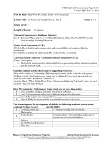
All Around the Neighborhood
Second graders explore the roles, responsibilities and skills of community leaders as they discuss the definition of community. They brainstorm businesses in the community and explore the importance of each profession represented in the...
Curated OER
Create a Math Road Trip
Students create a Road Trip. They work in small groups. Students are given a road map for each group. They plan a road trip between two cities on opposite edges of the map, estimating a reasonable distance to travel each day. Students...
Curated OER
Sunderland: Discovering Cities
Scholars investigate a local city (Sunderland) by participating in a discussion. They explore the different elements of the UK city by identifying the industrial and economic aspects. They also read an interview of two people speaking...
Curated OER
Follow Your Dreams: Career Goals
It is so important for impending high school graduates to start thinking about their potential careers. Here, they discuss the persistence of Blondie Hasler and his impressive transatlantic trip. They follow various routes on a map and...
Curated OER
Geography With Dr. Seuss
Students read the book, The King's Stilts by Dr. Seuss and discuss the geographical information given in the book. Then they discuss and locate on a map the physical features that make up the continent of Africa. They create an original...
Curated OER
A Different Point of View
Fourth graders imagine what North Carolina looks like from the air. Looking at a map, they list the different kinds of views we might find, (i.e., beach, mountains, cities, farms, etc.) then attempt to draw their own version of a map.
Curated OER
Making Lewis and Clark's Journals Come Alive
Students are presented daily excerpts from Lewis and Clark's experiences. The dates and activities are tracked on a classroom map.
Curated OER
Beyond Demographics
Students study the culture of the Dominican Republic. In this Peace Corps lesson, students watch, "Destination: Dominican Republic." Students also examine primary source materials on the nation and discuss their findings.
Curated OER
Are You a Super Sign Speler or Speller?
Why is spelling important? Develop your class' spelling skills. They examine examples of homonyms, heteronyms, and creative spelling. They also photograph misspellings in the real world in order to discover the importance of spelling...
Curated OER
Lesson Two: Writing Letters in Code
Combine your friendly letter lesson, grammar lesson, and technology lesson with this fun activity! Young writers compose letters to friends, and then convert the text to Webdings font. Their friends then decode the letter based on a key....
Curated OER
Newport Weather Project
Learners study weather and climate patterns using computer and Internet resources. They collect temperature information and share it with other classes via e-mail using graphs
Curated OER
How Much Water is in That River?
Students practice measurement using the Hudson River. They calculate the discharge measurement at a location on the Hudson River using ingenuity and a topographic map.
Other popular searches
- Map Skills Lesson Plans
- Map Skills Worksheets
- Elementary Map Skills
- Geography Map Skills
- Basic Map Skills
- Social Studies Map Skills
- Globe and Map Skills
- Beginning Map Skills
- United States Map Skills
- Map Skills, Continents
- Early Explorers Map Skills
- Free Map Skills Worksheets


