Alabama Wildlife Federation
Water Words
Water is an interesting substance that all living things need to survive. Learners focus on the characteristics of water as they create a list of words related to water and then incorporate them into descriptive paragraphs. They then use...
National Woman's History Museum
19th Amendment
As part of a study of the women's suffrage movement and the ratification of the Nineteenth Amendment, young historians examine documents that detail when voting rights were granted to women in various countries and when US states...
Roy Rosenzweig Center for History and New Media
The Battle of Trenton
The Continental Army's victory at the Battle of Trenton marked a turning point in the American Revolution. Young historians examine maps, read primary source materials, and create a timeline of events to understand why the victory was so...
Angel Island Immigration Station Foundation
Culminating Writing Project - Reporting on Angel Island
The unit study of Angel Island Immigration Station concludes with scholars using information from the previous lessons to craft a news story about the Angel Island program.
Newseum
Getting to the Source
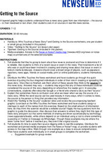
Reliable news stories are based on facts from reliable sources. Young journalists learn how to evaluate the reliability of news sources by watching a short explainer video. Teams apply their new source-digging skills to a current news...
American Institute of Physics
The Physical Sciences at Women's Colleges
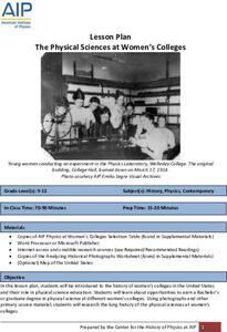
After a brief introduction to the history of women's colleges in the United States and a discussion of the resistance such institutions faced, young scientists investigate seven traditionally women's colleges and their physics programs....
Curated OER
"Trails, Rails, and Roads" Lesson 2: Road Tripping
Young scholars practice map skills and take a virtual road trip through Maine examining the history of transportation. They create questions from the information they learned and play a game against other groups.
Curated OER
Introduction to the United States Map
Students identify the United States of America and it's states on a map. In this mapping activity, students examine a globe and find the United States as well as a few land marks (Florida and the Great Lakes). Students then look at a...
Curated OER
MAP UNIT
First graders investigate how maps are used to identify different locations. They will also appreciate how there are different types of maps for their purposes. Finally students study how maps contain symbols that represent real places.
Curated OER
Welcome to My World!
Second graders increase their usage of maps and understand how maps are important in their lives. Students define what an atlas is, and to enforce the students' definition of what an atlas is, they also make their own atlas.
Curated OER
Hemingway Hangouts
Students use printed maps and websites to estimate driving distances and plan routes to Hemingway's home. They visit several locations online and record facts about each location.They calculate, distances, driving time, and other factors.
Curated OER
Lesson Plan for a 5th Grade Science Class
Sixth graders use the SQ3R reading strategy to learn about the behavior of light. In this behavior of light activity, 6th graders read a selection about the behavior of light and use the strategy to complete the reading. Students make a...
Curated OER
Discovering New Mexico
Seventh graders discuss the elements of maps and using basic linear measurement. They calculate the distance between the cities and create a simulated journey around New Mexico using a road map. They write out the directions for their...
Curated OER
The Amazing PE Race
Young scholars utilize map reading skills, perform locomotor movements, and practice skills as they make their way through the Amazing PE Race. They use a map of school grounds to collect clues around the building.
Curated OER
Planning A Railroad Online Lesson
Students plan a route across Donner Summit using topographical maps in order to understand the challenges involved in constructing the railroad in the Sierra Nevada Mountains. For this history lesson, students first discover how to read...
Curated OER
Locomotor Treasure Hunt
Young scholars practice in refining their locomotor skills and developing their understanding of pathways and basic map reading skills.
Curated OER
Mapping Africa
Young scholars identify the location of parallel and meridian coordinates. They illustrate their understanding of the physical shape of the continent of Africa through a mapping activity, then explain the processes that have influenced...
Curated OER
Create a Story May
First graders review the terms characters, setting and events in stories. They are shown how to access the Kidspiration Map, and how to add pictures in the correct spaces on the map. Students insert pictures in the map of the story...
Curated OER
Where in the World War? Mapping WWII in the Pacific
Students explore the Pacific Theatre of War. In this World War II lesson plan, students use reference material to access information about significant locations in the Pacific Theatre of War. Students identify the locations of the listed...
Curated OER
Longitude & Latitude
Seventh graders role play as ship's captains to study longitude and latitude.
Curated OER
COLONIAL FLYERS/TRAVEL BROCHURES TO THE COLONIES
Students investigate concepts of history and geography in this instructional activity. They create travel brochures for travelers who are crossing the Atlantic Ocean to populate the colonies of early America. The brochure has...
Curated OER
The Sands of Arabia
Sixth graders apply geographic information to the study of World History. In this Geography instructional activity, 6th graders create a political/physical map of the Middle East, develop questions and answers about the culture of the...
Curated OER
Claiming Land
Students examine several European maps with conflicting representations of the same geographic region. They uncover why different European nations produced different maps. In addition, they determine the role maps played in helping...
Curated OER
Map Making
First graders explore maps to realize the concept that maps are simply small representations of a much bigger picture. They discuss the importance of maps in everyday life, examine a map of the school, and then make a map of their...
Other popular searches
- Map Skills Lesson Plans
- Map Skills Worksheets
- Elementary Map Skills
- Geography Map Skills
- Basic Map Skills
- Social Studies Map Skills
- Globe and Map Skills
- Beginning Map Skills
- United States Map Skills
- Map Skills, Continents
- Early Explorers Map Skills
- Free Map Skills Worksheets


