Curated OER
How Do I Get There? Planning a Safe Route to School
One much-needed skill for young learners is direction giving. Have your class plan and draw a safe route for them to travel from home to school. They will also draw places and items that are in between home and school in order to build a...
Curated OER
Customized Topographic Maps and Models
Students explore the information depicted on topographic maps. They construct a 3-D topographic map of a local area. They go on a field trip to the depicted area and compare the 'real world' with their models.
Curated OER
Maps and Modes, Finding a Mean Home on the Range
Fifth graders investigate data from maps to solve problems. In this data lesson, 5th graders study maps and collect data from each map. Students present their data in a variety of ways and calculate the mode, mean, median, and range.
Curated OER
Three Dimensional Geology
Here is a fine lesson plan on geology designed for high schoolers. Learners use rocks, fossils, and other geological clues to determine the geology of an area. Then, they make recommendations to a fictitious city council about the...
Curated OER
Topographic Maps
Pupils complete a worksheet about topographic mapping. In this map skills lesson, students examine the features and discuss the uses for topographic maps.
Curated OER
Mapping the Past
Middle schoolers study historical maps to view how the world evolved from medieval times through the Renaissance. They work in groups to examine the maps and present a report on one of the listed maps.
Curated OER
Mapping Mount St. Helens
Students study topographic maps and contour lines and construct a simple three-dimensional model of Mount St. Helens before the May 18, 1980, eruption. They use topographic map skills to interpret the impact of the May 18, 1980, eruption...
Curated OER
Geo-Class Mapping My Neighborhood
Students create a map of the school and surrounding neighborhood. In this mapping lesson, students discover their school's location and learn about its past. Students use math skills and the steps in the design process to...
NASA
Cloudy vs. Clear - Maps
Find out the science of how clouds keep Earth cooler on hot days. Using guided discussions, investigators analyze and interpret maps of how much solar energy Earth receives at different times of the year. Participants draw conclusions...
Curated OER
Way to Go! Create a Road Map Game
Students create a travel game of one of the United States. They research a state of their choice and create a travel game using a common road map. They interpret map symbols as they calculate map mileage for their games. They create...
Curated OER
Finding Captain Hook's Treasure
Students use their map-reading skills to find Captain Hook's treasure. They see how the directions on a map correspond with "real-life" directions, and that symbols on a map represent real things.
Curated OER
Rivers Run Through It
Using a relief map of New York State, learners answer questions about the distance between different cities, identify bodies of water, and more. First, they discuss vocabulary related to the Hudson River area. Then, they complete a...
Curated OER
Geography of South America
Student's identify geographic features of a South American map. They use the scale of the map to calculate distances between points. They identify examples of the five geographic themes on the map of South America.
Curated OER
Using Different Kinds of Maps
Third graders explore the landforms and population diversity. They read maps and examine geographic terms. Students create their own map of the United States and answer questions about the location of people. After exploring the map, 3rd...
Curated OER
River Run Through It
With vocabulary lists, worksheets, and more, this lesson sets learners on an exploration of the Hudson River area. They read an essay about the area, analyze a relief map of New York State, and complete a worksheet.
Curated OER
A Map as a Tool
Young scholars study the concept of using a map as a tool with the usage of a balloon designed to mimic the features of the Earth with the major features marked and shown on the balloon.
Curated OER
Geography: Puerto Rico
Take a trip to Puerto Rico! Learners engage in a web quest, identify Puerto Rico on the map, and gather information related to physical features and cultural factors. Their efforts culminate when they design a brochure comparing the...
Curated OER
This is My Neighborhood
Students predict the things that they may see, smell, or hear in their neighborhood. They take part in a neighborhood walk, creating a rough map of their neighborhood as they go. Upon return to the classroom, students create a final map...
Curated OER
Hawaii: A Stolen Star
Explore the islands of Hawaii. Investigate Hawaiian culture and compare their personal traditions to Hawaiian traditions. They locate Hawaii on a map and research the history of Hawaii.
Curated OER
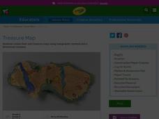
Treasure Map
Students study and recognize topographical symbols on maps. They create their own topographical Treasure Maps using symbols they learned or invent new ones. They create a bird's-eye view and include landscape details such as mountains...
Centers for Ocean Sciences
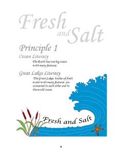
Ocean and Great Lakes Literacy: Principle 1
Is your current lesson plan for salt and freshwater literacy leaving you high and dry? If so, dive into part one of a seven-part series that explores the physical features of Earth's salt and freshwater sources. Junior hydrologists...
Curated OER
Map Skills
Students examine the nations, battlefields, troop movement of the Germans through Belgium and the location of both fronts during World War I by creating a map. They visualize the strength of the Germans early in the war.
National Park Service
Remembering Pearl Harbor: The USS Arizona Memorial
Young historians use primary source materials to investigate the 1941 attack on Pearl Harbor and the sinking of the USS Arizona. After reading background articles and studying maps and images of the attack, class members consider whether...
Curated OER
Mapping Perceptions of China
Students discuss what types of things are included on a map. They compare and contrast maps of China with a map they create and practice using different types of maps. They write analysis of their classmates maps.
Other popular searches
- Map Skills Lesson Plans
- Map Skills Worksheets
- Elementary Map Skills
- Geography Map Skills
- Basic Map Skills
- Social Studies Map Skills
- Globe and Map Skills
- Beginning Map Skills
- United States Map Skills
- Map Skills, Continents
- Early Explorers Map Skills
- Free Map Skills Worksheets


