Curated OER
School-Home Link: Maps
In this atlas and parent communication form worksheet, students use an atlas to find several things: the capitol city of Japan, the number of countries in Africa, where to buy a newspaper, the names of Presidents of the United States,...
Curated OER
The Oregon Trail
In this Oregon Trail worksheet, students practice their map skills while they explore the states of Oregon, Missouri, Idaho, Nebraska, and Wyoming. Students us a map of the US to plot six points on the map that show the Oregon Trail.
Curated OER
BOLTSS Map
In this geography activity, students identify the six features always used on maps. They identify each of these features by the acronym BOLTSS. Students examine the Melbourne Cricket Ground shown and respond to the 4 questions that follow.
Curated OER
Conversation Map
In this writing a conversation worksheet, students use the conversation map to identify the greeting, starting comment or question, body, short explanation, and farewell and then use them to create a written conversation. Students write...
Curated OER
Map Making
In this map making worksheet, students draw a map of their home including a map key. In this drawing worksheet, students create one map.
Curated OER
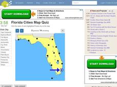
Florida Cities Map Quiz
In this online interactive geography instructional activity, learners examine a map of Florida and identify the 12 noted cities on the map using a pull down menu within 3 minutes.
Curated OER
Texas Cities Map Quiz
In this online interactive geography learning exercise, students examine a map of Texas and identify the 15 noted cities on the map using a pull down menu within 3 minutes.
Curated OER
Michigan Cities Map Quiz
In this online interactive geography worksheet, students examine a map of Michigan and identify the 14 noted cities on the map using a pull down menu within 3 minutes.
Curated OER
South America Map Quiz
In this online interactive geography quiz worksheet, students examine the map that includes all of South America's countries. Students identify the 13 countries in 2 minutes.
Curated OER
Middle East Map Quiz
For this online interactive geography quiz worksheet, students examine the map that includes 26 Middle Eastern countries. Students identify the names of the countries in 4 minutes.
Curated OER
Central America Map Quiz
In this online interactive geography quiz worksheet, students examine the map that includes 22 Central American countries. Students identify the names of the countries in 3 minutes.
Curated OER
UK Cities Map Quiz
In this online interactive geography worksheet, learners examine a map of the United Kingdom and identify the 25 noted cities on the map using a pull down menu within 3 minutes.
Curated OER
Canada Map Quiz
In this online interactive geography quiz worksheet, students examine the map that includes 13 Canadian provinces and territories. Students identify the names of the provinces and territories in 2 minutes, 30 seconds.
Curated OER
German Cities Map Quiz
For this online interactive geography quiz worksheet, students examine the map that includes 12 German cities. Students identify the names of the cities in 3 minutes.
Curated OER
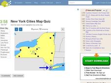
New York Cities Map Quiz
In this online interactive geography worksheet, students examine a map of New York and identify the 11 noted cities on the map using a pull down menu within 3 minutes.
Curated OER
Washington Cities Map Quiz
In this online interactive geography worksheet, students examine a map of the state of Washington and identify the 13 noted cities on the map using a pull down menu within 3 minutes.
Curated OER
California Cities Map Quiz
In this online interactive geography quiz worksheet, students examine the map that includes 12 California cities. Students identify the names of the cities in 3 minutes.
Curated OER
The Country of Venezuela
In this map skills of Venezuela learning exercise, students use an outline map to find an label important cities landforms, and bodies of water. Students label and color code 10 answers.
Curated OER
Animal Farm Chapter 2 Discussion Notes and Mini-Project
Imagine having the opportunity to create your own country. After responding to questions about chapter two, readers of George Orwell's dystopian classic are given a chance to design a utopia for one-million people, complete with...
Curated OER
Walk Two Moons: Discussion Web
Is Phoebe a good friend to Sal or not? After reading chapters twenty-five and twenty-six of Walk Two Moons, class members use the provided graphic organizer to develop an argumentative piece. Writers must decide if the two main...
McGraw Hill
Study Guide for Island of the Blue Dolphins
Dive your class into a reading of Island of the Blue Dolphins with this in-depth study guide. Breaking the novel into three parts, the resource begins each section with a focus activity that identifies a specific theme or question to be...
Curriculum Project
Comprehension and Discussion Activities for the Movie Rabbit-Proof Fence
Lead discussion and thoughtful analysis as pupils view Rabbit Proof Fence, a drama based on true story about three aboriginal girls who ran away from Western Australia to return to their Aboriginal families in 1931. Here you'll find...
Curated OER
Sub-Saharan Africa: Physical Geography
In this geography skills worksheet, students respond to 22 short answer and map skills questions about the location and geographic features of sub-Saharan Africa.
Curated OER
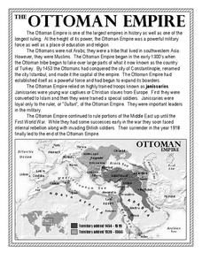
The Ottoman Empire
In this Ottoman Empire worksheet, students read a 1-page selection about the empire and examine a map. Students then respond to 5 short answer questions about the reading selection and the map.
Other popular searches
- Map Skills Lesson Plans
- Map Skills Worksheets
- Elementary Map Skills
- Geography Map Skills
- Basic Map Skills
- Social Studies Map Skills
- Globe and Map Skills
- Beginning Map Skills
- United States Map Skills
- Map Skills, Continents
- Early Explorers Map Skills
- Free Map Skills Worksheets


