Curated OER
Africa Map Quiz
In this online interactive geography quiz activity, students examine the map that includes all of Africa's countries. Students match each of the country names to the appropriate locations on the map.
Curated OER
Southern Africa Map Quiz
In this online interactive geography quiz worksheet, students examine the map that includes 15 Southern African countries. Students match the names of the countries to the appropriate locations on the...
Curated OER
Making Maps
In this map making worksheet, students learn about the science of making maps, which is cartography. They then answer the 11 questions on the worksheet. The answers are on the last page.
Curated OER
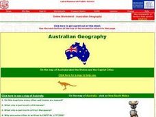
Australian Geography
In this map reading instructional activity, students label a map of Australia by adding the names of states and cities. They answer eight questions about the map.
Curated OER
North American Biomes
For this Science worksheet, students color a biome map of North America. Students color the map by solving the clues listed on a separate sheet of paper.
Curated OER
As a Bird Flies or as a Submarine Dives...
In this geography instructional activity, students look critically at a map containing a variety of different directions. Students answer 2 short answer questions regarding giving someone the best directions from point A to point B.
Curated OER
Africa Capitals Map Quiz
In this online interactive geography quiz learning exercise, students examine the map that includes 53 African countries. Students match the names of the countries to the appropriate locations.
Curated OER
Asia Map Quiz
In this online interactive geography quiz worksheet, students examine the map that includes 26 Asian countries. Students match the 26 country names to the appropriate locations on the map.
Curated OER
North American Rivers Map Quiz
In this online interactive geography quiz worksheet, students examine the map that includes 13 rivers in North America. Students match the names of the rivers to the appropriate places on the map.
Curated OER
Choose a Path
In this addition activity, students utilize data from a map to answer 6 fill in the blank questions where they provide the missing addends to addition problems.
Curated OER
Asia Rivers Map Quiz
In this online interactive geography quiz worksheet, students examine the map that includes 18 Asian rivers. Students match the names of the rivers to the appropriate locations on the interactive map.
Curated OER
Middle Eastern Lakes, Rivers, Bays, and Seas Map Quiz
In this online interactive geography quiz worksheet, students examine the map that includes 13 bodies of water and rivers in the Middle East. Students match the names of the bodies of water and rivers to the...
Curated OER
Middle Eastern Seas Map Quiz
In this online interactive geography quiz worksheet, students examine the map that includes 8 seas in the Middle East. Students match the names of the seas to the appropriate places on the map.
Curated OER
Caribbean Map Quiz
For this online interactive geography quiz worksheet, high schoolers examine the map that includes 20 Caribbean countries and territories. Students identify the names of the countries and...
Curated OER
Europe Rivers Map Quiz
In this online interactive geography quiz worksheet, students examine the map that includes 14 European rivers. Students match the names of the rivers to the appropriate locations on the interactive map.
Curated OER
Europe Seas Map Quiz
In this online interactive geography quiz instructional activity, learners examine the map that includes 14 European seas. Students match the names of the bodies of water to the appropriate locations on...
Curated OER
Germany States Map Quiz
In this online interactive geography quiz instructional activity, students examine the map that includes 12 German states. Students match the names of the states to the appropriate locations on the map.
Curated OER
United States Map Quiz
In this online interactive geography quiz worksheet, students examine the map that includes all 50 states of the United States. Students match the names of the 50 states to the appropriate places on the map.
Curated OER
African Lakes, Rivers, Bays, and Seas Map Quiz
In this online interactive geography quiz worksheet, students examine the map that includes 25 African lakes, river, bays, and seas. Students match the names of the bodies of water and waterways to the...
Curated OER
Middle East Map Quiz
In this online interactive geography quiz worksheet, students examine the map that includes 21 Middle Eastern countries. Students identify the names of the countries in 3 minutes.
Curated OER
Take a Hike
In this geography skills instructional activity, students respond to 9 questions that require them to read topographic maps and interpret them. The topographic maps are not included.
Curated OER
Latitude and Longitude- Online Interactive
In this maps worksheet, learners learn about longitude and latitude by reading a two paragraph text and studying two maps. Students answer 9 fill in the blank questions. This is an online interactive worksheet.
Curated OER
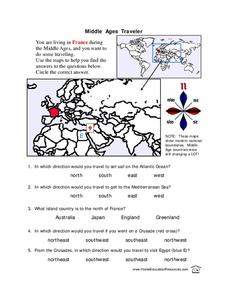
Middle Ages Traveler
In this map worksheet, students are given three maps of France to use to answer multiple choice questions. Students complete an activity from the perspective of a Middle Ages traveler.
Curated OER
Geography Worksheet
In this geography skills worksheet, learners respond to 14 short answer questions by using maps and atlases. The maps and atlases are not included.
Other popular searches
- Map Skills Lesson Plans
- Map Skills Worksheets
- Elementary Map Skills
- Geography Map Skills
- Basic Map Skills
- Social Studies Map Skills
- Globe and Map Skills
- Beginning Map Skills
- United States Map Skills
- Map Skills, Continents
- Early Explorers Map Skills
- Free Map Skills Worksheets


