University of California
The Vietnam War (1945 – 1975)
Have you ever wanted to do something so perfectly you wound up not doing it well at all? Young historians use primary and secondary documents to analyze the United States involvement in the Vietnam War. The issues surrounding the...
New York State Education Department
US History and Government Examination: August 2010
Geography has played a complex role in America history. The Atlantic Ocean has served as a buffer to protect the United States from European Wars, but its proximity to Cuba, however, left it vulnerable to nuclear war during the Cuban...
Curated OER
Nonfiction Genre Mini-Unit: Persuasive Writing
Should primary graders have their own computers? Should animals be kept in captivity? Young writers learn how to develop and support a claim in this short unit on persuasive writing.
Curated OER
Introduction to the United States Map
Students identify the United States of America and it's states on a map. In this mapping activity, students examine a globe and find the United States as well as a few land marks (Florida and the Great Lakes). Students then look at a...
Curated OER
Unit V: Worksheet 2 - Constant Force
Physics learners studying force and acceleration practice solving eight problems with this assignment. They calculate acceleration and deceleration, net force, and distances required for stopping a moving object. Kinematics equations and...
ProCon
Electoral College
The Electoral College's role in elections is sometimes confusing and controversial. Pupils use a debate topics website to research the pros and cons of the practice to debate whether the United States should still use the Electoral...
Curated OER
Immigration and Ancestors
We are all immigrants to this country and the study of immigration can help students connect to history in a personal way. Students will listen to audio clips from the Ellis Island web site, discuss the treatment of immigrants in the...
K20 LEARN
Slavery in the Constitution
Young historians may be surprised to learn that the Constitution of the United States includes provisions that protect the institution of slavery. Groups examine four clauses of the Constitution, as well as other primary sources, and...
Curated OER
Celebrate Kwanzaa in the United States
Students explore and study the celebration of Kwanzaa in which African-Americans remember their heritage and remind people of the importance of sharing with family and friends. They participate in a chant about the seven continents and...
Curated OER
Getting to the Core of World and State Geography
Students create topography relief maps. In this geography skills lesson, students review geography core knowledge skills, design and make a state relief map, and compile a student atlas.
Curated OER
Learning About Maps
Students investigate the many uses and features of maps and globes and locate where they live on both. In this map lesson, student play a travel game and create their own maps to explore states, continents, countries, and islands.
Curated OER
Mapping World War II: During and After
In this World War II learning exercise, students follow the provided instructions to mark 2 maps according to events and outcomes of the war.
Curated OER
The Nifty Fifty- Facts and Figures
Students explore an assigned state. In this United States geography lesson, students identify facts and figures related to a particular state. Students use the Internet for research and create a PowerPoint presentation displaying these...
Newark Public Schools
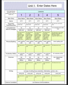
ELA Curriculum Map
Organize your curriculum of narratives and stories within an ELA unit and keep track of what elements are needed to ensure the unit's success. This curriculum map template allows you to plan for supporting texts, comprehension skills and...
Social Studies School Service
Ancient China: Introduction, Map
What a great resource for introducing your youngsters to the world of ancient China and the earliest stages of its timeline. Included are creative ideas for organizing your room, as well as an engaging lesson, anticipatory set, and map...
ProCon
Sanctuary Cities
Should sanctuary cities receive federal funding, or do they defy federal laws? That is precisely the question scholars attempt to answer as they prepare for a class discussion or debate. After reading some brief background information,...
Curated OER
The Great Military: Map of Texas
The battle at the Alamo may be one of the most famous military campaigns in Texas history, but it is by no means the only one. As part of their study of the military history of Texas, class members research less-well-known sites, locate...
National Wildlife Federation
Hot, Hotter, Hottest: Extreme Weather's Impact on Our Resources
How dry is it? It's so dry, the river only runs twice a week! Through an analysis of maps and discussions, pairs learn about droughts across the United States in the ninth of 12 lessons. They then read about, answer questions, analyze...
New York State Education Department
US History and Government Examination: January 2018
It's time to test those skills! Assess pupils' knowledge of US history and government with short answer questions, multiple-choice items, and essays. The resource serves as a standardized test that functions well for a final exam....
McGraw Hill
Study Guide for Bridge to Terabithia
Bridge to Terabithia is a story about friendship that brings magic into ordinary life. Study guides may not be magical, but the guided questions, graphic organizers, extension activities, vocabulary, and discussion questions help...
Delegation of the European Union to the United States
Cultural Identity
How does cultural diversity impact political identity? That is the question researchers face as they continue their examination of the European Union and the programs it has developed in its attempt to achieve unity in diversity. To gain...
Curated OER
A Place of My Own: A Study of Maps
Young scholars investigate maps. They demonstrate their knowledge about maps and place landforms in the proper place as they create salt dough maps. They create a geography folder as well.
Curated OER
Where in the Latitude Are You? A Longitude Here.
Students distinguish between latitude and longitude on the map. In this mapping lesson, students participate in mapping skills to recognize spatial relationships, and where to find natural resources on the map. Students create their own...
Curated OER
Our World With MapsQ
Learners examine and compare different types of maps. In this map skill lesson, students look at neighborhood and national maps on the overhead projector while making comparisons of the symbols and locations. They use a T-chart to record...


