Curated OER
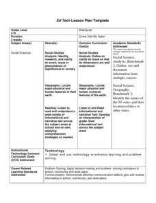
Come Visit My State!
Fourth graders conduct research on a selected state in the United States. They complete a WebQuest and conduct research on a variety of websites. Students then organize and present a visual display about their state that includes a...
Curated OER
Countries of the World
Students identify countries on a world map. In this map skills lesson, students define the word "country" and use post-it notes to locate several countries on a world map.
Curated OER
Empire State-Building
Students explore how empires around the globe have impacted the world in which they have existed. They analyze whether or not the United States is an imperialist nation and create their own empires based on their understanding of empires...
Delegation of the European Union to the United States
The Geography of Europe
What is the European Union? Where is it? Why is it? To begin a study of the EU, class members examine the physical geography of Europe and the size and population density of 28-member countries in comparison to non-member countries...
Curated OER
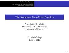
The Notorious Four-Color Problem
Take a walk through time, 1852 to 2005, following the mathematical history, development, and solution of the Four-Color Theorem. Learners take on the role of cartographers to study a United States map that is to be...
PBS
An Attack on Syria- What Would You Do?
Has United States military intervention in the conflicts of other countries always been warranted? After reviewing a brief background on contemporary US conflicts and reading articles describing the civil war in Syria, your learners...
Curated OER
Follow the Light
Here is another in the interesting series of lessons that use the special State Quarters as a learning tool. During this lesson, pupils learn about lighthouses, maps, the cardinal directions on a compass, and U.S. geography. There are...
Curated OER
Understanding "The Stans"
Students explore and locate "The Stans" in Central Asia to create, write and illustrate maps, graphs and charts to organize geographic information. They analyze the historical and physical characteristics of Central Asia via graphic...
NPR
Same-Sex Marriage
The battle over same-sex marriage is a prevalent issue in the United States, and a valuable topic to be discussed in your social studies classroom. Here is a basic outline of introductory questions, focus questions, vocabulary, and media...
Curated OER
US City Quality of Life Analysis and Comparison
Students analyze US census data and criteria to compare and measure the quality of life in the country's fifty largest cities. After accessing the 2005 quality of life world report online, students conduct their study to compare three...
Scholastic
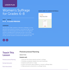
Women's Suffrage for Grades 6–8
Learners study the decisions and solutions involved in winning the right to vote. After reading background information on the fight for women's suffrage, including one woman's story, and its eventual success in the United States and...
Curated OER
Natural Resources and Transportation in the United States
Students study thematic maps (included with the lesson) to determine possible relationships. They develop three hypotheses about the relationship. Students choose one of their hypotheses to explain. The explanation is to include reasons...
Curated OER
Mapmaker, Make Me a Map!
Pupils are introduced to the state quarter program and examine the Colorado state quarter. They locate Colorado on a map and create a map with a key. They discuss the state motto and examine pictures of the state's geographical features.
Curated OER
The Geography of Europe
Students examine maps of Europe. In this geography skills lesson, students interpret several maps to determine the boundaries of the European Union and respond to assessment questions about the maps.
Curated OER
Map Keys
Third graders examine maps and map keys. In this locating map features lesson, 3rd graders use crayons, markers and colored pencils to label maps. Students work in partners to read map keys and locate given places and things.
Curated OER
States And Shapes
Students work together and investigate the shapes of 50 states. They identify the states that they find hardest to recognize. The group then list the states in order from most difficult to just difficult to recognize and create a...
Curated OER
Map Literacy
Pupils locate their home state on a map. They differentiate between physical and population sizes of states. In two groups, students "become" states with string for boundaries. They ascertain that area does not always equal large...
Curated OER
Borrowing Narrative Skills from Mr. Fletcher: Using a "Prompts in Reverse" Technique to Inspire Your Writers
Help your class find their writing voices with this lesson which uses the work of Ralph Fletcher to guide a "Prompt in Reverse" activity. Using the chapter "First Pen" from Fletcher's Marshfield Dreams, learners decipher what they...
Curated OER
The 50 States
Fifth graders use maps and music to learn the 50 states. In this US Geography lesson, 5th graders map out a region of the United States and practice singing the song, The 50 States that Rhyme.
Curated OER
Quarters from the Coast
Students discuss Fifty State Quarters Program, compare and contrast location of land and water on map of United States, while also becoming aware of physical shape of nation and home state, and explore coastal areas in United States.
Curated OER
Mapping China
Learners identify cities in China on a map. In this map skills lesson, students locate the continent of Asia and the country of China. Learners use a blank map to label China and bordering countries.
Curated OER
Where is the Trail? The Journey of Lewis and Clark
Learners explore the trail followed by Lewis and Clark on their journey across the United States. In this United States History lesson, students complete several activities to establish the Lewis and Clark Expedition, including a class...
Curated OER
Mapmaker, Mapmaker, Make Me a Map!
Young scholars evaluate the different types of historical and geographical information that one can gather through close study of historical maps from the 16th through the 19th centuries. They create their own maps.


