Curated OER
Mapping Worksheet #1
Get out the compass and a pencil its time to use a coordinate grid to practice mapping skills. Young cartographers use the prompts and provided grid to plot locations, draw parallel lines, and determine distances between points.
Curated OER
Topographic Mapping Skills
In this geography worksheet, students read an excerpt about topographic maps and why they are useful for various jobs. They also respond to eleven questions that follow related to the excerpt and locating specific map points on the map...
Curated OER
The Global Grid System-World Map Activity
Students demonstrate how to use the global grid system. In this map skills lesson, students use a world map to locate various locations. Students identify locations based on the global grid system. Students complete a worksheet as an...
Compton Unified School District
How Can We Locate Places?
How can we locate places? Maps, of course! Expose second graders to the tools available in maps and discuss how these tools can help people find locations. Students also look at communities, including what makes a community and the...
Scholastic
Volleyball Road Trip
Review coordinate mapping with your young geographers by matching cities on a volleyball team's road trip itinerary to their appropriate coordinate locations.
Curated OER
Where Am I? Map Activity
In this map activity worksheet, students determine which countries are shown on a set of 16 maps, then read facts about each country designed to help with a report on that country.
Curated OER
Put Me in My Place: Using Alphanumeric Grids to Locate Places
Students practice locating points on a large wall grid and create and label a neighborhood map. In this geography lesson, students spell and discuss places as the teacher places them on the map. They discuss the concept of an...
Curated OER
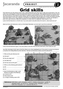
Grid Skills
In this geography activity, students use grid references on a map to locate places in the pictures given. They also identify another advantage of using a grid map, which they have an overhead view of the content to prevent any features...
Curated OER
Put the Mountains on the Map
Young scholars discuss what they know about the regions where snow leopards live. They observe the worksheets to see if they can identify any of the mountain ranges and then use atlases to check and complete the country identification...
Curated OER
Map Work: Using the Index and Grid References
In this maps worksheet, learners use the Oxford First Atlas to answer 20 questions about cities in Great Britain. Students will need to use the index and grid references to locate cities or countries.
Curated OER
WORLD GEOGRAPHY
Students identify and analyze map symbols and map grids by completing various worksheets and creating their own map using these skills. Students identify and analyze what latitude and longitude are on a map to play a game of Bingo....
Curated OER
Giving Students a Little Latitude
Young scholars use a world outline map to locate places using coordinates of latitude and longitude. They answer questions about places based on their knowledge of the map and on their research and make up more questions of this sort...
Curated OER
Metrics And Measurements
Students engage in a study of measuring distances between geographical locations on a map. They are able to define and use the map scale in conjunction with the metric system. For this lesson they make their own maps and measure the...
Curated OER
More Than One Grain of Rice
Young scholars explore mathematics, geography and agriculture by studying world rice production. In this production of rice lesson, students read One Grain of Rice and use a worksheet grid to calculate how much rice was received. Young...
Curated OER
Plotting A Hurricane Using latitude and Longitude
Students explore map and plotting skills by tracing the movement s of hurricanes through the Earth's systems. a hurricane map is developed from daily media reports.
Curated OER
Absolute and Relative Location
Second graders understand the difference between relative and absolute location using the grid map as an example of an absolute location. They observe a class map showing longitude and latitude lines and learn that they provide exact...
Curated OER
TE Activity: The Trouble with Topos
Pupils study the uses of topographical maps including the many forms that they take. They discover that the map features show its intended use such as city maps, wilderness maps, and state maps. They complete a worksheet in which they...
Curated OER
Causation-Exploration and World Trade
Students investigate spice trade. In this world history lesson, students identify various spices in jars and their places of origin. Students listen to a lecture on how spices came to countries in Europe. Students complete a source...
Curated OER
The Geography of Aboriginal Languages in Canada
Students study the relationship between geography and the Aboriginal language communities.
Curated OER
Atlas Scavenger Hunt
Students discover what type of information in an atlas by participating in a scavenger hunt. With a partner, they try to find the answers to many questions as possible. They exchange their papers with another partner group and check...
Curated OER
Glacial Landscapes
Students examine the impact of glaciers on Great Britain. In this geological history lesson, students examine and measure a glacial valley and look at several types of glacial landscapes in Britain.


