Curated OER
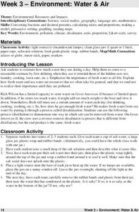
Environment: Water & Air
The introduction to the lesson mentions a sailor's limited capacity to store drinking water on his ship. Pupils then set up an overnight experiment to remove freshwater from salt water by distillation. There is a math and map activity to...
Curated OER
Where Does Our Food Come From?
Fourth graders identify the state or country that a food product came from and locate it on a map. They identify products that are grown in Hawaii and the factors important in the location of economic activities.
Curated OER
Sybil Ludington's Ride - a poem
Fourth graders examine the role a teen from the Hudson Valley played in the American Revolution. They view the map of Sybil's ride and calculate the distance using the map's legend.
Curated OER
A Canadian Inventory: The Way We Are!
Learners, in groups, explore major thematic sections of the Atlas of Canada. They use their findings to produce a wall display, consider and incorporate the issue of sustainability into their material and deliver a presentation to the...
Curated OER
Country: Austria
Students access a variety of Austria themed websites. They locate information about history, geography, climate, people and culture. They view a live webcam of different parts of Austria and read about famous personalities from Austria.
Curated OER
Social Studies:
Students identify various types of breads fromother countries and locate them on maps. In small groups, they make story maps of books that mention bread and make books resembling sandwiches. Students have a bread tasting party and...
Curated OER
Country: India
Students use the Internet to study the history, geography, culture and art of India. Videos, photographs and maps are included.
Curated OER
Mapping Lab and Lead Poisoning
High schoolers are introduced to GIS and its uses. They make predictions before viewing the actual lead poisoning cases by location of Dade County. Pupils use actual Miami-Dade County spatial data to explore basic principals. Students
Curated OER
Country: Japan
Students observe live Webcam views of Japan. They study its economy, government, and culture through paintings and facts. They label a map of Japan with its cities and rivers.
Curated OER
Twain: Steamboat's a-Comin'
Students discover how rivers inspire creative expression. In this Mark Twain instructional activity, students list songs about rivers and discuss common characteristics. They locate the Mississippi River on a map and write a script...
Curated OER
Where In the World Am I?
Learners identify their location in the world after studying latitude, longitude, relative location, and absolute location. They use assigned web site to find information to make a flipbook that answers questions about their location in...
University of New Mexico
New Mexico Land of Enchantment
Third graders research Native American Cultures surrounding New Mexico. They analyze the history and geography of the state. They play a guessing game that incorporates the indigenous plants and animals of New Mexico. In groups, learners...
Curated OER
Comparing the Impact of Multiple Uses
Students study multiple land uses and their effects on one another. They assess multiple land uses in National Forests and Grasslands and evaluate the effects of each use on all other uses. They develop a comprehensive list of human...
Curated OER
Gullah People of the Sea Islands
Students examine the history and culture of the Gullah people. They study the geography, impact of industrialization and effects of tourism on the people of Gullah. They view films, use a large map of West Africa,. Students will listen...
Curated OER
National Parks
Students conduct research on the U.S. National Parks. They conduct Internet research, analyze maps, and create and solve riddles that present specific clues pertaining to a selected national park and it's location.
Curated OER
Investigating Haiti
Students engage in a activity that is about the island of Haiti. They conduct research using a variety of resources. The information is used in order to help students locate the island on a map. They answer questions while participating...
Curated OER
A Place Called Nepal
Learners investigate maps of Nepal and then create their own to disover how human activity is influenced by terrain and climate. Students participate in a trek across Nepal simulation to imagine the challenges people have to face...
Curated OER
A Geopoem About Alaska
Sixth graders conduct Internet research on the physical and human characteristics of Alaska. They compose and write geopoems about the state of Alaska, using a template.
Curated OER
What is the Population Distribution of Cartoon Characters Living On the Pages of Your Newspaper?
Learners read various cartoons in their local newspaper and calculate the population demographics, spatial distribution and grouping of the characters. Using this information, they create a population distribution map and share them with...
Curated OER
Route 66 And Population Patterns
Students investigate the geography located along Route 66. They research how the population patterns change in certain areas along the highway. Students use the information in order to form hypotheses about how and why the population...
Curated OER
Movement of Native American Tribes 1830-1890
Students examine the movement of Native American tribes during the mid 1800's. In this American History lesson, students study two Native American tribes that live in the United States and complete a comparison/analyze project. Students...
Curated OER
The Helenistic Age and the Legacy of Alexander
Eighth graders describe, analyze and evaluate the history of ancient Greece from 2000 to 300 B.C. They explore the influence of geography on Greek economical, social, and political development.
Curated OER
Who Lives in the Arctic North?
Students study the Arctic North. In this Canada history lesson, small groups of students research and then teach the class about either the plants, animals, humans, or geography in relation to the Arctic North. Students make their own...
Curated OER
Showing Your Community to the World
Students investigate the environmental and human implications to local communities of hosting a major exposition or fair in their region. They study current site conditions and develop a comprehensive plan.


