Curated OER
Using Vegetation, Precipitation, and Surface Temperature to Study Climate Zones
Students begin their examination of the climate zones found around the world. Using a software program, they identify the relationship between the vegetation, climate and temperatures of the different zones. They also plot coordinates...
Curated OER
The Study of the Spanish-Speaking People of Texas: Understanding Photo Essays
Students analyze a photo essay of the Spanish-Speaking People of Texas by the photojournalist Russell Lee. They identify the goals of the photo essay, explore a website, and complete a worksheet.
Teachers' Curriculum Instituted
The Roman Record
Using Google Earth, Google Docs, and other Google Tools, collaborative groups of seventh graders research and then create and share online newspapers reporting on the early development, geographical features, political issues, and family...
Curated OER
Polar Adventure: Read All About It!
Students investigate reports of an adventure to the North Pole or the South Pole and then chronicle it by writing a newspaper article or making a timeline. The focus is placed on a recent or historic expedition to the region selected.
Scholastic
Perfect Postcards: Illinois
Connect the geography and history of Illinois using an art-centered lesson on the railroads. The railroad connected once-distant places, particularly in the Midwest. Using research, class members create postcards of fictional cross-state...
Curated OER
Narrative Structure: Les Miserables
What is the initiating event? What is the protagonist's goal? What attempts are made to achieve this goal? What is the outcome? Model for your class how to map out the structure of any narrative. Readers then search for answers as the...
Curated OER
Dangerous Road: A Letter of Complaint
Engage your English learners with this resource. To begin, learners describe a map to a partner. After a vocabulary exercise and a jumbled letter activity, pupils are asked to write their own letter. The letter reading and writing...
Curated OER
1668 Map of Newark Activity
Eleventh graders read a map for historical information, decipher a map legend and symbols, and expand their knowledge of a historic time.
Curated OER
Reading Around the World
Students use the internet to identify the seven continents. Using maps, they locate and identify major physical features of Earth. They are read different books by various authors on the Earth and answer questions related to it. They...
Curated OER
Maps
First graders look at their classroom or school setting. They use positional word to describe where things are located in the school. Students discuss a map and why they are important. They read the story "Taylor's New School" and...
Curated OER
Using Cinderella Stories to Study Venn Diagrams
Seventh graders read Cinderella stories and complete graphic organizers for the various versions. For this story analysis lesson, 7th graders read versions of the story Cinderella. Students organize the story's information using a...
Curated OER
Life Map
Learners compose plans for their futures. In this writing lesson, students create life maps of past events and predict future events. They brainstorm events of their lives and decide which ones are most pertinent to the map. Learners...
Curated OER
Maps that Teach
Students study maps to locate the states and capital on the US map. Students locate continents, major world physical features and historical monuments. Students locate the provinces and territories of Canada.
Curated OER
Make Your Own "Weather" Map
High schoolers create their own "weather" map using data from x-ray sources. They analyze and discuss why it is important to organize data in a fashion in which is easy to read. They compare and contrast different x-ray sources using a...
Curated OER
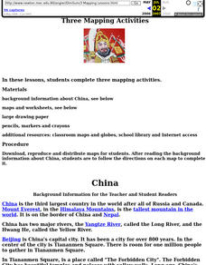
China: Dim Sum: 3 Mapping Lessons
Fourth graders, after studying maps, draw a very large outline map of Asia and then a large map of China on it in the appropriate place. They label the appropriate information.
Curated OER
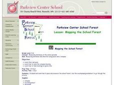
MAPPING THE SCHOOL FOREST
Students measure distances and directions using paces and a compass. They determine their own pace, explore how to read a compass bearing, and how to take bearings on given sites.
Curated OER
The Science of Weather: How Doppler Radar reads weather
Young scholars read about how radar detects changes in the weather. In this lesson on weather reporting, students read a diagram that shows how radar reads weather. This lesson includes discussion questions and an individual activity...
Curated OER
Temperature Zones
Students read and make inferences about a map showing various temperature zones across the United States.
Curated OER
Silly Sally: Love Two Teach
In these reading and writing skills worksheets, students complete a packet about a story titled 'Silly Sally.' Students create popsicle stick characters to retell the story, create their own alliteration name and draw themselves silly,...
Curated OER
Mapas Bailados: Creating Visual Representations of Dances Using Maps
Third graders listen to "Frank the Monster..." and discuss the dance map on the inside cover of the book. They create their own dance map using sentence strips to record the types of movement.
Curated OER
Critical Literacy In The 21st Century
Students read the book Sitti's Secrets and complete prediction and comprehension activities. For this literacy lesson plan, students also write questions and comments they have on chart paper.
Curated OER
Studying the Caribbean Immigration
Students use the site maps and other resources to research one of the influential Caribbean immigrants or descendents of immigrants mentioned in a narrative they have read. They write an essay about an influential immigrant.
Curated OER
READIN', WRITIN' AN' AMERICAN MEMORY
Pupils research World Series baseball teams and use the information to play a game. They also use railroad maps to determine how teams traveled from one game to another.
Curated OER
United States Geography and Topography
Fifth graders recognize the major regions of the US while reading a map. Students study the physical features of the US. Student research and report on states and their capitols.


